Near Florence in Florence County, South Carolina — The American South (South Atlantic)
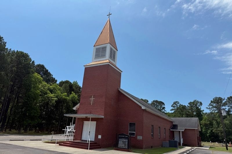
Salem United Methodist Church
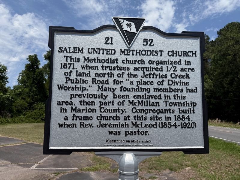
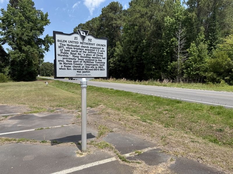
This Methodist church organized in 1871, when trustees acquired 1/2 acre of land north of the Jeffries Creek Public Road for "a place of Divine Worship." Many founding members had previously been enslaved in this area, then part of McMillan Township in Marion County. Congregants built a frame church at this site in 1884, when Rev. Jeremiah McLeod (1854-1920) was pastor.
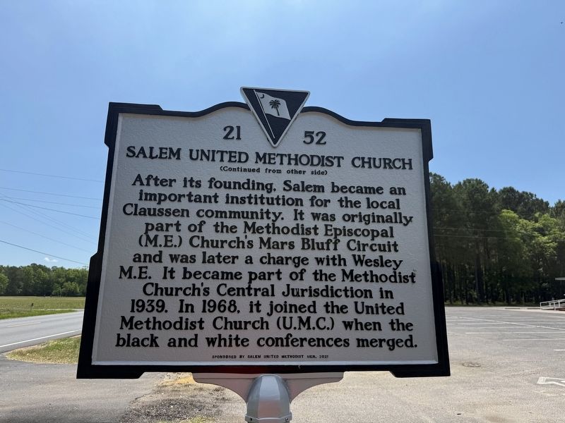
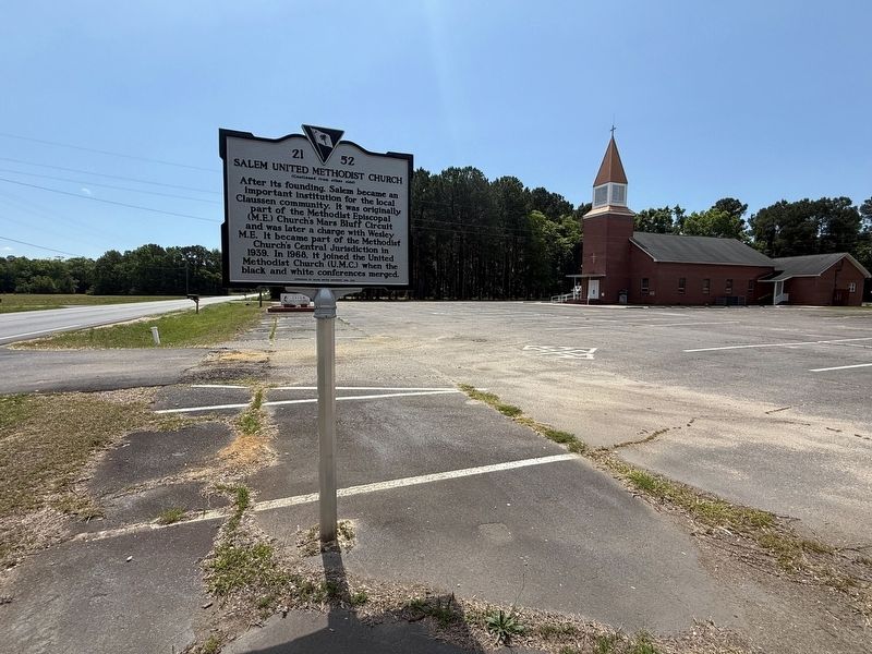
After its founding, Salem became an important institution in the Claussen community. It was originally part of the Methodist Episcopal (M.E.) Church's Mars Bluff Ciruit and was later a charge with Wesley M.E. It became part of the Methodist Church's Central Jurisdiction in 1939. In 1968, it joined the United Methodist Church (U.M.C.) when the black and white conferences merged.
Erected 2021 by South Carolina Department of Archives and History; sponsored by Salem United Methodist Church. (Marker Number 21-52.)
Topics. This historical marker is listed in these topic lists: African Americans • Religion & Religious Structures. A significant historical year for this entry is 1871.
Location. 34° 7.436′ N, 79° 36.774′ W. Marker is near Florence, South
this page online

Regionally, this marker is in the Pee Dee. It is also in the American South and specifically in the Deep South. Globally, it is in North America, the Western Hemisphere, the Western World, and the Anglosphere. Historically, it finds itself in what was once the territory of the Mississippian Culture, one of the original Thirteen Colonies, one of the Confederate States of America, and the Antebellum South.
Other nearby markers. At least 8 other markers are within 5 miles of this marker, measured as the crow flies: Hopewell Presbyterian Church (approx. 0.7 miles away); William W. Harllee (approx. 0.7 miles away); William Wallace Harllee / Florence Henning Harllee (approx. 0.7 miles away); Veterans Memorial (approx. 0.7 miles away); Willow Creek Baptist Church (approx. 1.8 miles away); Red Doe (approx. 4.1 miles away); Mt. Zion Methodist Church (approx.
Photographed by Devry Becker Jones (CC0), May 21, 2026
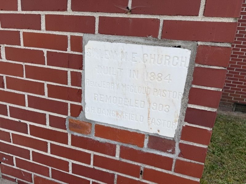
6. 1903 Cornerstone on the church building
Built in 1884
Rev. Jerry McCloud Pastor
Remodeled 1903
G.H. Dangerfield Pastor
Photographed by Devry Becker Jones (CC0), May 21, 2026
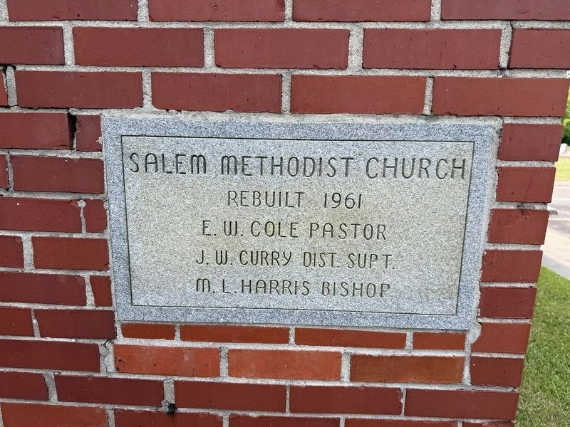
7. Cornerstone from 1961
Rebuilt 1961
E. W. Cole Pastor
J. W. Curry Dist. Supt.
M. L. Harris Bishop
Credits. This page was last revised on May 25, 2026. It was originally submitted on May 25, 2026, by Devry Becker Jones of Washington, District of Columbia. This page has been viewed 26 times since then. Photos: 1, 2, 3, 4, 5, 6, 7. submitted on May 25, 2026, by Devry Becker Jones of Washington, District of Columbia.
