Pickens in Pickens County, South Carolina — The American South (South Atlantic)
Table Rock State Park
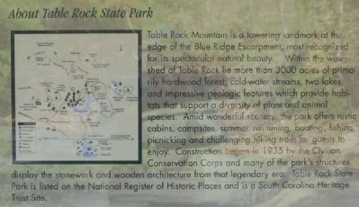
About Table Rock State Park
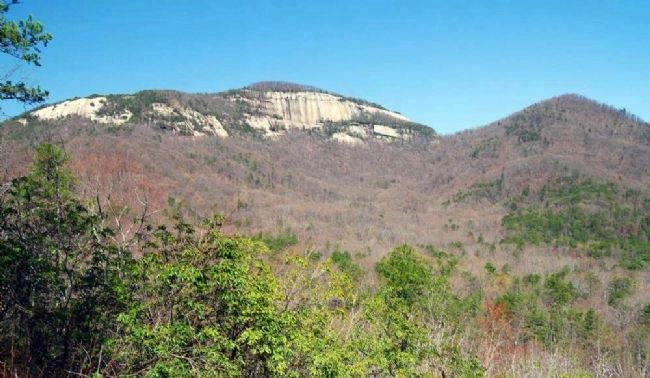
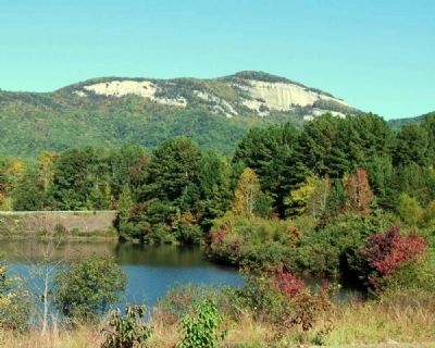
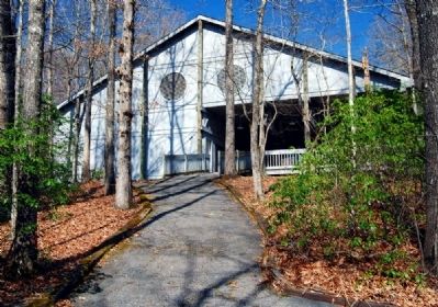
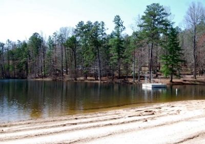
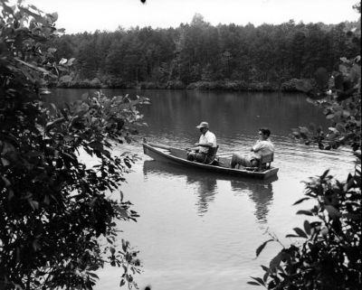
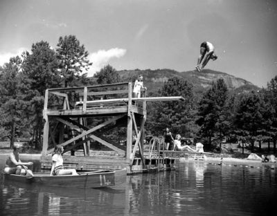
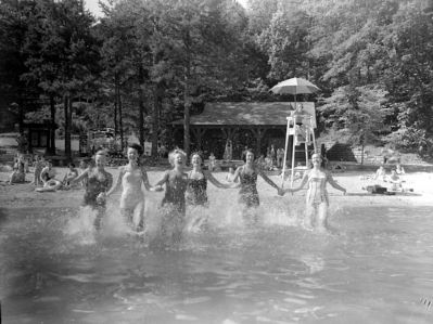
Table Rock Mountain is a towering landmark at the edge of the Blue Ridge Escarpment, most recognized for its spectacular natural beauty. Within the watershed of Table Rock lie more than 3,000 acres of primarily hardwood forests, cold-water streams, two lakes, and impressive geologic features which provide habitats that support a diversity of plant and animal species. Amid wonderful scenery, the park offers rustic cabins, campsites, summer swimming, boating, fishing, picnicking and challenging hiking trails for guests to enjoy. Construction began in 1935 by the Civilian Conservation Corps and may of the parks structures display the stonework and wooden architecture from that legendary era. Table Rock State Park is listed on the National Register of Historic Places and is a South Carolina Heritage Trust Site.
South Carolina State Park Mission
To encourage people to discover South Carolina's state parks by providing resource-based recreational and educational opportunities that emphasize the conservation, protection and interpretation of the states natural and cultural resources.
Table Rock State Park Mission Statement
To provide quality recreation and educational opportunities emphasizing the natural, cultural, and geological features of the park and its environs, and to manage its facilities in a manner consistent with protecting the preserving its resources.
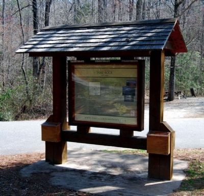
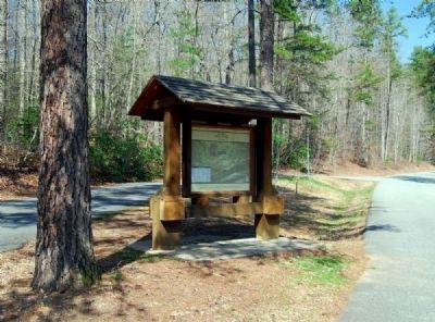
Erected by South Carolina Department of Parks, Recreation and Tourism.
Topics and series. This historical marker is listed in these topic lists: Natural Features • Natural Resources • Notable Places. In addition, it is included in the Civilian Conservation Corps (CCC) series list. A significant historical year for this entry is 1935.
Location. 35° 1.485′ N, 82° 42.283′ W. Marker is in Pickens, South Carolina, in Pickens County. Marker is at the intersection of TR Campground Road and West Gate Road on TR Campground Road. Marker is located near the Table Rock Country Store. Touch for map. Marker is in this post office area: Pickens SC 29671, United States of America. Touch for directions.
Other nearby markers. At least 10 other markers are within 5 miles of this marker, measured as the crow flies. Parkitecture (approx. 0.4 miles away); The Civilian Conservation Corps (approx. 0.6 miles away); A CCC Classic (approx. 0.6 miles away); a different marker also named Civilian Conservation Corps (approx. 0.6 miles away); Granite and Gravity (approx. ¾ mile away); Beliefs Set in Stone (approx. one mile away); Pumpkintown (approx. 3.4 miles away); Cornelius Keith - 1715-1808 (approx. 3.6 miles away); Cornelius Keith (approx. 4.1 miles away); Oolenoy Baptist Church (approx. 4.2 miles away). Touch for a list and map of all markers in Pickens.
Also see . . .
1. Table Rock State Park Historic District. Table Rock State Park Historic District is significant for its cultural and social relationship to the history and prehistory of the area within the state park boundaries and is also architecturally significant as an example of the construction of a state park by the Civilian Conservation Corps (CCC). (Submitted on April 24, 2010, by Brian Scott of Anderson, South Carolina.)
2. Table Rock State Park. Table Rock State Park is a 3,083-acre (12.48 km2) park at the edge of the Blue Ridge Mountains in northern Pickens County, South Carolina. (Submitted on April 24, 2010, by Brian Scott of Anderson, South Carolina.)
3. Civilian Conservation Corps. The Civilian Conservation Corps (CCC) was a public work relief program for unemployed men, providing vocational training through the performance of useful work related to conservation and development of natural resources in the United States from 1933 to 1942. (Submitted on April 24, 2010, by Brian Scott of Anderson, South Carolina.)
4. Review:Table Rock State Park. Built by the CCC in late 1930-1940, this campground retains it rustic charm after all these years. 2 Lakes available, many campsites, and a Lodge capable of hosting a wedding reception (which it did on the weekend we were there). (Submitted on April 25, 2010, by Brian Scott of Anderson, South Carolina.)
Additional commentary.
1. Table Rock State Park Historic District
The Table Rock State Park Historic District is located in Pickens County in the mountainous northwest region of South Carolina. The district includes approximately 2,900 acres and a diverse variety of historic resources. The district's resources include natural features, management buildings and structures, recreational buildings and structures, residences, transportation systems, and water systems.
Most of the district's contributing resources date from the era of Civilian Conservation Corps (CCC) construction. Pinnacle Lake is the focal point of construction and many resources are grouped around the lake. These buildings and structures are connected by a system of roads and trails designed to take advantage of scenic, natural and constructed features.
Table Rock State Park Dam
The Table Rock State Park Dam impounds Carrick's Creek, thus forming Pinnacle Lake. Located at the south end of the lake, the dam is constructed of granite laid in stepped or tiered courses. This stepped construction results in a waterfall effect when water flows down the face of the dam. Designed as a principal scenic feature, the dam can be viewed from an overlook constructed with a coursed ashlar masonry retaining wall. Stone steps lead from the overlook to a path extending to the creek bank, providing a view from below the dam as well.
Lodge
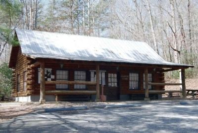
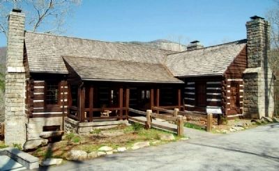
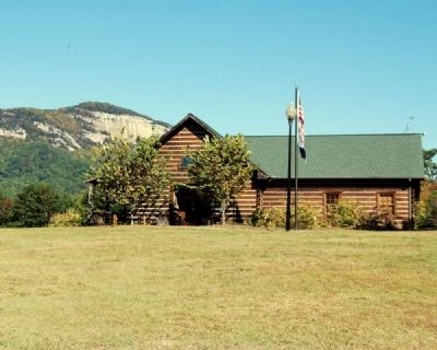
As the centerpiece of Table Rock State Park, the Lodge is sited on a hillside above Pinnacle Lake to allow scenic views of the lake, Pinnacle Mountain, and Table Rock Mountain. The Lodge is of hewn log construction with dove-tail joints, coursed granite foundation and waney-siding in the gables. It has a lateral gable roof with composition shingles and a front gable extension.
This L-shaped building has a one story facade. Its full story basement and hillside setting create a two story rear elevation. A shed roof porch with timber posts and rails extends across the facade to the front gable extension. The lodge has 6/9 double-hung sash windows and a central entry into the great hall. The basement level dining hall can be approached through a secondary entrance in the left gable end.
An open shed addition has been made to the left elevation of the lodge and the rear terrace has been enclosed.
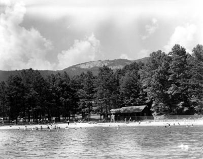
The Pinnacle Lake beach area can be accessed from the Lodge either by driving the branch road which circles the lake to the northeast and includes constructed overlooks of Pinnacle Lake and Table Rock Mountain or by a foot trail which follows the lake shore.
Bathhouse
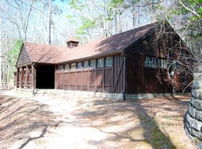
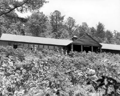
The Bathhouse is sited just above the beach area and is a one-story frame building with a symmetrical facade. It has a rectangular plan and lateral gable roof with composition shingles. A one-story gable roof entry creates a T-shape appearance. Grouped, six-light transom windows stretch across the facade. Louvered vents are located at floor level and in each gable end. The primary entrance to the bath facilities is centrally located and recessed.
The rustic appearance of the bathhouse is conveyed by exposed, heavy, upright framing members, board and batten siding, waney-siding, and rock-faced, coursed granite foundation.
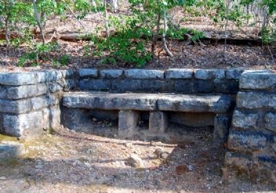
Landscape features associated with the bathhouse include masonry coping and a coursed, rock-faced granite retaining wall, approximately six feet in height, which is sited directly behind the bathhouse. A foot trail connecting the bathhouse and beach area begins at a cut-stone love seat bench located to the east of the bathhouse and extends down a long flight of cut-stone steps to the Concession Building.
Concession
Building
The Concession Building is sited on the north beach of Pinnacle Lake. It is a one-story, rectangular plan, frame building with board and batten siding. It has a lateral gable roof and a hip roof addition to the left elevation. An engaged concession area extends across the facade and features heavy timber supports and braces. A single bay addition was made to the right elevation in 1986.
Cabins
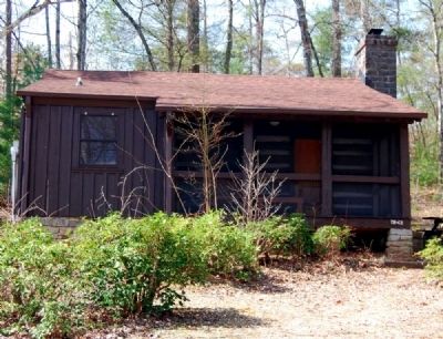
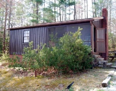
Seven cabins are located in two cabin groups on the west side of Pinnacle Lake. Four cabins are of hewn log construction and three of frame construction with board and batten siding. They are one-story with rectangular plans, gable roofs, coursed stone foundations and chimneys. The cabins have one and two bedroom plans with kitchen, bath, and living room. Each cabin is sited and landscaped to provide privacy.
Two picnic areas are located in wooded sites to the northeast of Pinnacle Lake.
Hemlock Shelter
The Hemlock Shelter, located in Picnic Area No.1, is a partially enclosed masonry building. It has a rectangular plan and lateral gable roof with exposed trusses and composition shingles. The roof is supported by four large coursed granite piers in the front and a coursed granite rear wall. The shelter rests on a stepped coursed granite foundation. The gable ends are enclosed with waney-siding, timber posts and rails. A single stone chimney and fireplace are centrally located in the rear wall. Bathrooms are located at the rear elevation.
Landscape features associated with the Hemlock Shelter include a coursed granite retaining wall directly behind the building, rustic cut-stone drinking fountains and small stone trash incinerators.
Picnic Shelter No. 2
Picnic Shelter No.2, also known as the White Oaks Shelter is a partially enclosed frame building with a rectangular plan. It has an end to front gable roof with composition shingles. Heavy timber supports with side rails sit on a concrete slab foundation. The end bay and front gable of the shelter are enclosed with shiplap siding. The rear section of the shelter bas a lower gable roof with exposed rafters. One interior brick chimney contains back-to-back fireplaces with built-in ovens.
Included in the Table Rock State Park Historic District is a fish rearing complex which includes Fish Rearing Pools, Diversion Dam, Warden's Dwelling, and Workmen's Quarters.
Fish Rearing Pools
The Fish Rearing Pools are situated between two small creeks and are of poured concrete construction. This facility consist of twelve pools designed for the raising of fish stock. Four rectangular primary fry pools are sited at the highest elevation and are four feet wide, three feet deep, and fifty feet long. Four rectangular secondary fry pools are sited below the primary fry pools and are five feet wide, three feet deep, and sixty feet long. Four fish-shaped fingerling pools are sited at the lowest elevation.
Warden's Dwelling
The Warden's Dwelling was built to house the fish warden and is located near the Fish Rearing Pools. This one story house is of frame construction with waney-siding. It has a lateral gable roof with composition shingles and a gabled rear wing. A shed roof porch with insect screening stretches across most of the front facade. It has 9/6 double hung sash windows and one interior and one exterior end chimney. The chimneys and foundation are of coursed, rock-faced granite.
Constructed hiking or foot trails extend north from Pinnacle Lake to Table Rock Mountain and Pinnacle Mountain.
Table Rock Trail
The Table Rock Trail extends from the Nature Center to the peak of Table Rock Mountain. Features along the trail which were constructed by the Civilian Conservation Corps include stone cribbing. log cribbing, stone steps placed at steep inclines, and steps chiseled or carved into stone outcroppings.
Trailside Shelter
The Trailside Shelter is located along the Table Rock Trail at an elevation of 2500 feet overlooking Pinnacle Lake. The shelter is of log construction with a rectangular plan, gable roof, and wood shakes. Hand hewn log supports with braces rest in a stone pier foundation. A flagstone floor surface remains largely intact. The shelter was designed with horizontal hewn log side rails which are partially intact.
Pinnacle Mountain Trail
The Pinnacle Mountain Trail branches off the Table Rock Trail and extends to the peak of Pinnacle Mountain. Though this trail has few constructed features, some log and stone cribbing is present.
The following properties contribute to Table Rock State Park Historic District:
1. Pinnacle Lake
2. Table Rock State Park Dam
3. Dam Overlook
4. Lodge
5. Foot Trail - Lodge to Overlook
6. Lodge Boat Landing
7. Superintendent's House
8. Branch Road to Proposed Cabin Group No. 2
9. Bathhouse
10. Concession Building
11. Vehicle Bridge (Over Carrick's Creek)
12. Cabin #l
13. Cabin #2
14. Cabin #4
15. Cabin #5
16. Cabin #6
17. Cabin #7
18. Cabin #8
19. Lifeguard Quarters
20. Chlorinator Plant
21. Water Intake System Including Sluice Dam
22. Trailside Shelter
23. Hemlock Shelter at Picnic Area No. 1 (Picnic Shelter #1)
24. Parking Overlook #1
25. Parking Overlook #2
26. Service Building #l
27. Service Building #2
28. Picnic Shelter #2 at Picnic Area No. 2 (White Oaks Shelter)
29. Latrine at Picnic Area No. 2
30. Workmen's Quarters
31. Warden's Dwelling
32. Fish Rearing Pools
33. Diversion Dam
34. Foot Trail - Chlorinator Plant to Fish Rearing Pools
35. Table Rock Trail
36. Carrick's Creek Nature Trail
37. Foot Trail - Lodge Area to Beach Area
38. Pinnacle Mountain Trail
39. Table Rock and Stool
40. Old Ox Trail
41. Experimental Chestnut Plot
The following properties do not contribute to Table Rock State Park Historic District:
1. West Gatehouse
2. Park Residence
3. Park Residence
4. Country Store
5. Community Recreation Building
6. Camper Recreation Building (TR 32)
7. Bathhouse (TR 33)
8. Bathhouse (TR 34)
9. Bathhouse (TR 35)
10. Meeting House (moved to park)
11. Personnel Barracks
12. Cabin #3
13. Cabin #9
14. Cabin #10
15. Cabin #11
16. Latrine (TR 36)
17. Carpet Golf
18. Nature Center (altered)
19. Boathose (altered)
20. Diving Platform (altered)
21. Mechanical Building
22. Picnic Shelter
23. Picnic Shelter
24. Sewage Treatment Plant
Significance
Table Rock State Park Historic District is significant for its cultural and social relationship to the history and prehistory of the area within the state park boundaries and is also architecturally significant as an example of the construction of a state park by the Civilian Conservation Corps (CCC). It is also significant as one of sixteen state parks constructed by the CCC, under the direction of the National Park Service (NPS) as a part of the South Carolina State Park System.
Table Rock Mountain, located in Pickens County in the mountainous northwest section of South Carolina, and in the foothills of the Blue Ridge Mountains, has for centuries attracted man's interest and curiosity. The area including Table Rock Mountain was once part of the Lower Cherokee Nation. By 1777 all of their territory in South Carolina, which included the present counties of Greenville, Anderson, Pickens, and Oconee, was ceded to the state by a treaty of 20 May 1777, except for a narrow strip along the western boundary of the state. The Hopewell Treaty of 1785, the first made between the Cherokees and the new government of the United States, redefined South Carolina's boundaries with the Cherokee Nation more specifically than that of the 1777 treaty. It left the Cherokees less land east of the Blue Ridge. With the Treaty of 1816, the last remaining lands of the Cherokee Nation in South Carolina were ceded to the state.
Even after the Cherokees had left the area, their traditions remained to influence and interest the white settlers who immediately inhabited their former lands. One of these traditions concerned their belief in a "Great Spirit" which inhabited the mountains of the Southern Appalachians and whose shadow, manifested in the blue haze, could be seen throughout their lands. This area was known to the Cherokees as "Sah-ka-na-ga." or "The Great Blue Hills of God." This "Great Spirit" was thought to eat its meals from a giant rock mountain, shaped like a table, that seemed to the Cherokees to reach to the heavens. Next to this "table mountain" was a smaller hill resembling a "stool," where the spirit sat to enjoy its meal.
According to one visitor to Table Rock Mountain in 1842,
Sentimental young ladies I am told, are apt to dream a pretty Indian legend, substantiating the former existence of an aboriginal brobdignian, whose colossal person and lordly appetite could be satisfied with no humbler seat than the 'Stool' in question, and no less a board, than the noble 'Table.' Hence the names.
The earliest known written record of the name Table Rock or "Table Mountain," as it was referred to in earlier records, was in 1809, when it was mentioned as a reference point in a joint committee report concerning the existing boundary dispute between North and South Carolina. In the report, addressed to Governor John Drayton of South Carolina, the committee members wrote that one of the points of intersection of the boundary was believed "to be about eight miles to the northwest of that notable Rock known by the name of Table Mountain."
It is not known exactly when visitors and tourists began arriving to view and climb Table Rock Mountain. Though it was probably not long after the Cherokees completely left the area. It may have started as a result of an article published in the Camden Gazette on 6 June 1816, which described "Table Mountain" as a "grand spectacle." The article also mentioned that occasional visits were being made to Table Rock by "curious travellers and sometimes by men of science." An 1816 petition to the General Assembly of South Carolina by Cornelius Keith, Jr., asked for a turnpike road to Table Rock Mountain. Keith, the son of the first white settler into this area, noted:
...that a number of gentlemen & ladies from the lower Country Visits the table mountain Every Summer which by Reason by the badness of the way Canot have access to it with Carriages nor Even on horseback to some parts of it & some of them have professed a desire to have a road opened so as they may have Easy access to the face of the Rock.
Keith claimed that he could open "a tolerable good road to the face of the...mountain" and with "such rates of tole" that would be approved by the legislature. The request was not granted, but by 1837, Keith, in another petition to the legislature, asked for the renewal of his expired charter for "the turnpike road leading from Pumpkin Town to the Table Rock." Visits to this area of the state by lowcountry residents were numerous on account of the cool summers, the lessening of the threat of malaria, and the willingness to pay the seventy-five cents toll for passage on the turnpike.
For whatever reasons people visited Table Rock Mountain during the antebellum period, its existence was well publicized in a few books such as Mill's Statistics of South Carolina (1826), William Gilmore Simms' The Geography of South Carolina (1843), and Oscar Lieber's Report on the Survey of South Carolina (1859). Mills referred to Table Rock as
...perhaps one of the greatest natural curiosities of the kind in the world. It rears a colossal, and almost perpendicular wall of solid granite rock upward a of 1000 feet above its base...and strikes the beholder with awe and wonder.
Simms likewise wrote,
The stupendous precipice called the Table mountain is an object of great curiosity and admiration...From this eminence the prospect 1s equally grand and extensive...The eye takes in a vast extent of the country--mountains and vallies, cultivated spots, and serpentine vallies.
Lieber, a geologist, unlike Mills, an architect, and Simms, an author, wrote,
Traced,
as if by the careless pencil of some master-hand, it everywhere forces itself upon the attention of the roaming eye of the beholder, and the height of the encompassing precipice...produces the effect of close proximity.
To accommodate travelers and tourists who ventured into this section of the state, James Keith and William Sutherland, each of whom had married the other's sister, operated a wayside inn from their shared and expanded log house in nearby Pumpkintown. At that time it was the "only place of sojourn for visitors to the 'Rock.'" As one visitor to the area noted, "Messrs. K.&S.'s hotel. We were informed was the only house in the place. Understanding the term 'house' technically, little did we dream said house was literally the only building the town could boast." In c. 1845 the Table Rock Hotel, a twenty-room facility, was constructed by William Sutherland, from lumber that was cut at a nearby sawmill, fitted together and transported to the building site. The location of the new hotel was at the present site of the White Oaks Picnic Area at Table Rock State Park. The hotel faced the mountain and was in an area that was level and surrounded by giant white oaks. After the hotel was completed, Sutherland moved his family here and kept the hotel until his death in 1859. There may have been an earlier attempt to construct a hotel on the summit of Table Rock Mountain. A visitor to the area in the 1840s wrote that near the center of the top were the remains of "a hut...a building erected as a kitchen to a hotel, which it was once contemplated to erect on the Rock."
There were various ways, at that time, to reach the summit of Table Rock Mountain. The location of the Table Rock Hotel provided guests convenient access to a few of these. Many tourists chose a trail on the western side that led to the top of the mountain and passed by a spring near the top. Others preferred to ride horseback up the ridge to a place between the base of Table Rock and The Stool. The area which connected the two was known as the "saddle" or the "hitchingpost." The horses were left here and the rest of the journey was completed on foot. Steps built by Daniel Carrol, an employee of William Sutherland, aided the ascent. Iron pins or spikes were inserted into holes drilled in the rock and the steps bolted to the pins. According to one source, "the steps were in sections bridging the steepest points where there were no crevices or footholds by which one could climb." One visitor, who used the steps in the 1840s, wrote that
The ascent is made by means of flights of wooden steps, secured to the rock. Of these steps we counted about 130. They are substantially built and with the assistance of the rail, or banister, the passage is safe and tolerably easy.
Although
it is not known exactly when the steps were constructed, tradition is that they were built soon after the Table Rock Hotel opened in the 1840s. In 1832, however, John Masters, for the sum of ten dollars, leased to William Sutherland, for a term of ten years, "all the northeastern end of Table Rock...for the purpose...to Erect steps up the said Table Rock for the benefit of visitors." The lease included the use of all materials, stone or timber necessary to build the steps.
Sutherland was also entitled to any income or profit that might be made from the steps. After ten years, Masters would be entitled to half the income from this "Institution" for a term of ninety-nine years. It seems from this transaction that the steps were built before the hotel was constructed or possibly while the construction was taking place. The pins that once held the steps to this venture are still visible in the rock today.
With Sutherland's death in 1859 and the Civil War, the number of hotel guests and visitors dwindled. The hotel did not regain popularity as a summer resort until the 1870s when Stephen D. Keith took over its management and made some building improvements. After his death in 1880 it was operated by family members until abandoned sometime after the turn of the twentieth century.
According to Mrs. Amos Coleman Sutherland, a new hotel was built c. 1900 nearer the base of Table Rock Mountain, by Edwin Foster Keith. This facility enjoyed a brief period of prosperity, its only drawback being access by a "steep and rocky road." It was later moved to a place at the foot of Slickin Falls in the South Saluda Valley. It is no longer extant.
Not until after the enactment of the Emergency Conservation Work Act (ECW) on 31 March 1933, did Table Rock Mountain and its environs once again become a viable part of the recreational life of the surrounding area and of South Carolina.
Table Rock and the surrounding area was selected for development as a state park because of its "spectacular mountain scenery" and "outstanding beauty." It was to furnish a public recreational area in the mountains, "where picnicking, swimming, boating, fishing, vacationing, hiking, and nature studies could be enjoyed" at little or no cost. It was also in a region that had long been famous as a summer retreat. Table Rock State Park was recognized by National Park Service officials as an area "having [the most] outstanding park possibilities of all mountain parks of the east," and as the park neared its completion some considered it to be at least the best park in the southeast, as well as the most important and spectacular in the South Carolina State Park System.
Table Rock State Park was established in the late spring of 1935 with the acquisition of 2,500 acres by the state. Of this, the city of Greenville donated 1,010 acres of land which included Table Rock
Mountain. This donation was contingent, however, upon other land being provided. Pickens County purchased the remainder of the acreage from private owners and donated it to the state. By 1938 Table Rock State Park had expanded to 2,680 acres.
The most outstanding features of the park were Table Rock Mountain, a mass of whiteside granite with an elevation of 3,124 feet (3,157 feet according to CCC surveys), Pinnacle Mountain (elevation 3.425 feet) on the west, the highest mountain, not highest point, in South Carolina, and The Stool (elevation 2,530 feet) on the east.
When the area of the park was being surveyed and investigated by the CCC, the old Table Rock Hotel built by William Sutherland c. 1845, was found to be a "pile of decayed timbers." It was also noted by park officials that there were several areas of the park that were allegedly "old Indian camping grounds." This, they said, was somewhat substantiated by the large number of arrowheads and bits of pottery found there. They recommended that a "careful inspection and study of these areas should be made" and that until such a study could be made "these areas will be carefully protected and left undisturbed."
Development work began at Table Rock State Park with the establishment of two veteran CCC Camps, SP-5 (No. 2434) and SP-6 (No. 2435), in August 1935. They were located not far off park property on private land that was leased at little or no cost. The camps were originally comprised of World War I veterans.
One veteran stationed at Table Rock wrote in protest of the work hours and lack of rest periods when he said,
We Veterans...find the time of work...a mighty long time for we old V.F.W. veterans to stand on [our] feet. We have palpitation of the heart, post hernia operation~ varicose veins and our nerves are wrecked. [We] would appreciate sitting down a couple of minutes every hour to catch our breath. We are willing to do our bit as we did in 1917 and '18.
The veteran camps were soon replaced by cwo camps of younger men, Companies 5465 and 5466. The younger enrollees were placed there because of the hard labor involved with the mountainous terrain, and to speed the development of the park.
Social, recreational and educational activities were provided for the enrollees at the Table Rock camps. The recreation building at the camps was a popular place with pool, reading, and music available to pass the time. Some of the CCC enrollees at Table Rock played baseball in an old field nearby, but it, like the rest of the area was not level enough for a ballpark. L.H. Trayweek, a Furman graduate, worked as the educational director at the Table Rock camps and taught the fundamental skills of reading and writing.
CCC Camp SP-5, under the direction of Project Superintendent Norman R. House, was responsible for the "more technical phases of park development." Camp SP-6, under Project Superintendent M.B. Richardson, was concerned almost entirely with the construction of a dam and spillway. Both camps were responsible for the prevention and fighting of forest fires. This included the reduction of fire hazards caused by storms and lumbering activities before the park was started and of constructing a fire telephone line to report fires and constructing truck trails for fire prevention.
Each camp was composed of approximately two hundred men, the largest percentage of which were from South Carolina. The remainder were from North Carolina and Georgia. CCC Camp SP-6 was disbanded in June 1937 upon completion of the dam.
The architects responsible for helping design all the park structures were John W. Linley, a graduate of Clemson College, and Fred Ledbetter. Of course, final approval of all designs was by the National Park Service to be insure its specifications would be met. Students in Clemson's Architectural Department were involved wich the early stages of the architectural planning of the park. Twenty students with "pads and pencils" visited the area before the CCC camps arrived. Once there, the park's development was explained to them and the type of buildings described. Each student then submitted his drawings for competition. Several of the winning drawings were reproduced in the 1936 Columbia Sesquicentennial Edition of The State newspaper.
National Park Service officials from the regional office in Richmond, Virginia visited Table Rock State Park early to determine the locations for the various buildings along the lake. After the visit Project Superintendent House wrote that much thought had been given to the architectural design and suggestions given by the officials had presented "a real picture for future planning." He admitted that it took time "for even technical men as well as non-technical men to acquaint themselves with the fundamental principles on park development." He went further to say that because park construction on the mountains presented many problems, inspections like this one saved time and effort.
Actual work on Table Rock State Park began in early September 1935. The initial projects involved the construction of a water system, the main park road, and a dam and spillway to impound a twenty-three acre man-made lake.
The main water supply was derived from a branch of Carrick's Creek, the largest stream on the park, and was a gravity fed system which required no pumping. It supplied water to the CCC camps and later to the park structures. The water ran through a sand filter, but a chlorinator plant was later built nearby to combat pollution that might occur by accident or by vandalism.
The park's road system was carefully planned due to the topography of the area. Only necessary access roads were built. The main park road leading from the original park entrance to the bathhouse was "carefully" and "naturally" sloped and planted in an effort to duplicate the adjacent wooded areas, and also to provide vistas of the surrounding countryside, mountains, and lake. Also constructed as part of the road system were stone culverts, roadside gutters, a vehicle bridge, and parking overlooks.
In advance of the construction of the dam, thirty-two acres of the lake site were cleared. Construction of the dam that impounded Carrick's Creek to form Pinnacle Lake began in late 1935. An earthen dam, it featured a concrete core and gravity section spillway. The spillway was founded on solid rock, but the core walls were spread out a considerable distance until it reached fairly tight and strong soil. The spillway consists of granite rock ledges specifically placed to give the appearance of a natural waterfall. The back of the dam was filled with dirt to prevent seepage. Although efforts at first were centered entirely on the dam, weather conditions, personnel problems, and the widening of the core wall slowed construction. The lake, to be used for boating, swimming, and fishing, once it had been stocked, was filled to its spillway level in late 1937.
The rock used for aggregate in concrete for the dam. as well as for foundations, chimneys, retaining walls, road surfacing, and other park features, was of native whiteside granite. A majority of the rock used for construction was quarried within the park boundaries and locally on private lands. Agreements were made with individual land owners to quarry rock from their properties and to allow access to the quarry by CCC constructed truck trails.
Timber used for park construction was obtained locally but not from the park area, except for a small amount of wood obtained from clearing the lake bed and from wind falls. Some of the logs used for construction were donated by local landowners. Park structures were roofed with wood shakes of white oak handmade by the CCC workers.
By the middle of 1937 a new paved highway was completed by the Works Progress Administration (WPA) to make Table Rock State Park more accessible to the public.
Table Rock State Park was officially opened to the public on 4 April 1938, at which time an estimated five hundred visitors came to the park. A contact station had been built at the park entrance where a guide greeted visitors and gave them information concerning the park and the available facilities. The total attendance for the entire calendar year of 1939 was over 22,000 people. Even though the park was not yet complete, attendance was expected to reach at least 100,000 visitors per year after all the facilities were completed.
At the time of the park opening, the facilities included: Pinnacle Lake and beach area; five vacation cabins of stone and log construction, each accommodating up to six people and renting for fifteen dollars a week; a picnic area, with a shelter and latrines, water fountain, fireplace, grills, outdoor barbecue pits, and tables and benches; and twelve fish rearing pools, which were operated jointly with the South Carolina Fish and Game Department and used mainly for stocking the park lake but also for streams and lakes outside the park area. By 1938 approximately 245,000 rainbow trout had been placed in Pinnacle Lake, which opened for fishing in the spring of 1940. Also completed at the time of the park opening were approximately six miles of foot trails, with foot bridges, steps, and signs to direct hikers. A few of these trails had been constructed to connect various facilities of the park, but most were built for hikers. One trail, of three and one-half miles, led to the top of Table Rock Mountain, and for a distance followed an old ox cart trail which had been built c. 1846. According to tradition, this trail was used prior to the Civil War to haul camping equipment to the base of the mountain. At an elevation of 2,500 feet up the Table Rock Trail, a trailside shelter was built with seats to provide a rest spot and a spectacular view of the area for hikers. By 1939 over 100.000 people had walked these trails. A trail to the top of Pinnacle Mountain and extensions to the trail system were constructed shortly thereafter.
Under construction at the time of the park opening was a bathhouse and a lodge. The bathhouse, located near the lake and beach area, was designed to accommodate a maximum of four hundred bathers. Temporary structures were used until the bathhouse was completed.
In design and craftsmanship, the Lodge may be one of the highp01nts of achievement by the CCC in South Carolina. The Lodge, with one of the best views of the park, Table Rock Mountain, and Pinnacle Mountain, was built as a recreation building to provide facilities for entertaining and dancing. These included a kitchen, a dining room, a "sun parlor" downstairs, and a large upstairs for dancing and special parties. The lower story of the Lodge was built of hand worked native rock and the upper part of handhewn chestnut logs. The flagstones for walkways and stairways were obtained from Morrow Mountain State Park in North
Carolina. The Lodge was used for special events during the completion of the park, but its restaurant did not open until the summer of 1940. Below the Lodge, on the lake, a boat landing was constructed to provide tourists an opportunity to arrive at the lodge by boat to have dinner.
Landscaping of the park was done with native trees, shrubs, and vegetation, much of which was taken from the lake bed before it was cleared. Also during 1937 and 1938, a large number of blight-resistant Asiatic Chestnut trees were planted in an experimental plot for study, near the fish rearing pools.
By 1941, construction was completed on three additional cabins, che lifeguard quarters, the concession building, a residence for a fish game warden near the fish rearing pools, and the residence for the park superintendent. The superintendent's residence was conveniently located near the Lodge for his duties, which included year-round upkeep of the trails and roads, and protection of the park from fires and vandalism.
The concession building had a refreshment service and first aid rooms. and was located near the beach and parking area for convenience to the general public.
As the threat of war drew closer, work and planning continued on the park, even though the amount of funds needed far exceeded availability. Construction continued on a second picnic shelter and picnic area, and on a branch road to a proposed additional cabin area. There were also plans for additional cabins, riding stables and bridle trails, a craft shop, a pioneer camping area in an isolated section of the park, and an organized group camp to be located nearer the mountain, but these were never begun by the CCC.
One of the last projects to be completed by the CCC was a trailside museum. It was the first to be completed in the South Carolina State Park System and was considered an important addition to the park. The museum housed specimens of "geological and horticultural interest." Project Superintendent House, a landscape architect and botanist, had already gathered and mounted two hundred specimens of flowering plants from the park area. He estimated that there were at least 1,000 different kinds of flora within the park area and that it would take ten to fifteen years to gather and classify them all. The museum was also responsible for making trail information available to the public.
Work on Table Rock State Park ceased in late October 1941 when CCC Camp SP-5 disbanded because of a presidential order to conserve CCC appropriations for that year. Norman R. House, who had been with the project since the beginning, resigned as superintendent shortly before the official word was received that the camp would be closed. Third District Congressman Butler B. Hare argued that camps at those parks "nearest completion should be retained." The opinion, however, was to abandon camps at state parks that were nearest completion. Unfinished jobs at Table Rock, such as buildings without roofs or windows were completed. Although the CCC camp had not completed the park development, there was still optimism expressed by the State Forester, H.A. Smith. In a letter to the Pickens Sentinel, he explained that the South Carolina State Commission of Forestry had provided a large percentage of operating cost of the park and that this was part of the regular park program. He wrote,
I believe you have no fear of the Park ever being abandoned. The only fear need be lack of maintenance and keeping order, thereby securing a bad name for an area to which you will not care to go. To avoid that funds must be, and I believe will be appropriated by the Legislature...if the people express an interest in the area.
In June 1942, Congress discontinued the appropriation of any more funds for the operation of the CCC, other than those necessary to close the remaining camps throughout the nation. Table Rock State Park continued its operation as a recreational area for public use and is today a visual reminder to the work done by the CCC in the development of the South Carolina State Park System.
In 1967 the South Carolina State Park System was transferred to the South Carolina Department of Parks, Recreation and Tourism which was created that same year.
Future preservation planning should take into consideration the archaeological potential of Table Rock. Although no archaeological site survey and inventory has been conducted within the property boundaries, Table Rock has a high potential for yielding significant archaeological sites and data. The high probability for the presence of prehistoric and historic period sites is based on ecological, geological, and historical factors. The mixed mesophytic mountain forest characteristic of the study area has the capacity to support a rich and varied flora and fauna. Archaeologically documented settlement patterns within areas characterized by a topography similar to Table Rock indicate both prehistoric and historic period occupations were situated near streams and springs, in mountain valleys, and on ridge tops and ridge saddles. Additional factors arguing for the presence of archaeological sites are: (a) numerous archaeological sites, including Cherokee Villages. have been identified and inventoried in the vicinity; (b) Cherokee-owned lands encompassed Table Rock; and (c) CCC records document the discovery, during park construction, of numerous ceramic shards and projectile points. (Source: National Register nomination form.)
— Submitted April 24, 2010, by Brian Scott of Anderson, South Carolina.
Credits. This page was last revised on November 24, 2020. It was originally submitted on April 24, 2010, by Brian Scott of Anderson, South Carolina. This page has been viewed 7,405 times since then and 128 times this year. Photos: 1, 2, 3, 4, 5, 6. submitted on April 24, 2010, by Brian Scott of Anderson, South Carolina. 7. submitted on April 25, 2010, by Brian Scott of Anderson, South Carolina. 8, 9, 10, 11, 12, 13. submitted on April 24, 2010, by Brian Scott of Anderson, South Carolina. 14. submitted on April 25, 2010, by Brian Scott of Anderson, South Carolina. 15, 16, 17. submitted on April 24, 2010, by Brian Scott of Anderson, South Carolina. 18, 19, 20, 21. submitted on April 25, 2010, by Brian Scott of Anderson, South Carolina.
