Near Lake City in Williamsburg County, South Carolina — The American South (South Atlantic)
St. John School
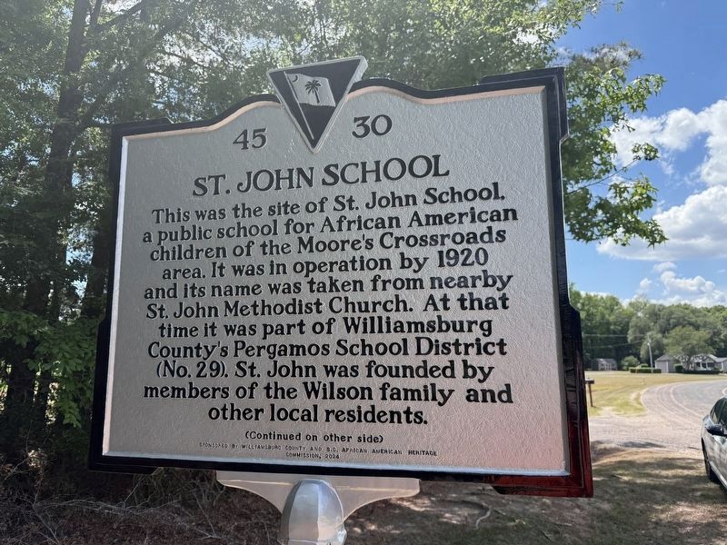
This was the site of St. John School, a public school for African American children of the Moore's Crossroads area. It was in operation by 1920 and its name was taken from nearby St. John Methodist Church. At that time it was part of Williamsburg County's Pergamos School District (No. 29). St. John was founded by members of the Wilson family and other local residents.
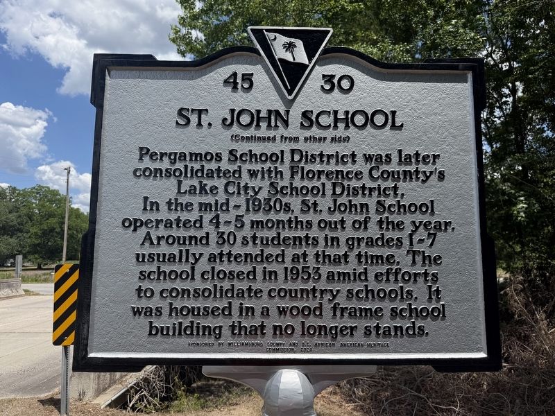
Pergamos School District was later consolidated with Florence County's Lake City School District. In the mid-1930s, St. John School operated 4-5 months out of the year. Around 30 students in grades 1-7 usually attended at that time. The school closed in 1953 amid efforts to consolidate country schools. It was housed in a wood frame school building that no longer stands.
Erected 2024 by South Carolina Department of Archives and History; sponsored by Williamsburg County and S.C. African American Heritage Commission. (Marker Number 45-30.)
Topics. This historical marker is listed in these topic lists: African Americans • Education. A significant historical year for this entry is 1920.
Location. 33° 51.563′ N, 79° 50.484′ W. Marker is near Lake City,
this page online

Regionally, this marker is in the Pee Dee. It is also in the American South and specifically in the Deep South. Globally, it is in North America, the Western Hemisphere, the Western World, and the Anglosphere. Historically, it finds itself in what was once the territory of the Mississippian Culture, one of the original Thirteen Colonies, one of the Confederate States of America, and the Antebellum South.
Other nearby markers. At least 8 other markers are within 5 miles of this marker, measured as the crow flies: Greater St. James A.M.E. Church (approx. 4.4 miles away); The Lynching of Frazier Baker (approx. 4.7 miles away); Lake City Tobacco Markets / Imperial Tobacco Company (approx. 4.9 miles away); W.T. Askins House (approx. 5 miles away); 102 East Main Street (approx. 5 miles away); 115 West Main Street (approx. 5 miles away); 111 West Main Street
Credits. This page was last revised on May 25, 2026. It was originally submitted on May 25, 2026, by Devry Becker Jones of Washington, District of Columbia. This page has been viewed 15 times since then. Photos: 1, 2, 3, 4. submitted on May 25, 2026, by Devry Becker Jones of Washington, District of Columbia.
