Carlsbad in Eddy County, New Mexico — The American Mountains (Southwest)
Eddy County Courthouse
Discover Carlsbad
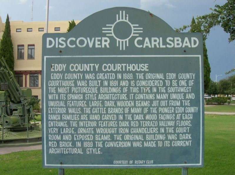
Photographed by Jimmy Emerson, 2010
1. Eddy County Courthouse Marker
Eddy County was created in 1889. The original Eddy County courthouse was built in 1892 and is considered to be one of the most picturesque buildings of this type in the Southwest with its Spanish style architecture. It contains many unique and unusual features. Large, dark, wooden beams just out from the exterior walls. The cattle brands of many pioneer Eddy County ranch families are hand carved in the dark wood facings at each entrance. The interior features dark red terrazzo hallway floors, very large, ornate wrought iron chandeliers in the courtroom and exposed beams. The original building was dark red brick. In 1939 the conversion was made to its current architectural style.
Erected by Rotary Club.
Topics. This historical marker is listed in this topic list: Architecture. A significant historical year for this entry is 1889.
Location. Marker is missing. It was located near 32° 25.256′ N, 104° 13.72′ W. Marker was in Carlsbad, New Mexico, in Eddy County. It was on North Canal Street north of West Mermod Street, on the right when traveling north. Touch for map. Marker was at or near this postal address: 102 N
this page online

Regionally, this marker was in the Pecos Valley. It was also in the American Southwest, on the Great Plains, on the Southern Plains, and specifically on the High Plains. Globally, it was in North America, the Western Hemisphere, the Western World, and the Anglosphere. Historically, it found itself in what was once New Spain, the Comanchería, and the Republic of Texas.
Other nearby markers. At least 7 other markers are within 16 miles of this location, measured as the crow flies: Mother Magdalen and the Sisters of Loretto (1852 - 1968) / Carlsbad (approx. 0.9 miles away); Josephine Cox "Grandma" Anderson (approx. 0.9 miles away); Carlsbad Irrigation Flume (approx. 2.2 miles away); Civilian Conservation Corps Carlsbad Campsite (approx. 2.2 miles away); a different marker also named Carlsbad Irrigation Flume (approx. 2.4 miles away); a different marker also named Carlsbad Irrigation Flume (approx. 2½ miles away); Goodnight-Loving Trail (approx. 9.8 miles away). Touch for a list and map of all markers in Carlsbad.
Other markers no longer nearby. Loving's Bend (was approx. 11½ miles away but has been permanently removed); Espejo's Trail (was approx. 15.9 miles away but has been confirmed missing).
More about this marker. The marker stood on the courthouse lawn but it and the military equipment behind are not there as of May 2026.
Credits. This page was last revised on May 28, 2026. It was originally submitted on May 27, 2026, by Jimmy Emerson of Dalton, Georgia. This page has been viewed 28 times since then. Last updated on May 27, 2026, by Jimmy Emerson of Dalton, Georgia. Photo 1. submitted on May 27, 2026, by Jimmy Emerson of Dalton, Georgia. • Devry Becker Jones was the editor who published this page.
