
Bunratty East in County Clare, Munster, Ireland — Irish South-West ((Éire) North Atlantic Ocean)
Bunratty Castle
| — | Bunratty Village Heritage Trail | — |
Photographed by Ian Lefkowitz, May 14, 2026
1. Bunratty Castle Marker

Bunratty Castle
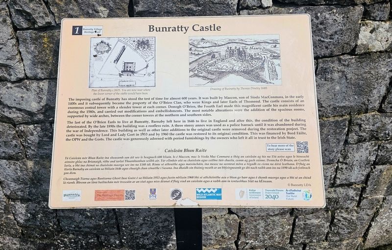
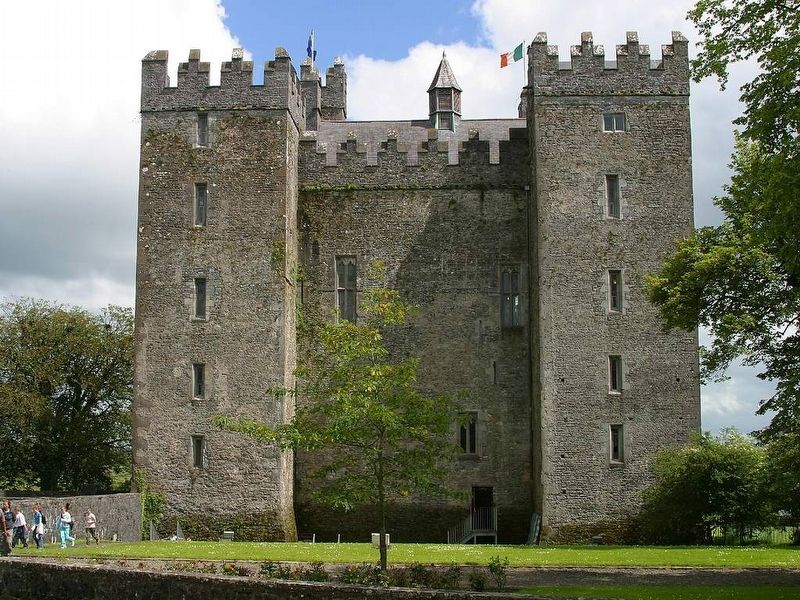
The imposing castle of Bunratty has stood the test of time for almost 600 years. It was built by Maccon, son of Sioda MacConmara, in the early 1400s and it subsequently became the property of the O’Brien Clan, who were Kings and later Earls of Thomond. The castle consists of an enormous central tower with a slender tower at each corner. Donogh O’Brien, the Fourth Earl made this magnificent castle his main residence during the 1580s, and carried out modifications and embellishments. The most notable alterations were the addition of the spacious rooms, supported by wide arches, between the corner towers at the northern and southern sides.
The last of the O’Brien Earls to live at Bunratty, Barnaby left here in 1646 to live in England and after this, the condition of the building deteriorated. By the late 1890s the building was a roofless ruin. A three storey annex was used as a police barrack until it was abandoned during the war of Independence. This building as well as other later additions to the original castle were removed during the restoration project. The castle was bought by Lord and
this page online
Caisleán Bhun Raite
Tá Caisleán mór Bhun Raite ina sheasamh san áit seo le beagnach 600 bliain. Is é Maccon, mac le Sioda Mac Conmara a thóg an caisleán ag tús na 15ú aoise agus le himeacht aimsire ghlac na Brianaigh, ríthe and iarlaí Thuamhumhan seilbh air. Tár ollmhór atá sa chaisleán agus ceithre túir chaola, ceann ag gach cúinne. Donncha Ó Briain, an Ceathrú Iarla, a bhí ina chónaí sa chaisleán maorga seo ins na 1580 idí. Rinne sé athraithe agus maisiúcháin, ina measc na seomraí móra a tógadh os cionn na áirsí leathana. D’fhág an tIarla Barnaby an caisleán sa bhliain 1646 agus chuaigh chun cónaithe i Sasana. Ina dhaidh sin tháinig meath ar an bhfoirgneamh go dtí nach raibh ann ins na 1890 idí ach fothrach gan díon.
Cheannaigh Tiarna agus Bantiarna Ghort Inse Guire é sa bhliain 1953 agus faoin mbliain 1960 bhí sé athchóirithe acu o bhun go barr agus é chomh maorga agus a bhí
Photographed by Ian Lefkowitz, May 14, 2026
2. Bunratty Castle Marker
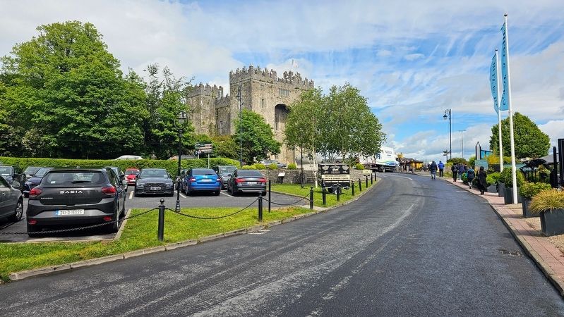
Bunratty Castle, with the marker visible in the middle of the photo.
(Captions)
Plan of Bunratty c.1625. You are now near where the lower corner of the stable would have been.
Drawing of Bunratty by Thomas Dineley 1680.
© Bunratty LDA
Erected by Bunratty Local Development Association. (Marker Number 1.)
Topics. This historical marker is listed in this topic list: Forts and Castles. A significant historical year for this entry is 1646.
Location. 52° 41.783′ N, 8° 48.771′ W. Marker is in Bunratty, Munster, in County Clare. It is in Bunratty East. It can be reached from the intersection of Old Bunratty Road and Bunratty West, on the right when traveling east. The marker is located at the northern end of the car park. Touch for map. Marker is at or near this postal address: 49 Old Bunratty Road, Bunratty, Munster, Ireland. Touch for directions.

Regionally, this marker is in the Hidden Heartlands. Globally, it is on the Atlantic Ocean, in the North Atlantic Region, in Europe, on the Island of Ireland, on the Celtic Fringe, in the European
Jon Sullivan, Public domain, via Wikimedia Commons, June 14, 2002
3. Bunratty Castle
Other nearby markers. At least 8 other markers are within 13 kilometers of this marker, measured as the crow flies: Caiseal Óir (here, next to this marker); Bunratty House (within shouting distance of this marker); Bunratty Bridge (about 90 meters away, measured in a direct line); Military Events (about 120 meters away); Landscape and River (about 120 meters away); Sarsfield Bridge (approx. 12.8 kilometers away); Sóivéid Luimní / Limerick Soviet (approx. 12.8 kilometers away); Dockers Monument (approx. 12.8 kilometers away). Touch for a list and map of all markers in Bunratty.
Also see . . . Bunratty Castle (Wikipedia).
Bunratty Castle (Irish: Caisleán Bhun Raithe) is a large 15th-century tower house in County Clare, Ireland. It is located in the centre of Bunratty village, by the N18 road between Limerick and Ennis, near Shannon Town and its airport. The castle and the adjoining folk park are run by Shannon Heritage as tourist attractions.(Submitted on May 27, 2026, by Ian Lefkowitz of New York, New York.)
Credits. This page was last revised on May 28, 2026. It was originally submitted on May 27, 2026, by Ian Lefkowitz of New York, New York. This page has been viewed 15 times since then. Photos: 1, 2, 3. submitted on May 27, 2026, by Ian Lefkowitz of New York, New York. • Andrew Ruppenstein was the editor who published this page.
