Summerton in Clarendon County, South Carolina — The American South (South Atlantic)
Fort Watson
Photographed by Mike Stroud, October 23, 2009
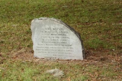
1. Fort Watson Stone Marker
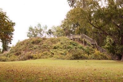
One of the chain of British posts in South Carolina. Located on this Indian Mound. Besieged April 15-23, 1781 by use of Maham's tower, Francis Marion forced the British to surrender and secured for his men badly needed ammunition and supplies.
Erected 1950 by the State of South Carolina and the South Carolina Daughters of the American Revoluion.
Topics and series. This historical marker is listed in these topic lists: Forts and Castles • Patriots & Patriotism • War, US Revolutionary. In addition, it is included in the Daughters of the American Revolution (DAR), and the Francis Marion Trail series lists. A significant historical date for this entry is April 15, 1781.
Location. 33° 32.339′ N, 80° 26.206′ W. Marker is in Summerton, South Carolina, in Clarendon County. It is on Fort Watson Road (State Highway 14-803) one mile west of St Paul Road (U.S. 15/301), on the left when traveling west. Touch for map. Marker is at or near this postal address: 2125 Fort Watson Rd, Summerton SC 29148, United States of America. Touch for directions.

Regionally, this marker is in the Pee Dee and in Santee Cooper Country. It is
this page online
Other nearby markers. At least 8 other markers are within 5 miles of this marker, measured as the crow flies: Santee National Wildlife Refuge (a few steps from this marker); Swamp Fox (approx. half a mile away); 2nd Battle of Fort Watson (approx. half a mile away); a different marker also named Fort Watson (approx. half a mile away); Fort Watson: (approx. 0.8 miles away); Liberty Garden (approx. 3.6 miles away); Butler Cemetery / Butler School (approx. 3.7 miles away); Liberty Hill Church / Pioneers in Desegregation (approx. 4½ miles away). Touch for a list and map of all markers in Summerton.
Related marker. Click here for another marker that is related to this marker.
Also see . . . National Register Properties in South Carolina, Santee Indian Mound and Fort Watson.
Photographed by Mike Stroud, October 11, 2009
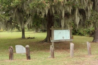
2. Fort Watson Marker
In 1780, Francis Marion and Light Horse Harry Lee decided to capture the fort. Bombardment was out of the question, for the Americans were without artillery, but Colonel Maham, one of Marion’s officers, proposed building a log tower higher than Fort Watson. Hidden by trees, men hewed logs and the tower was erected in a single night. At dawn a shower of lead poured down into the enemy enclosure, effecting a quick victory. Fort Watson was the first fortified British military outpost in South Carolina recaptured by patriot forces after the British occupation of 1780.
There are no remains of Fort Watson on the site. Listed in the National Register July 29, 1969. (Submitted on November 13, 2009.)
Photographed by Mike Stroud, October 23, 2009
3. Fort Watson was built atop this Indian Burial Mound
Photographed by N.p.s., May 21, 2006
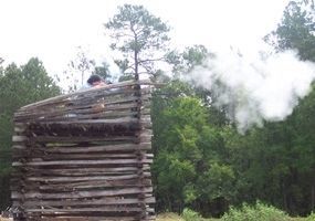
4. Maham Tower
It is named after Lt Col. Hezekiah Maham, one of Francis Marion's men who first developed the idea at Fort Watson early in the War.
Credits. This page was last revised on May 29, 2026. It was originally submitted on November 10, 2009, by Mike Stroud of Bluffton, South Carolina. This page has been viewed 2,113 times since then and 48 times this year. Last updated on May 29, 2026, by C Summers of Manning, South Carolina. Photos: 1, 2, 3, 4. submitted on November 10, 2009, by Mike Stroud of Bluffton, South Carolina. • Devry Becker Jones was the editor who published this page.
