Sonora in Tuolumne County, California — The American West (Pacific Coastal)
Tuolumne County Jail
1857 – 1960
Photographed by Syd Whittle, June 13, 2010
1. Tuolumne County Jail Marker
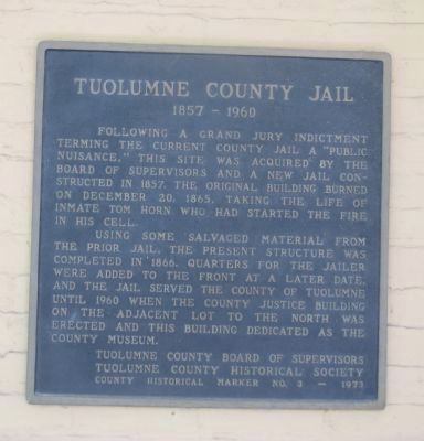
Following a grand jury indictment terming the current county jail a “public nuisance,” this site was acquired by the Board of Supervisors and a new jail constructed in 1857. The original building burned on December 20, 1865, taking the life of inmate Tom Horn who had started the fire in his cell.
Using some salvaged material from the prior jail, the present structure was completed in 1866. Quarters for the jailer were added to the front at a later date, and the jail served the County of Tuolumne until 1960 when the county justice building on the adjacent lot to the north was erected and this building dedicated as the County Museum.
Erected 1973 by Tuolumne County Board of Supervisors and the Tuolumne County Historical Society. (Marker Number 3.)
Topics. This historical marker is listed in these topic lists: Government & Politics • Notable Buildings. A significant historical year for this entry is 1857.
Location. 37° 59.022′ N, 120° 23.131′ W. Marker is in Sonora, California, in Tuolumne County. It can be reached from West Bradford Avenue west of Lower Sunset Drive, on the right when traveling west. Marker is
this page online

Regionally, this marker is in the Sierra Nevada. It is also in the American Mountain West. Globally, it is in North America, on the Ring of Fire, on the Pacific Rim, in the Western Hemisphere, in the Western World, and in the Anglosphere. Historically, it finds itself in what was once New Spain and also Mexico’s Alta California.
Other nearby markers. At least 8 other markers are within walking distance of this marker: Jedediah Strong Smith (a few steps from this marker); Tuolumne County Courthouse (about 700 feet away, measured in a direct line); Tuolumne County Albert N. Francisco Building (about 700 feet away); Site of the First Office of The Union Democrat (about 800 feet away); Bradford Building (approx. 0.2 miles away); Veterans Memorial Building (approx. 0.2 miles away); First Home of Wells Fargo & Company in Sonora (approx. 0.2 miles away); Original Site of the Sonora Daily (approx. 0.2 miles away). Touch for a list and map
Photographed by Syd Whittle, June 13, 2010
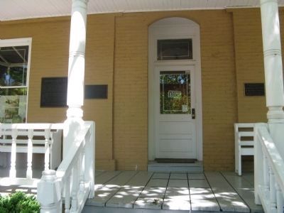
2. Front of Building Displaying Markers
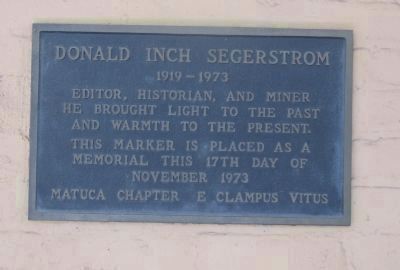
This marker is the far left marker seen next to the window. The Donald Inch Segerstrom
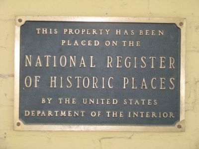
Memorial Plaque is to the left of the door and the National Register of Historic Places plaque is to the right of the door.
Also see . . . Tuolumne County Jail. Tom Horn, a miner from nearby Columbia, who on December 20 of 1865, raised a little too much havoc in the local saloons was locked up for the night. He set a fire in his cell that resulted in the destruction of the jail and his cremation. [Not the famous outlaw Tom Horn] (Submitted on June 27, 2010.)
Photographed by Syd Whittle, June 13, 2010
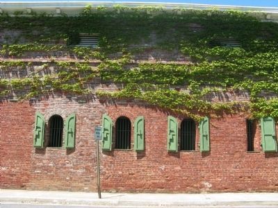
3. Jail Cell Windows
View of building and jail cell windows seen from Lower Sunset Drive.
Photographed by Syd Whittle, June 13, 2010
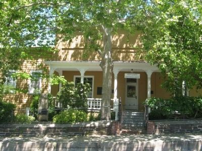
4. Tuolumne County Museum and History Center
Photographed by Syd Whittle, June 13, 2010
5. Donald Inch Segerstrom
1919-1973. Editor, historian, and miner. He brought light to the past and warmth to the present. This marker is placed as a memorial this 17th day of November 1973, Matuca Chapter E Clampus Vitus
Photographed by Syd Whittle, June 13, 2010
6. National Register of Historic Places
Credits. This page was last revised on June 1, 2026. It was originally submitted on June 16, 2010, by Syd Whittle of Mesa, Arizona. This page has been viewed 1,474 times since then and 38 times this year. Last updated on May 29, 2026, by Liam Williams of Irvine, California. Photos: 1, 2, 3, 4, 5, 6. submitted on June 16, 2010, by Syd Whittle of Mesa, Arizona. • Devry Becker Jones was the editor who published this page.
