Summerville in Dorchester County, South Carolina — The American South (South Atlantic)
In the Path of War
Dorchester in the American Revolution, 1775 - 1783
| — | South Carolina State Park Service | — |
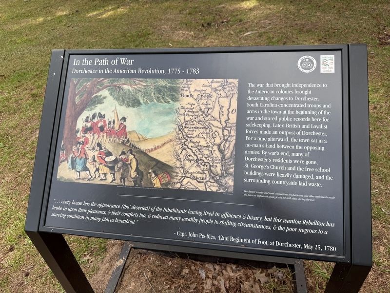
The war that brought independence to the American colonies brought devastating changes to Dorchester. South Carolina concentrated troops and arms in town at the beginning of the war and stored public records here for safekeeping. Later, British and Loyalist forces made an outpost of Dorchester. For a time afterward, the town sat in a no-man's-land between the opposing armies. By war's end, many of Dorchester's residents were gone. St. George's Church and the free school buildings were heavily damaged, and the surrounding countryside laid waste.
"…every house has the appearance (tho' deserted) of the Inhabitants having lived in affluence & luxury, but this wanton Rebellion has broke in upon their pleasures, & their comforts too, & reduced many wealthy people to shifting circumstances, & the poor negroes to a starving condition in many places hereabout.
- Capt. John Peebles, 42nd Regiment of Foot, at Dorchester, May 25, 1780
[Caption:]
Dorchester's water and road connections to Charleston and other settlements made the town an important strategic site for both sides during the war.
Erected by South Carolina
this page online
Topics. This historical marker is listed in these topic lists: Settlements & Settlers • War, US Revolutionary. A significant historical date for this entry is May 25, 1780.
Location. 32° 56.891′ N, 80° 10.256′ W. Marker is in Summerville, South Carolina, in Dorchester County. It is on Shop Road north of County Road 18-373, on the right when traveling south. Touch for map. Marker is at or near this postal address: 300 State Park Rd, Summerville SC 29485, United States of America. Touch for directions.

Regionally, this marker is in the Lowcountry. It is also in the American South, specifically in the Deep South, and on the Eastern Seaboard. Globally, it is in the North Atlantic Region, North America, the Western Hemisphere, the Western World, and the Anglosphere. Historically, it finds itself in what was once the territory of the Mississippian Culture, one of the original Thirteen Colonies, one of the Confederate States of America, and the Antebellum South.
Other nearby markers. At least 8 other markers are within walking distance of this marker: Clues of Wealth (within shouting distance of this marker);
Another marker is no longer nearby. Welcome to Colonial Dorchester State Historic Site (was about 500 feet away but has been replaced with another marker now near it).
Credits. This page was last revised on May 29, 2026. It was originally submitted on May 29, 2026, by Devry Becker Jones of Washington, District of Columbia. This page has been viewed 16 times since then. Photos: 1, 2. submitted on May 29, 2026, by Devry Becker Jones of Washington, District of Columbia.
