
Frydek in Austin County, Texas — The American South (West South Central)
Mt. Zion Baptist Church
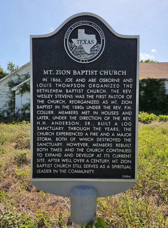
Photographed by James Hulse, May 28, 2026
1. Mt. Zion Baptist Church Marker
In 1866, Joe and Abe Osborne and Louis Thompson organized the Bethlehem Baptist Church. The Rev. Wesley Stevens was the first pastor of the church, reorganized as Mt. Zion Baptist in the 1880s under the Rev. P.H. Collier. Members met in houses and later, under the direction of the Rev. H.H. Anderson, Sr., built a log sanctuary. Through the years, the church experienced a fire and a major storm, both of which destroyed the sanctuary. However, members rebuilt both times and the church continued to expand and develop at its current site. After well over a century, Mt. Zion Baptist Church still serves as a spiritual leader in the community.
Erected 2006 by Texas Historical Commission. (Marker Number 13553.)
Topics. This historical marker is listed in these topic lists: African Americans • Religion & Religious Structures. A significant historical year for this entry is 1866.
Location. 29° 43.643′ N, 96° 4.819′ W. Marker is in Frydek, Texas, in Austin County. It is at the intersection of Harvest Road and Mixville Road, on the left when traveling south on Harvest Road. Touch for map. Marker is at or near this postal
this page online

Regionally, this marker is in the American South and on the Gulf Coast. Globally, it is in North America, a Gulf of Mexico state, the Western Hemisphere, the Western World, and the Anglosphere. Historically, it finds itself in what was once New Spain, the Republic of Texas, one of the Confederate States of America, and the Antebellum South.
Other nearby markers. At least 8 other markers are within 6 miles of this marker, measured as the crow flies: Frydek Catholic Cemetery (approx. 3 miles away); San Felipe de Austin (approx. 4 miles away); Martin Allen (approx. 4.6 miles away); San Felipe School (approx. 5 miles away); San Felipe de Austin Cemetery (approx. 5.1 miles away); Hartsville Cemetery (approx. 5.1 miles away); a different marker also named Hartsville Cemetery (approx. 5.1 miles away); Hartsville Veterans Memorial (approx. 5.1 miles away).

Photographed by James Hulse, May 28, 2026
2. Mt. Zion Baptist Church Marker
The view of the church and marker from Harvest Road.

Photographed by James Hulse, May 28, 2026
3. Mt. Zion Baptist Church Marker
The front view of the church.
Credits. This page was last revised on May 30, 2026. It was originally submitted on May 30, 2026, by James Hulse of Medina, Texas. This page has been viewed 16 times since then. Photos: 1, 2, 3. submitted on May 30, 2026, by James Hulse of Medina, Texas.
