Ville-Marie in Montréal, Québec — Central Canada (French-Canadian)
Une ville en profonde mutation
⎯⎯⎯
Transformation of a City

Photographed by Cosmos Mariner, May 21, 2024
1. Une ville en profonde mutation / Transformation of a City Marker

Une ville en profonde mutation
Stimulée par l'industrialisation contemporaine, la Ville de Montréal connaît une période de croissance phénoménale entre 1850 et 1950, alors que sa population passe de 58 000 à plus de 1 million de personnes. A eux seuls, les quartiers en plein essor de Griffintown et de Pointe-Saint-Charles comptent plus d'habitants que la vieille ville. Cette dernière, avec ses petites rues bordées d'immeubles de pierre, se voit encerclée par de nouveaux quartiers industriels et ouvriers où la brique règne en maître. Les clochers d'église ne sont plus seuls à dominer le paysage : grues, cheminées et usines colossales les rejoignent désormais.
[légendes]
• Manœuvres en grève, 1878. La grève des ouvriers du canal en 1843 fait date dans l'histoire des relations de travail au Canada.
• Vue de Montréal depuis la cheminée de la centrale de la Montreal Street Railway, 1896.
• Les tanneries (de Saint-Henri) près de Montréal, vers 1838-1840.
• View partielle du port et de la ville de Montréal, 1830.
Transformation of a City
Driven by modern industrialization, the city of Montreal experienced
this page online
[captions]
• The Lachine Canal Labourers’ Strike, 1878. The canal workers' strike of 1843 was a milestone in the history of labour relations in Canada.
• Montreal from Street Railway Power House chimney, 1896.
• (Saint-Henri) Tanneries near Montreal, circa 1838-1840.
• View of the harbour and the City of Montreal, 1830.
Erected by Parcs Canada & Société du Vieux-Port de Montréal / Parks Canada & Old Port of Montreal Corporation.
Topics. This historical marker is listed in these topic lists: Architecture • Industry & Commerce.
Location. 45° 29.787′ N, 73° 33.146′ W.
Photographed by Cosmos Mariner, May 21, 2024
2. Une ville en profonde mutation / Transformation of a City Marker
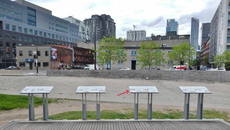
This marker is the third from the left of four interpretive panels overlooking Rue de la Commune Ouest at this location.

Regionally, this marker is in Central Canada. Globally, it is in North America, the Western Hemisphere, and the Western World. Historically, it finds itself in what was once a British colony, the Viceroyalty of New France, the Haudenosaunee (Iroquois) Confederacy, and Rupert’s Land.
Other nearby markers. At least 8 other markers are within walking distance of this marker: Le berceau de l'industrie / Cradle of Canadian Industry (here, next to this marker); Un petit monde en soi / A World Unto Itself (here, next to this marker); Trois Siecles D'histoire / Three Centuries of History (here, next to this marker); La batellerie du Saint-Laurent / The St. Lawrence Fleet (here, next to this marker); L'époque revolue des canalers / The Era of the Canaler (here, next to this marker); Les canaux du Saint-Laurent / The St. Lawrence Canals (here, next to this marker); Vers L'intérieur du continent / Gateway to the Interior (here, next to this marker); Le site des écluses nos 1 et 2 / The site of locks 1 and 2 (within shouting distance of this marker). Touch for a list and map of all markers in Montréal.
Also see . . . Montreal: Industrialization (Wikipedia).
Excerpt: In 1852, Montreal had 58,000 inhabitants and by 1860, Montreal was the largest city in British North America, and it was the undisputed economic and cultural center of Canada. From 1861 to the Great Depression of 1930, Montreal developed in what some historians call its Golden Age. Saint Jacques Street became the most important economic center of the Dominion of Canada. The Canadian Pacific Railway made its headquarters there in 1880, and the Canadian National Railway in 1919. At the time of its construction in 1928, the new head office of the Royal Bank of Canada at 360 St. James Street was the tallest building in the British Empire. Montreal shared control of the Canadian securities market with Toronto from the 1850s to the 1970s causing a persistent rivalry between the two.(Submitted on June 1, 2026, by Cosmos Mariner of Cape Canaveral, Florida.)
Credits. This page was last revised on June 1, 2026. It was originally submitted on May 30, 2026, by Cosmos Mariner of Cape Canaveral, Florida. This page has been viewed 16 times since then. Photos: 1, 2. submitted on June 1, 2026, by Cosmos Mariner of Cape Canaveral, Florida.
