Saint Helena Island in Beaufort County, South Carolina — The American South (South Atlantic)
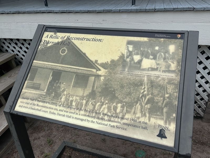
A Relic of Reconstruction: Darrah Hall
| — | Reconstruction Era National Historical Park | — |
Photographed by Benjamin Rubin, May 30, 2026
1. A Relic of Reconstruction: Darrah Hall Marker
(caption) For generations, residents of St. Helena Island have come together at Darrah Hall. Pictured here are Penn scholars gathered inside for an assembly. Photos from the Penn Center Collections.
Erected by National Park Service, U.S. Department of the Interior.
Topics. This historical marker is listed in these topic lists: African Americans • Education. A significant historical year for this entry is 1900.
Location. 32° 23.234′ N, 80° 34.714′ W. Marker is on Saint Helena Island, South Carolina, in Beaufort County. It is on Holland Court west of Dr Martin Luther King Jr Drive, on the right. Touch for map. Marker is at or near this postal address: 16 Penn Center Cir E, Saint Helena Island SC 29920, United States of America. Touch for directions.

Regionally, this marker is in the Lowcountry and on the Sea Islands. It
this page online
Other nearby markers. At least 8 other markers are within 5 miles of this marker, measured as the crow flies: Dawn of a Revolution: The Penn School (about 400 feet away, measured in a direct line); Trailblazers at Penn Center National Historic Landmark District (about 600 feet away); The Great Sea Island Storm (about 700 feet away); In Honor Of Edith M. Dabbs and James McBride Dabbs (about 700 feet away); Penn School (about 700 feet away); Water — A Way Home, A Way of Life (approx. 0.2 miles away); Chapel of Ease (approx. 0.8 miles away); Lady's Island Oyster Factory (approx. 4.7 miles away). Touch for a list and map of all markers in Saint Helena Island.
Also see . . .
1. Reconstruction Era National Historical Park. National Park Service (Submitted on June 12, 2026.)
2. Penn Center. The first school in the South for formerly enslaved West Africans. (Submitted on June 12, 2026.)
Credits. This page was last revised on June 12, 2026. It was originally submitted on May 31, 2026, by Benjamin Rubin of Columbia, South Carolina. This page has been viewed 21 times since then. Photo 1. submitted on May 31, 2026, by Benjamin Rubin of Columbia, South Carolina. • Bernard Fisher was the editor who published this page.
Editor’s want-list for this marker. Wide shot of marker and its surroundings. • Can you help?
