Near Hudgins in Mathews County, Virginia — The American South (Mid-Atlantic)
Battle of Cricket Hill
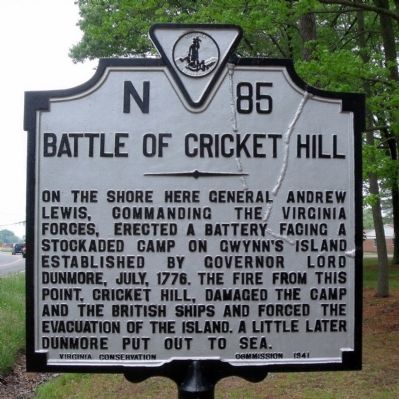
Photographed by Bernard Fisher, April 25, 2010
1. Battle of Cricket Hill Marker
Erected 1941 by Virginia Conservation Commission. (Marker Number N-85.)
Topics and series. This historical marker is listed in these topic lists: Forts and Castles • War, US Revolutionary. In addition, it is included in the Virginia Department of Historic Resources (DHR) series list. A significant historical year for this entry is 1776.
Location. 37° 29.156′ N, 76° 18.561′ W. Marker is near Hudgins, Virginia, in Mathews County. It is at the intersection of Cricket Hill Road (Virginia Route 223) and Mill Point Road ( Route 669), on the right when traveling north on Cricket Hill Road. Touch for map. Marker is in this post office area: Hudgins VA 23076, United States of America. Touch for directions.

Regionally, this marker is on the Middle Peninsula and in the Hampton Roads Metropolitan
this page online
Other nearby markers. At least 8 other markers are within 4 miles of this marker, measured as the crow flies: Dunmore's Last Stand (approx. 0.2 miles away); Captain Louis d'Ohicky Arundel (approx. 0.2 miles away); a different marker also named Battle of Cricket Hill (approx. 0.2 miles away); By Duty Done Is Honor Won (approx. 1.7 miles away); Black Exodus from Gwynn's Island (approx. 2.6 miles away); Flights to Freedom (approx. 2.6 miles away); Fitchett's Wharf (approx. 3 miles away); Veterans Memorial (approx. 3.3 miles away). Touch for a list and map of all markers in Hudgins.
Also see . . . Fort Cricket Hill. Virginia Department of Historic
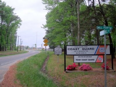
Photographed by Bernard Fisher, April 25, 2010
2. Cricket Hill Rd & Mill Point Rd (facing north)
Credits. This page was last revised on August 30, 2026. It was originally submitted on April 26, 2010, by Bernard Fisher of Richmond, Virginia. This page has been viewed 2,497 times since then and 124 times this year. Photos: 1, 2. submitted on April 26, 2010, by Bernard Fisher of Richmond, Virginia.
