Gloucester Point in Gloucester County, Virginia — The American South (Mid-Atlantic)
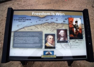
Freedom is Won
During the siege of Yorktown, a French force supported by 3,000 colonial militia encircled the British forces of Colonel Tarleton at Gloucester Point. One significant engagement took place on October 3, 1781, when the British forces conducting a food gathering mission into Gloucester County were overtaken by an Allied force and the 'Battle of the Hook' followed. During the battle, Colonel Tarleton was nearly captured when his horse was killed. The bottling up of British forces at the Point and siege in Yorktown cut off Cornwallis's supplies of food for men and horses.
General Cornwallis had hoped to evacuate his troops through the Point during the night of October 17th, but a strong storm forced him to cancel the plan. Two days later, he was forced to surrender his forces and inform General Clinton of his actions.
Erected by Chesapeake Bay Gateways Network.
Topics. This historical marker is listed in this topic list: War, US Revolutionary. A significant historical month for this entry is October 1701.
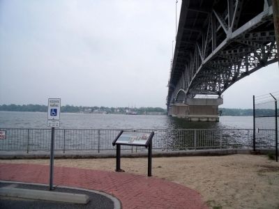
Location. 37° 14.727′ N, 76° 30.274′ W. Marker is in Gloucester Point, Virginia, in Gloucester County. Marker can be reached from the intersection of Greate Road (Virginia Route 1208) and Franklin Road. This marker is located in the Gloucester Point Beach parking area under the Coleman Bridge. Touch for map. Marker is in this post office area: Gloucester Point VA 23062, United States of America. Touch for directions.
Other nearby markers. At least 8 other markers are within walking distance of this marker. Virginia's First Shots in the Civil War (a few steps from this marker); Port of Call (a few steps from this marker); To Get to the Other Side (within shouting distance of this marker); Harvesting Nature's Bounty (within shouting distance of this marker); Mother Nature Comes Calling (about 300 feet away, measured in a direct line); Virginia Institute of Marine Science (about 400 feet away); a different marker also named Port of Call (approx. 0.2 miles away); Gloucester Point (approx. 0.3 miles away). Touch for a list and map of all markers in Gloucester Point.
More about this marker. On the right of the panel are three portraits: "George Washington", "Lord Cornwallis", and "Colonel Tarleton".
Credits. This page was last revised on November 5, 2021. It was originally submitted on April 26, 2010, by Bernard Fisher of Richmond, Virginia. This page has been viewed 811 times since then and 13 times this year. Photos: 1, 2, 3. submitted on April 26, 2010, by Bernard Fisher of Richmond, Virginia.


