Wind Gap in Northampton County, Pennsylvania — The American Northeast (Mid-Atlantic)
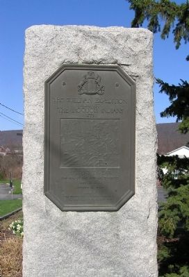
Sullivan Expedition Against the Iroquois Indians
1779
Photographed by Paul Crumlish, April 4, 2010
1. Sullivan Expedition Against the Iroquois Indians 1779 Plaque
Erected 1929 by The Pennsylvania Historical Commission
The Valley Forge Chapter, S.A.R.
Topics and series. This historical marker is listed in this topic list: War, US Revolutionary. In addition, it is included in the The Sullivan-Clinton Expedition Against the Iroquois Indians series list. A significant historical date for this entry is June 18, 1892.
Location. 40° 50.349′ N, 75° 17.783′ W. Marker is in Wind Gap, Pennsylvania, in Northampton County. It is on South Broadway (Pennsylvania Route 512) 0.3 miles north of Male Road (County Road 1028), on the left when traveling north. Touch for map. Marker is in this post office area: Wind Gap PA 18091, United States of America. Touch for directions.

Regionally, this marker is in Southeast Pennsylvania and in Lehigh Valley. It is also in the American Northeast and in the Mid-Atlantic. Globally, it is in North America, the Western Hemisphere, the Western World, and the Anglosphere. Historically, it finds itself in what was once the Haudenosaunee (Iroquois) Confederacy and also one of the original Thirteen Colonies.
Other nearby markers. At least 8 other markers are within 4 miles of this marker, measured as the crow flies: Sullivan's March (here, next to this marker); World Wars Memorial (approx. 0.8 miles away); Wind Gap Veterans Memorial (approx. 0.9 miles away); "Homefront" (approx. 3 miles away); War Memorial (approx. 3 miles away); Veterans Memorial (approx. 3.3 miles away); Weona Park Carousel (approx. 3.4 miles away); a different marker also named World Wars Memorial (approx. 3.9 miles away). Touch for a list and map of all markers in Wind Gap.
Related markers. Click here for a list of markers that are related to this marker. To better understand the relationship, study
this page online
Photographed by Paul Crumlish, April 4, 2010
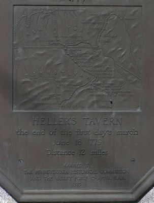
2. Detail of the Sullivan Expedition Against the Iroquois Indians 1779 plaque
Photographed by Paul Crumlish, April 4, 2010
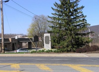
3. Wide view of the Sullivan Expedition Against the Iroquois Indians 1779 Plaque
Credits. This page was last revised on June 16, 2016. It was originally submitted on April 26, 2010, by PaulwC3 of Northern, Virginia. This page has been viewed 1,431 times since then and 36 times this year. Photos: 1, 2, 3. submitted on April 26, 2010, by PaulwC3 of Northern, Virginia.
