Grantsville in Tooele County, Utah — The American Mountains (Southwest)
Grantsville Fort

Photographed by Jeremy Snow, May 30, 2026
1. Grantsville Fort Marker
About fifty people lived inside the fort during the early settlement of the town of Grantsville which was named in honor of George D. Grant, one of its pioneers.
Daughters of the Utah Pioneers, Grantsville Chapter
Utah Pioneer Trails and Landmarks Association
Erected 1954 by Utah Pioneer Trails and Landmarks Association, Daughters of the Utah Pioneers. (Marker Number 42.)
Topics and series. This historical marker is listed in these topic lists: Forts and Castles • Settlements & Settlers. In addition, it is included in the Daughters of Utah Pioneers series list. A significant historical year for this entry is 1853.
Location. 40° 36.127′ N, 112° 28.408′ W. Marker is in Grantsville, Utah, in Tooele County. It is on West Clark Street, on the right when traveling east. Touch for map. Marker is at or near this postal
this page online

Regionally, this marker is in the Wasatch Front, in the West Desert, and in Greater Salt Lake. It is also in the American Mountain West and on the Colorado Plateau. Globally, it is in North America, the Rocky Mountains, the Western Hemisphere, the Western World, and the Anglosphere. Historically, it finds itself in what was once New Spain and also Mexico’s Alta California.
Other nearby markers. At least 8 other markers are within 2 miles of this marker, measured as the crow flies: The Cherokee Trail (within shouting distance of this marker); Donner-Reed Memorial Museum (within shouting distance of this marker); Jeffries Property Cabin (within shouting distance of this marker); Twenty Wells/Emigrant Graves (within shouting distance of this marker); Pioneer Blacksmith Shop (within shouting distance of this marker); The Lincoln Highway (approx. half a mile away); Alex and Mary Johnson Home (approx. half a mile away); Hilda Anderson Erickson (approx. 1.4 miles away). Touch for a list and map of all markers in Grantsville.
Photographed by Jeremy Snow, May 30, 2026
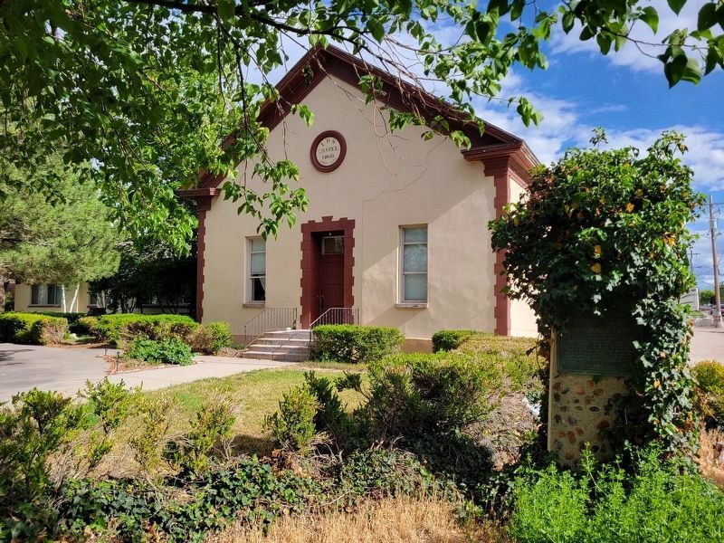
2. Grantsville Fort Marker
Marker located beneath the large foliage on the right side of the photo.
Credits. This page was last revised on June 3, 2026. It was originally submitted on June 1, 2026, by Jeremy Snow of Cedar City, Utah. This page has been viewed 11 times since then. Photos: 1, 2. submitted on June 1, 2026, by Jeremy Snow of Cedar City, Utah. • Andrew Ruppenstein was the editor who published this page.
