Holbrook in Navajo County, Arizona — The American Mountains (Southwest)
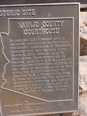
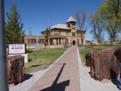
Navajo County Courthouse

Photographed By Thomas Chris English, April 27, 2010
1. Navajo County Courthouse Marker, Holbrook, Arizona
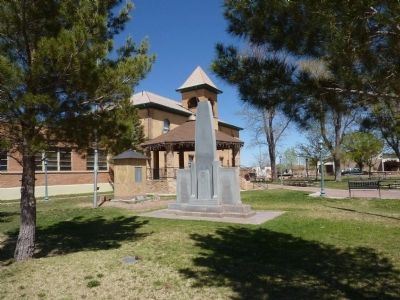
An interesting fact about this courthouse is that it was approved by Congress and constructed 14 years before Arizona became a state. Statehood was a foregone conclusion, or people simply knew the value of U.S. law in one of the last vestiges of the American Frontier.
Erected 1981.
Topics. This historical marker is listed in this topic list: Government & Politics. A significant historical date for this entry is January 9, 1830.
Location. 34° 54.167′ N, 110° 9.489′ W. Marker is in Holbrook, Arizona, in Navajo County. Marker is on West Arizona Street near Navajo Boulevard (Business Interstate 40), on the left when traveling east. Touch for map. Marker is at or near this postal address: 100 East Arizona Street, Holbrook AZ 86025, United States of America. Touch for directions.
Other nearby markers. At least 7 other markers are within 14 miles of this marker, measured as the crow flies. Historic Wagon Road (approx. 0.2 miles away); Sidney Sapp House (approx. 0.2 miles away); Henry R. Holbrook (approx. 0.2 miles away); Wigwam Village #6 (approx. 0.6 miles away); Little Colorado River Bridge (approx. 0.6 miles away); The Old Fort (approx. 10 miles away); Historic Woodruff Snowflake Bridge (approx. 13.2 miles away).
Credits. This page was last revised on January 9, 2020. It was originally submitted on April 26, 2010, by Chris English of Phoenix, Arizona. This page has been viewed 1,228 times since then and 25 times this year. Photos: 1, 2. submitted on April 27, 2010, by Chris English of Phoenix, Arizona. 3. submitted on May 1, 2010, by Chris English of Phoenix, Arizona. 4. submitted on April 27, 2010, by Chris English of Phoenix, Arizona. • Syd Whittle was the editor who published this page.


