
Slootdorp in Hollands Kroon, North Holland, Netherlands — Northwestern Europe
Vliegtuigcrash Haviland Mosquito DZ316 Herdenking
⎯⎯⎯
Haviland Mosquito DZ316 Crash Memorial
Photographed by Andrew Ruppenstein, June 2, 2026
1. Haviland Mosquito DZ316 Crash Memorial

Schelpenbolweg Slootdorp
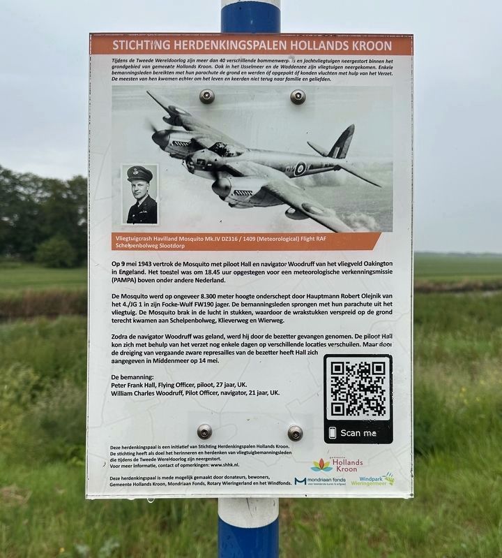
Op 9 mei 1943 vertrok de Mosquito met piloot Hall en navigator Woodruff van het vliegveld Oakington in Engeland. Het toestel was om 18.45 uur opgestegen voor een meteorologische verkenningsmissie (PAMPA) boven onder andere Nederland. De Mosquito werd op ongeveer 8.300 meter hoogte onderschept door Hauptmann Robert Olejnik van het 4./JG 1 in zijn Focke-Wulf FW190 jager. De bemanningsleden sprongen met hun parachute uit het vliegtuig. De Mosquito brak in de lucht in stukken, waardoor de wrakstukken verspreid op de grond terecht kwamen aan Schelpenbolweg, Klieverweg en Wierweg.
Zodra de navigator Woodruff was geland, werd hij door de bezetter gevangen genomen. De piloot Hail kon zich met behulp van het verzet nog enkele dagen op verschillende locaties verschuilen. Maar door de dreiging van vergaande zware represailles van de bezetter heeft Hall zich aangegeven in Middenmeer op 14 mei.
De bemanning:
Peter Frank Hall, Flying Officer, piloot, 27 jaar, UK.
William Charles Woodruff, Pilot Officer, navigator, 21 jaar, UK.
Tijdens de Tweede Wereldoorlog zijn meer dan 40 verschillende bommenwerp is en jachtvliegtuigen neergestort binnen het grondgebied van gemeente Hollands Kroon. Ook in het Usselmeer en de Waddenzee zijn vliegtuigen neergekomen. Enkele bemanningsleden bereikten met hun parachute de grond en werden of opgepakt of konden vluchten met hulp van het Verzet. De meesten van hen kwamen echter om het leven en keerden niet terug naar familie en geliefden.
Deze herdenkingspaal is een initiatief van Stichting Herdenkingspalen Hollands Kroon. De stichting heeft als doel het herinneren en herdenken van vliegtuigbemanningsleden die tijdens de Tweede Wereldoorlog zijn neergestort. Voor meer informatie, contact of opmerkingen: www.shhk.nl.
Airplane Crash Havilland Mosquito Mk.IV DZ316 / 1409 (Meteorological) Flight RAF
Schelpenbolweg Slootdorp
On May 9, 1943, the Mosquito, piloted by Hall and navigator Woodruff, departed from Oakington Airfield in England. The aircraft had taken off at 18:45 for a meteorological reconnaissance mission (PAMPA) over the Netherlands, among other places. The Mosquito was intercepted at an altitude of approximately 8,300 meters by Hauptmann Robert Olejnik of 4./JG 1 in his Focke-Wulf FW190 fighter. The crew members parachuted out of the aircraft. The Mosquito broke into pieces in mid-air, causing the wreckage to land scattered on the ground along Schelpenbolweg, Klieverweg, and Wierweg.
As soon as navigator Woodruff had landed, he was captured by the occupying forces. Pilot Hail was able to hide at various locations for a few days with the help of the resistance. However, due to the threat of severe reprisals from the occupying forces, Hall surrendered in Middenmeer on May 14.
The crew:
Peter Frank Hall, Flying Officer, pilot, 27 years old, UK.
William Charles Woodruff, Pilot Officer, navigator, 21 years old, UK.
During the Second World War, more than 40 different bombers and fighter planes crashed within the territory of the municipality of Hollands Kroon. Aircraft also crashed in the IJsselmeer and the Wadden Sea. Some crew members reached the ground by parachute and were either captured or managed to escape with the help of the Resistance. However, most of them perished and did not return to family and loved ones.
This memorial post is an initiative of the Hollands Kroon Memorial Poles Foundation. The foundation aims to remember and commemorate aircraft crew members who crashed during the Second World War. For more information, contact, or comments: www.shhk.nl.
Erected 2022
this page online
Topics. This memorial is listed in these topic lists: Air & Space • War, World II. A significant historical date for this entry is May 9, 1943.
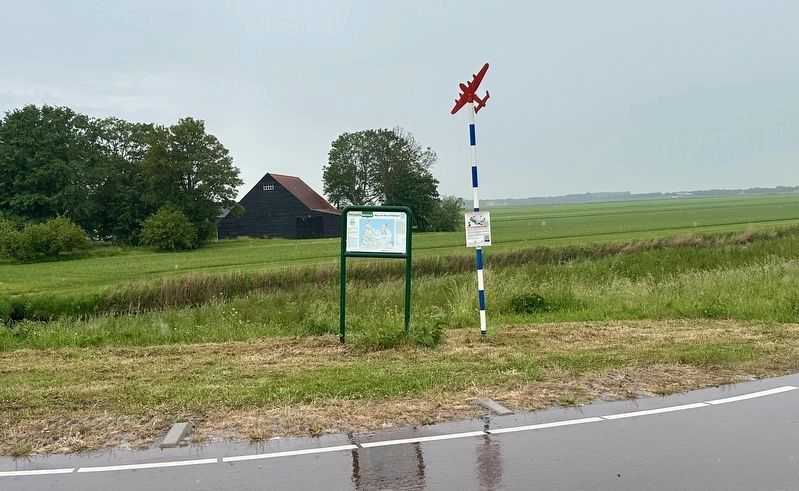
Location. 52° 52.265′ N, 4° 59.44′ E. Memorial is in Slootdorp, Noord-Holland (North Holland), in Hollands Kroon. It is at the intersection of Schelpenbolweg and Den Oeverseweg, on the left when traveling east on Schelpenbolweg. Touch for map. Memorial is in this post office area: Slootdorp, Noord-Holland 1774 NN, Netherlands. Touch for directions.

Regionally, it is in Europe, the European Union, Atlantic Europe, the Benelux Low Countries, the Schengen Area, Western Europe, and the Western World. Historically, it finds itself in what was once the Holy Roman Empire.
Other nearby markers. At least 8 other markers are within 14 kilometers of this marker, measured as the crow flies: Wieringermeerdijk / Wieringermeer Dike (approx. 5.7 kilometers away); Vliegtuigcrash Mosquito Mk. IV DZ386 Herdenking / Mosquito Mk. IV DZ386 Crash Memorial (approx. 9.6 kilometers away); Medemblik: heden en verleden / Medemblik: Past and Present (approx. 13.3
Photographed by Andrew Ruppenstein, June 2, 2026
2. Haviland Mosquito DZ316 Crash Memorial - Wide View
Also see . . . Crash-informatie DZ316 Slootdorp (Stichting Herdenkingspalen Hollands Kroon, in Dutch). This page is that referenced by the QR code on the marker. It provides photos of the marker dedication, as well as an extended version of the story óf the plane crash. (Submitted on June 3, 2026.)
Credits. This page was last revised on June 3, 2026. It was originally submitted on June 3, 2026, by Andrew Ruppenstein of Lamorinda, California. This page has been viewed 11 times since then. Photos: 1, 2. submitted on June 3, 2026, by Andrew Ruppenstein of Lamorinda, California.
