National Museum of Transportation near Kirkwood in St. Louis County, Missouri — The American Midwest (Upper Plains)
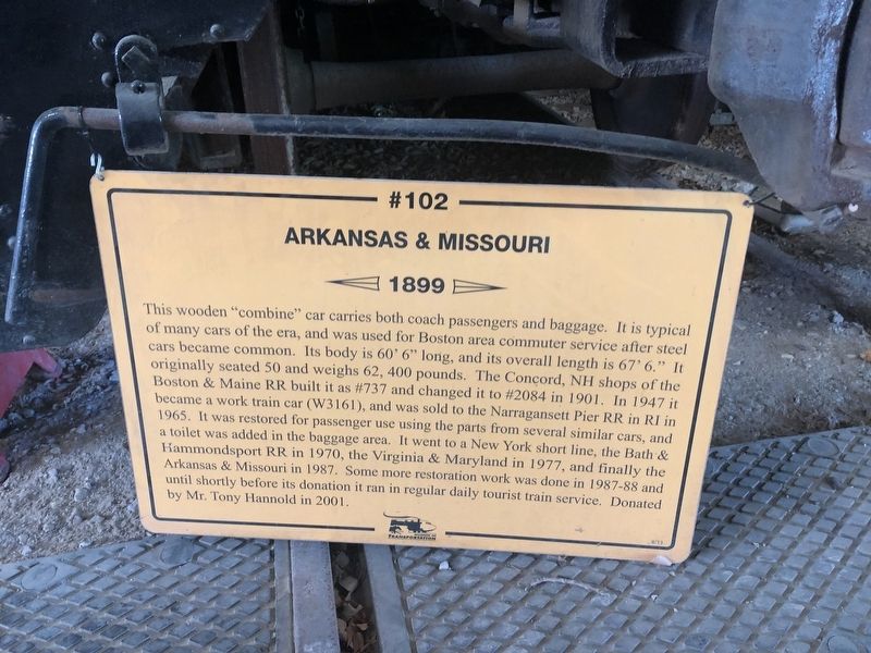
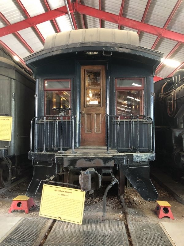
Arkansas & Missouri #102
—
1899
—
Photographed by Devry Becker Jones (CC0), April 22, 2019
1. #102 Marker
Inscription.
This wooden "combine" car carries both coach passengers and baggage. It is typical of many cars of the era, and was used for Boston area commuter service after steel cars became common. Its body is 60' 6" long, and its overall length is 67' 6." It originally seated 50 and weighs 62,400 pounds. The Concord, NH shops of the Boston & Maine RR built it as #737 and changed it to #2084 in 1901. In 1947 it became a work train car (W3161) and was sold to the Narrangansett Pier RR in RI in 1965. It was restored for passenger use using the parts from several similar cars and a toilet was added in the baggage area. It went to a New York short line, the Bath & Hammondsport RR in 1970, the Virginia & Maryland in 1977, and finally the Arkansas & Missouri in 1987. Some more restoration work was done in 1987-88 and until shortly before its donation it ran in regular daily tourist train service. Donated by Mr. Tony Hannold in 2001.
Erected 2013 by Museum of Transportation.
Topics. This historical marker is listed in this topic list: Railroads & Streetcars. A significant historical year for this entry is 1899.
Location. 38° 34.308′ N, 90° 27.665′ W.
Click or scan to see this page online
Marker is near Kirkwood, Missouri, in St. Louis County. It is in National Museum of Transportation. It can be reached from Barrett Station Road east of Old Dougherty Ferry Road, on the right when traveling east. Touch for map. Marker is at or near this postal address: 3015 Barrett Station Road, Saint Louis MO 63122, United States of America. Touch for directions.
Regionally, this marker is in Greater St. Louis. It is also in the American Midwest, in the Lewis & Clark Corridor, in the Corn Belt, and in the Great River Road Region. Globally, it is in North America, the Western Hemisphere, the Western World, and the Anglosphere. Historically, it finds itself in what was once the Viceroyalty of New France, the territory of the Mississippian Culture, the Louisiana Purchase, and the Antebellum South.
Credits. This page was last revised on June 8, 2026. It was originally submitted on April 28, 2019, by Devry Becker Jones of Washington, District of Columbia. This page has been viewed 270 times since then and 36 times this year. Last updated on June 4, 2026, by Garrett Koch of Saint Louis, Missouri. Photos:1, 2. submitted on April 28, 2019, by Devry Becker Jones of Washington, District of Columbia.