Dominion City in Emerson – Franklin Municipality, Manitoba — Canada’s Prairie Region (North America)
First Railway in Western Canada
⎯⎯⎯
Le Premier Chemin de Fer de L'Ouest du Canada

Photographed by Jimmy Emerson, June 24, 2013
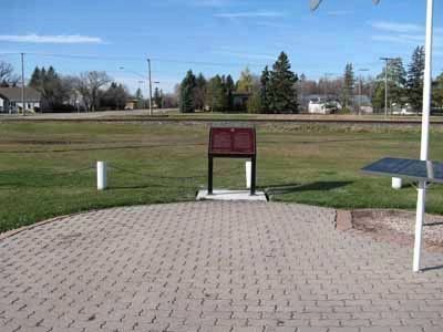
1. First Railway in Western Canada/ Le Premier Chemin de Fer de L' Ouest du Canada Marker

On December 3, 1878, the last spike was driven here to complete the first railway line built in the Canadian West. Known as the Pembina Branch, it ran some 100 kilometres from St. Boniface to the international boundary at Emerson, connecting Manitoba to eastern Canada by rail through the United States. Proposed in the 1860s, this line was ultimately endorsed by Prime Minister Alexander Mackenzie in 1874 as an alternative to a more expensive all-Canadian railway line. The route brought prosperity to the region, serving as an important link with eastern Canada until the Canadian Pacific Railway reached Winnipeg in 1883.
Ici eut lieu, le 3 décembre 1878, l'inauguration du premier chemin de fer de l'Ouest canadien. Connue sous le nom de Pembina, cette voie ferrée de quelque 100 kilomètres entre Saint-Boniface et la frontière internationale, à Emerson, reliait par le réseau américain le Manitoba à l'Est canadien. Ce projet, proposé dans les années 1860, fut adopté en 1874 par le premier ministre Alexander Mackenzie comme
this page online
Erected 2008 by Historic Sites and Monuments Board of Canada.
Topics and series. This historical marker is listed in this topic list: Railroads & Streetcars. In addition, it is included in the Canada, Historic Sites and Monuments Board series list. A significant historical date for this entry is December 3, 1878.
Location. 49° 8.541′ N, 97° 9.358′ W. Marker is in Dominion City, Manitoba, in Emerson – Franklin Municipality. It is on Centennial Drive, on the left when traveling north. Touch for map. Marker is at or near this postal address: 16 Centennial Drive, Dominion City MB R1A 2B9, Canada. Touch for directions.

Regionally, this marker is in the Red River Valley. It is also in the Prairies. Globally, it is in North America, the Western Hemisphere, the Western World, and the Anglosphere. Historically, it finds itself in what was once a British colony, the Viceroyalty of New France, and Rupert’s Land.
Other nearby markers. At
©2008 Parks Canada Agency / Agence Parcs Canada (Terms of use: pc.gc.ca/termes-terms#p05), 2008
2. First Railway in Western Canada
Photo available at Parks Canada website pc.gc.ca
Another marker is no longer nearby. The March West / La Marche Vers L'ouest (was approx. 12.8 kilometers away but has been permanently removed).
Also see . . . Historic Sites of Manitoba: First Railway in Western Canada Plaque… (Manitoba Historical Society). (Submitted on June 9, 2026.)
Credits. This page was last revised on July 26, 2026. It was originally submitted on June 5, 2026, by Jimmy Emerson of Dalton, Georgia. This page has been viewed 22 times since then. Photos: 1. submitted on June 5, 2026, by Jimmy Emerson of Dalton, Georgia. 2. submitted on July 26, 2026, by Kevin Westell of St. Catharines, Ontario. • Andrew Ruppenstein was the editor who published this page.
