
Harbour Grace in CensusDiv 1 - Avalon Peninsula-St. John's, Newfoundland and Labrador — The Atlantic Provinces (North America)
Laurence Coughlan
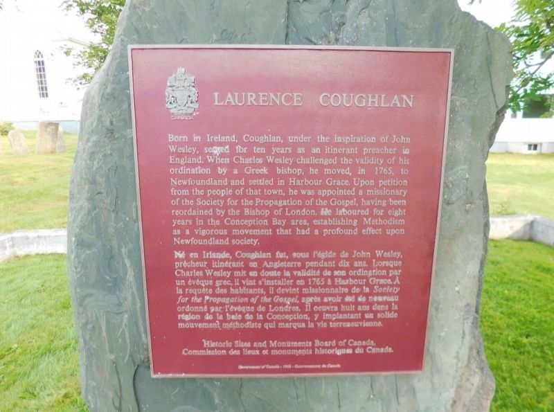
Photographed by Jimmy Emerson, July 28, 2024
1. Laurence Coughlan Marker

this page online
Erected 1968 by Historic Sites and Monuments Board of Canada.
Topics and series. This historical marker is listed in this topic list: Religion & Religious Structures. In addition, it is included in the Canada, Historic Sites and Monuments Board series list. A significant historical year for this entry is 1765.
Location. 47° 41.656′ N, 53° 12.664′ W. Marker is in Harbour Grace, Newfoundland and Labrador, in CensusDiv 1 - Avalon Peninsula-St. John's. It is on Water Street East, on the right when traveling north. Touch for map. Marker is at or near this postal address: 1 Water Street E, Harbour Grace NL A0A 2M0, Canada. Touch for directions.

Regionally, this marker is in Atlantic Canada. Globally, it is in the North Atlantic Region, North America, the Western Hemisphere, the Western World, and the Anglosphere. Historically, it finds itself in what was once a British colony and also the Viceroyalty of New France.
Other nearby markers. At least 8 other markers are within 6 kilometers of this marker, measured as the crow flies: Transatlantic Flights / Vols Transatlantiques (within shouting distance of this marker); Harbour Grace Court House / Palais de Justice D'Harbour Grace (about 180 meters away, measured in a direct line); Rothesay House, Munn/Godden Residence (about 210 meters away); Otterbury Schoolhouse (Built circa 1884) / Preserving the Schoolhouse (approx. 4.1 kilometers away); Education & Confederation (approx. 4.1 kilometers away); Amelia Earhart (approx. 4.2 kilometers away); CN Railway Station (approx. 5 kilometers away); Former Carbonear Railway Station / L'Ancienne Gare de Carbonear (approx. 5 kilometers away). Touch for a list and map of all markers in Harbour Grace.
Credits. This page was last revised on June 8, 2026. It was originally submitted on June 6, 2026, by Jimmy Emerson of Dalton, Georgia. This page has been viewed 11 times since then. Photo 1. submitted on June 6, 2026, by Jimmy Emerson of Dalton, Georgia. • Andrew Ruppenstein was the editor who published this page.
