
Grafton in Jersey County, Illinois — The American Midwest (Great Lakes)
Pointe Du Hoc
D-Day · 6 June 1944
Photographed by Thomas Smith, June 6, 2026
1. Pointe Du Hoc Marker
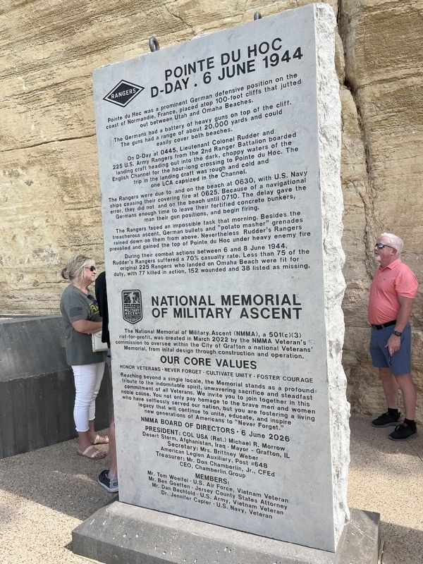
Pointe du Hoc was a prominent German defensive position on the coast of Normandie, France, placed atop 100-foot cliffs that jutted out between Utah and Omaha Beaches.
The Germans had a battery of heavy guns on top of the cliff. The guns had a range of about 20,000 yards and could easily cover both beaches.
On D-Day at 0445, Lieutenant Colonel Rudder and 225 U.S. Army Rangers from the 2nd Ranger Battalion boarded landing craft heading out into the dark, choppy waters of the English Channel for the hour-long crossing to Pointe du Hoc. The trip in the landing craft was rough and cold and one LCA capsized in the Channel.
The Rangers were due to land on the beach at 0630, with U.S. Navy ships ceasing their covering fire at 0625. Because of a navigational error, they did not land on the beach until 0710. The delay gave the Germans enough time to leave their fortified concrete bunkers, man their gun positions, and begin firing.
The Rangers faced an impossible task that morning. Besides the treacherous ascent, German bullets and “potato masher” grenades rained down on them from above. Nevertheless Rudder’s Rangers
this page online
During their combat actions between 6 and 8 June 1944, Rudder’s Rangers suffered a 70% casualty rate. Less than 75 of the original 225 Rangers who landed on Omaha Beach were fit for duty, with 77 killed in action, 152 wounded and 38 listed as missing.
Honor Veterans · Never Forget · Cultivate Unity · Foster Courage
Topics.
Photographed by Thomas Smith, June 6, 2026
2. Pointe Du Hoc Memorial
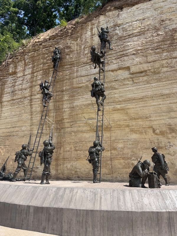
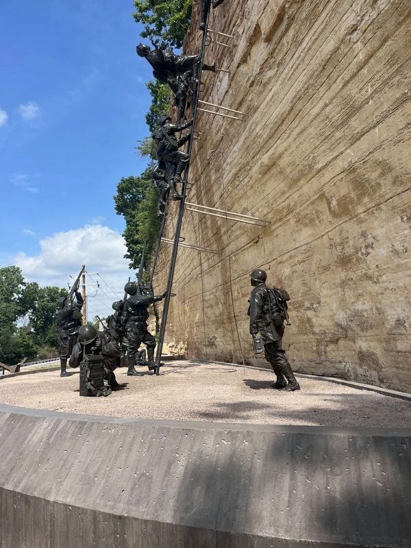
Location. 38° 58.09′ N, 90° 25.321′ W. Memorial is in Grafton, Illinois, in Jersey County. It is on Great River Road (Illinois Route 100) one mile west of Palisades Parkway, on the right when traveling west. The memorial and marker stands on the grounds of the Grafton Visitor Center. Touch for map. Memorial is at or near this postal address: 950 E Main St, Grafton IL 62037, United States of America. Touch for directions.

Regionally, this memorial is in the Illinois River Valley. It is also in the American Midwest, in the Corn Belt, and in the Great River Road Region. Globally, it is in North America, the Western Hemisphere, the Western World, and the Anglosphere. Historically, it finds itself in what was once the territory of the Mississippian Culture and also the Northwest Territory.
Other nearby markers. At least 8 other markers are within 3 miles of this marker, measured as the crow flies: Strike Assault Boat (within shouting distance of this marker); The Dinky (about 300 feet away,
Photographed by Thomas Smith, June 6, 2026
3. Pointe Du Hoc Memorial
Photographed by Thomas Smith, June 6, 2026
4. Jeeps at Pointe Du Hoc Memorial
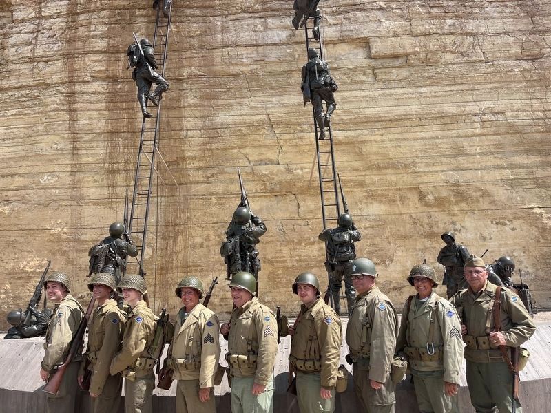
Photographed by Thomas Smith, June 6, 2026
5. Reenactors at Pointe Du Hoc Memorial
Credits. This page was last revised on June 12, 2026. It was originally submitted on June 6, 2026, by Thomas Smith of Waterloo, Ill. This page has been viewed 39 times since then. Photos: 1, 2, 3, 4, 5. submitted on June 6, 2026, by Thomas Smith of Waterloo, Ill. • Devry Becker Jones was the editor who published this page.
