Old Wethersfield in Capitol Region, Connecticut — The American Northeast (New England)
The Stillman Tavern
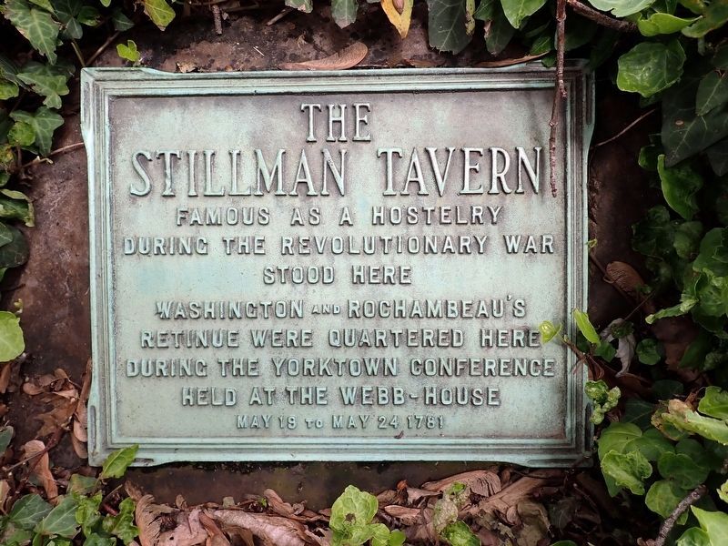
Photographed by Conrad Ward, May 25, 2025
1. The Stillman Tavern Marker
Famous as a hostelry during the Revolutionary War stood here
Washington and Rochambeau's retinue were quartered here during the Yorktown Conference held at the Webb-House May 19 to May 24 1781
Topics and series. This historical marker is listed in these topic lists: Industry & Commerce • Patriots & Patriotism • War, US Revolutionary. In addition, it is included in the Former U.S. Presidents: #01 George Washington, and the The Washington-Rochambeau Route series lists. A significant historical month for this entry is May 1781.
Location. 41° 42.939′ N, 72° 39.147′ W. Marker is in Wethersfield in Capitol Region, Connecticut. It is in Old Wethersfield. It is at the intersection of Main Street and Hart Street, on the right when traveling north on Main Street. Touch for map. Marker is at or near this postal address: 320 Main Street, Wethersfield CT 06109, United States of America. Touch for directions.

Regionally, this marker is in the Connecticut River Valley, in Greater Hartford, and in the Knowledge Corridor. It is also in the American Northeast and in New England. Globally, it is in North America, the Western
this page online
Other nearby markers. At least 8 other markers are within walking distance of this marker: The Cradle of American Seed Companies (within shouting distance of this marker); Trinity Parish (about 300 feet away, measured in a direct line); Comstock, Ferre & Co. (about 800 feet away); Washington – Rochambeau Revolutionary Route (approx. ¼ mile away); Hanmer Park (approx. ¼ mile away); Webb House (approx. ¼ mile away); Society of the Cincinnati (approx. ¼ mile away); a different marker also named Webb House (approx. ¼ mile away). Touch for a list and map of all markers in Wethersfield.
Also see . . . Planning the Final Action: George Washington and Rochambeau, May 1781.
After the Americans’ stunning victory at Saratoga on October 17, 1777, King Louis XVI ordered his ministers to negotiate a formal alliance between France and the United States. Conrad Alexander Gérard of France and Benjamin Franklin, Silas Deane, and Arthur Lee of the United States negotiated(Submitted on June 7, 2026.)the terms of the Franco-American alliance in the Treaty of Amity and Commerce, which they signed on February 6, 1778.Photographed by Conrad Ward, May 25, 20252. The Stillman Tavern Marker(The tavern is no longer in existence)

Credits. This page was last revised on June 8, 2026. It was originally submitted on June 7, 2026, by Conrad Ward of Guilford, Connecticut. This page has been viewed 33 times since then. Photos: 1. submitted on June 7, 2026, by Conrad Ward of Guilford, Connecticut. 2. submitted on June 7, 2026. • Andrew Ruppenstein was the editor who published this page.
