Near Weston in Platte County, Missouri — The American Midwest (Upper Plains)
Weston, Missouri
Established 1837

Photographed by William Fischer, Jr., June 4, 2026
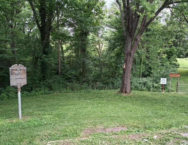
1. Weston, Missouri Marker
Weston, Missouri, as shown on Edwards Brother's map of 1877, was placed on the National Register of Historic Places August 21, 1972. The historic area encompasses sixteen full blocks and portions of eight additional city blocks and approximately 131 acres. The Historic District area is bound on the West by the east line of the Burlington Railroad track, Summit Street, Gay Street, and Rock Street.
Project was approved by Weston City officials and in recognition of the following members of the Landmark Committee: Bertha Bless, Chairman; Robert Jones, Co-Chairman; Stephen J. Raiche, Chief Research Historian of the Missouri State Park Board; Edgar Crigler, Publicity Director; Mary Pepper, Recording Secretary; Dr. R.J. and Mary Felling; Virginia Osthoff; Ruth Ohlhausen; Mary Spratt; Betty Hull; Dorothy Pierce; Beverly Amstutz; Pat Benner with students Margaret Ann Spratt; Ted Wilson; Karen Stephens; and Ora Lynn Collison.
On National Register of Historical Places
August 21, 1972
Erected by City of Weston.
Topics. This historical marker is listed in this topic list: Notable Places. A significant historical date for this entry is August 21, 1972.
Location. 39° 24.398′ N,
this page online

Regionally, this marker is in Greater Kansas City. It is also in the American Midwest, in the Lewis & Clark Corridor, and in the Corn Belt. Globally, it is in North America, the Western Hemisphere, the Western World, and the Anglosphere. Historically, it finds itself in what was once the territory of the Mississippian Culture, the Louisiana Purchase, and the Antebellum South.
Other nearby markers. At least 8 other markers are within 2 miles of this marker, measured as the crow flies: Laurel Hill Cemetery (approx. one mile away); a different marker also named Laurel Hill Cemetery (approx. one mile away); a different marker also named Laurel Hill Cemetery (approx. one mile away); a different marker also named Laurel Hill Cemetery (approx. 1.1 miles away); Benjamin Wood House (approx. 1.1 miles away); a
Photographed by William Fischer, Jr., June 4, 2026
2. Weston, Missouri Marker
More about this marker. An identical marker can be found at the former railroad depot in town.
Regarding Weston, Missouri. National Register Statement of Significance excerpt:
Weston, in Platte County, Missouri, is significant as a mid-nineteenth century Missouri River port community which has retained a substantial proportion of its early residences and commercial structures. Because of the collapse of the hemp and tobacco industries in northwest Missouri after the Civil War, and because of Weston's failure to attract a suitable rail connection as river traffic diminished, by 1870 the small community had become dominated by the larger distribution centers of St. Joseph and Kansas City, and consequently suffered severe economic decline. Weston's economy has remained relatively stagnant, although since the early years of the twentieth-century a revival in tobacco production has sustained the community, and in

Photographed by William Fischer, Jr., June 4, 2026
3. Welcome to Bless Park Sign
Related marker. Click here for another marker that is related to this marker.
Also see . . . Weston Historic District National Register Nomination Form. (Submitted on June 7, 2026, by William Fischer, Jr. of Reynoldsburg, Ohio.)

Photographed by William Fischer, Jr., June 4, 2026
4. Weston Welcome Sign in Bless Park
Credits. This page was last revised on June 7, 2026. It was originally submitted on June 7, 2026, by William Fischer, Jr. of Reynoldsburg, Ohio. This page has been viewed 13 times since then. Photos: 1, 2, 3, 4. submitted on June 7, 2026, by William Fischer, Jr. of Reynoldsburg, Ohio.
