Massie Township near Wellman in Warren County, Ohio — The American Midwest (Great Lakes)
Caeser Creek Schoolhouse
Original construction Unknow - Relocated to the village 1975.

Photographed by Craig Doda, November 7, 2025
1. Caeser Creek Schoolhouse Marker
This schoolhouse has been restored from a building that came from near Harvysburg on Johan's Run. Property have been close to Hight Tate's Mill, located on Johan's Run.
Schools were established very early in the 1800's as soon as a small community developed. These were subscription schools financed by local people. Some early teachers were paid sixty cents a day. Early pioneer schools were small with little furniture and light comfort.
Some believe this small log cabin was the early settlers cabin of Levi Lukers used by his family while he built his 2 1/2 story home located across the Caesar Creek here. This small cabin came from Levi Luken's land in the valley below the Pioneer Village sign.
It was nice for settlers to build a small shelter cabin close to water in which to live while building a larger home. There would be a well by the home so it could be pumped right from the stream.
Topics. This historical marker is listed in these topic lists: Architecture • Education • Settlements & Settlers.
Location. 39° 29.127′ N, 84° 2.338′ W. Marker is near Wellman,
this page online

Regionally, this marker is in Greater Cincinnati and in the Miami Valley. It is also in the American Midwest and in the Corn Belt. Globally, it is in North America, the Western Hemisphere, the Western World, and the Anglosphere. Historically, it finds itself in what was once the Haudenosaunee (Iroquois) Confederacy, the territory of the Mississippian Culture, and the Northwest Territory.
Other nearby markers. At least 8 other markers are within 4 miles of this marker, measured as the crow flies: Caesar Creek Pioneer Village (within shouting distance of this marker); Project History (approx. one mile away); Harveysburg / The Harveysburg School (approx. 2.1 miles away); First Free Black School (approx. 2.1 miles away); The Bullskin Trace (approx. 2.4 miles away); Miami Cemetery Veterans Memorial
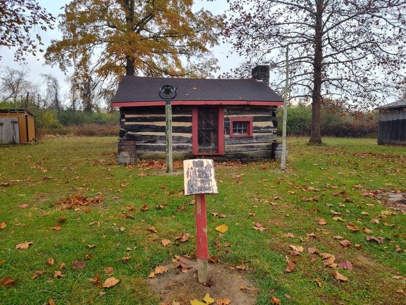
Photographed by Craig Doda, November 7, 2025
2. Caeser Creek Schoolhouse
Credits. This page was last revised on June 10, 2026. It was originally submitted on June 7, 2026, by Craig Doda of Napoleon, Ohio. This page has been viewed 11 times since then. Photos: 1, 2. submitted on June 7, 2026, by Craig Doda of Napoleon, Ohio. • Devry Becker Jones was the editor who published this page.
