Poquoson, Virginia — The American South (Mid-Atlantic)
Raptors
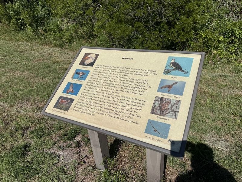
During the past 30 years the Back River ecosystem has welcomed back two important species: Bald Eagles and Ospreys. Both of these birds were almost driven to extinction by loss of habitat and pesticides found in fish during the 1960’s.
The most common raptor in the Chesapeake Bay region is the Osprey. Also called fish hawks, Ospreys are large winged birds whose sole diet is fish. They are well adapted for this purpose. The soles of their feet are equipped with sharp, spiny projectiles that give them a grip on their slippery prey. Ospreys are brown above and dark below, with a white head featuring a dark brown line through the eye on each side of the face.
An even larger raptor, the Bald Eagle may also be seen. The mature Eagle has a distinctive white head and tail, while immature Eagles, less than four years of age, are solid black. These huge birds feed on fish, waterfowl and small mammals. Their massive nest can be found in the tops of trees. Several other raptors also inhabit the woodland and fields along this marsh including the Red-Tailed and Red-Shouldered Hawks and Sharp-Shinned Hawk, as well as Barred Owls
this page online
Erected by Poquoson Museum.
Topics. This historical marker is listed in these topic lists: Animals • Entertainment • Industry & Commerce.
Location. 37° 7.46′ N, 76° 21.847′ W. Marker is in Poquoson, Virginia. It is on Poquoson Museum Marsh Trail south of Poquoson Avenue (Virginia Route 171), on the left when traveling south. Touch for map. Marker is at or near this postal address: 1 Dryden Farm Ln, Poquoson VA 23662, United States of America. Touch for directions.

Regionally, this marker is on Virginia’s Peninsula, in Coastal Virginia, and in the Hampton Roads Metropolitan Area. It is also in the American South, specifically in the Upper South, in the Tidewater, and on the Eastern Seaboard. Globally, it is in the North Atlantic Region, North America, the Western Hemisphere, the Western World, and the Anglosphere. Historically, it finds itself in what was once the territory of the Mississippian Culture, one of the original Thirteen Colonies, one of the Confederate States of

Other nearby markers. At least 8 other markers are within walking distance of this marker: Man and the Marsh (within shouting distance of this marker); Native Longleaf Pine Restoration at the Poquoson Museum (about 300 feet away, measured in a direct line); Atlantic Menhaden / Cownose Ray (about 400 feet away); Antique Farm Equipment Exhibit (approx. ¼ mile away); Native American Three Sisters Garden (approx. ¼ mile away); Wash House Restoration (approx. ¼ mile away); Chesapeake Bay Two Log Canoe (approx. ¼ mile away); Barn (approx. ¼ mile away). Touch for a list and map of all markers in Poquoson.
Credits. This page was last revised on June 7, 2026. It was originally submitted on June 7, 2026, by Devry Becker Jones of Washington, District of Columbia. This page has been viewed 9 times since then. Photos: 1, 2. submitted on June 7, 2026, by Devry Becker Jones of Washington, District of Columbia.
