Kiptopeke in Northampton County, Virginia — The American South (Mid-Atlantic)
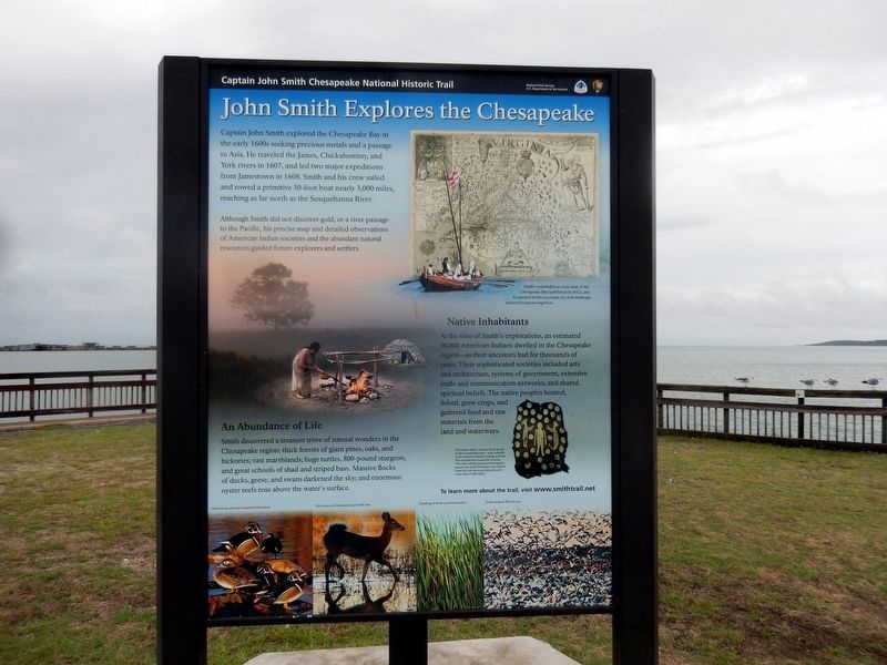
John Smith Explores the Chesapeake
Captain John Smith Chesapeake National Historic Trail
| — | National Park Service, U.S. Department of the Interior | — |
Photographed by Don Morfe, September 21, 2016
1. Captain John Smith Explores the Chesapeake Marker
Captain John Smith explored the Chesapeake Bay in the early 1600s seeking precious metals and a passage to Asia. He traveled the James, Chickahominy, and York rivers in 1607, and led two major expeditions from Jamestown in 1608. Smith and his crew sailed and rowed a primitive 30-foot boat nearly 3,000 miles, reaching as far north as the Susquehanna River.
Although Smith did not discover gold, or a river passage to the Pacific, his precise map and detailed observation of American Indians societies and the abundant natural resources guided future explorers and settlers.
An Abundance of Life
Smith discovered a treasure trove of natural wonders in the Chesapeake region: thick forests of giant pines, oaks and hickories; vast marshlands; huge turtles, 800-pound sturgeon, and great schools of shad and striped bass. Massive flocks of ducks, geese, and swans darkened the sky; and enormous oyster reefs rose above the water’s surface.
Native Inhabitants
At the time of Smith’s explorations, an estimated 50,000 American Indians dwelled in the Chesapeake region-as their ancestors had for thousands of years. Their sophisticated
this page online
Erected by National Park Service, U.S. Department of the Interior.
Topics and series. This historical marker is listed in this topic list: Exploration. In addition, it is included in the Captain John Smith Chesapeake National Historic Trail series list. A significant historical year for this entry is 1607.
Location. 37° 9.998′ N, 75° 59.333′ W. Marker is in Kiptopeke, Virginia, in Northampton County. It is on Kiptopeke Drive west of Florida Avenue, on the right when traveling west. Touch for map. Marker is in this post office area: Cape Charles VA 23310, United States of America. Touch for directions.

Regionally, this marker is on the Eastern Shore. It is also in the American South, specifically in the Upper South, on the Delmarva Peninsula, in the Tidewater, and on the Eastern Seaboard. Globally, it is in the North Atlantic Region, North America, the Western Hemisphere, the Western World, and the Anglosphere. Historically, it finds itself in what was once the territory of the Mississippian Culture, one of the original Thirteen Colonies, one of the Confederate States of America, and the Antebellum South.
Other nearby markers. At least 8 other markers are within 3 miles of this marker, measured as the crow flies: Concrete Ships (here, next to this marker); Join the Adventure (here, next to this marker); A Good Start (here, next to this marker); The Dunes (about 700 feet away, measured in a direct line); Chesapeake Bay (about 700 feet away); Farm to Market (about 700 feet away); Maritime Highway (about 700 feet away); Local Patriots (approx. 2.7 miles away). Touch for a list and map of all markers in Kiptopeke.
Credits. This page was last revised on August 21, 2026. It was originally submitted on June 7, 2026, by Don Morfe of Baltimore, Maryland. This page has been viewed 12 times since then. Photo 1. submitted on October 8, 2016, by Don Morfe of Baltimore, Maryland. • Devry Becker Jones was the editor who published this page.
