Rogers City in Presque Isle County, Michigan — The American Midwest (Great Lakes)
Fish Docks
Historical Marker No. 23
Photographed by Sean Higgins, May 23, 2026
1. Fish Docks Marker
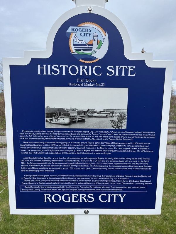
Evidence is sketchy about the beginning of commercial fishing at Rogers City. The "Fish Docks," shown here in this photo, believed to have been from the 1940's, shows three of the local gill net fishing boats and some of the "sheds," some of which were ice houses where ice was stored to chill down the fish before they were shipped to markets as far away as New York City. The fish docks were located around a small harbor at the east end of Huron Avenue that was partially formed by the remnants of the dock that had been built by the Rogers-Molitor Sawmill Co.
There was undoubtedly commercial fishing going on in the area around Rogers before the Village of Rogers was formed in 1871 and it was an important local business until the 1950's when it fell victim to overfishing and depredation by sea lampreys. Most of the fishing was for lake trout, chubs, and whitefish, a species that was particularly popular with Jewish residents in the New York area. Fish was shipped, packed in chipped or shaved ice. on passenger and freight steamers that regularly called at Rogers and nearby Crawford's Quarry. An article in the May 13, 1879
this page online
According to Lincoln's daughter, at one time her father operated six sailboats out of Rogers, including boats named Fanny Joyce, Little Pickerel, Old Man, and Mohawk. Generally referred to as "Mackinaw boats," they were 18 to 24 feet long and schooner rigged with one mast. In the fall of 1881, the Advance reported that a fisherman named Joseph LaBelle had brought in 2,657 pounds of fish, apparently the best one-day "lift" of the season. In November, four boats came in with a total of 8,000 pounds of fish. The following spring, the newspaper reported that there were five boats fishing out of Rogers and they were averaging about 1,000 pounds each catch. Twenty-five to fifty percent of the catches were usually whitefish with lake trout making up most of the rest.
Fishing wasn't always great, however, and fishermen would occasionally have to pull up their equipment and leave Rogers in search of better luck in Georgian Bay, the waters at the north end of Lake Huron, or maybe even as far north as Whitefish Bay on Lake Superior.
By
Photographed by Sean Higgins, May 23, 2026
2. Fish Docks Marker
Partial funding for this project was provided by the Community Foundation for Northeast Michigan. The image and text was provided by the Presque Isle County Historical Museum. The sign was installed by employees of the city's Public Works Department.
Erected by Community Foundation for Northeast Michigan • Presque Isle County Historical Museum • Rogers City Public Works Department. (Marker Number 23.)
Topics. This historical marker is listed in this topic list: Industry & Commerce.
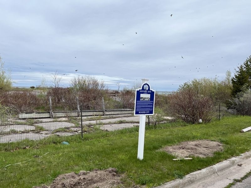
Location. 45° 25.407′ N, 83° 48.814′ W. Marker is in Rogers City, Michigan, in Presque Isle County. It can be reached from East Huron Avenue. Marker is located on the northwest side of the parking lot of the Rogers City Marina. Touch for map. Marker is at or near this postal address: 270 North Lake Street, Rogers City MI 49779, United States of America. Touch for directions.

Regionally, this marker is in Northern Michigan Lower Peninsula and in one of the Lake Huron Shore counties. It is also in the American Midwest. Globally, it is in North America, in the Great North Woods, on the Great Lakes, in the Western Hemisphere, in the Western World, and in the Anglosphere. Historically, it finds itself in what was once the Northwest Territory.
Other nearby markers. At least 8 other markers are within walking distance of this marker: Thunder Bay National Marine Sanctuary (about 400 feet away, measured in a direct line); Schooners (about 400 feet away); Rogers City Sailors Memorial (about 400 feet away); The Founders of Rogers City (about 500 feet away); Calcite - The World's Largest Limestone Quarry (approx. 0.2 miles away); The International Hotel (approx. 0.2 miles away); The Rogers City Shoreline During the Lumber Era (approx. 0.2 miles away); Presque Isle County Courthouse (approx. ¼ mile away). Touch for a list and map of all markers in Rogers City.
Credits. This page was last revised on July 1, 2026. It was originally submitted on June 7, 2026, by Sean Higgins of Rochester Hills, Michigan. This page has been viewed 14 times since then. Photos: 1, 2. submitted on June 7, 2026, by Sean Higgins of Rochester Hills, Michigan. • J. Makali Bruton was the editor who published this page.
