
Harbour Grace South in CensusDiv 1 - Avalon Peninsula-St. John's, Newfoundland and Labrador — The Atlantic Provinces (North America)
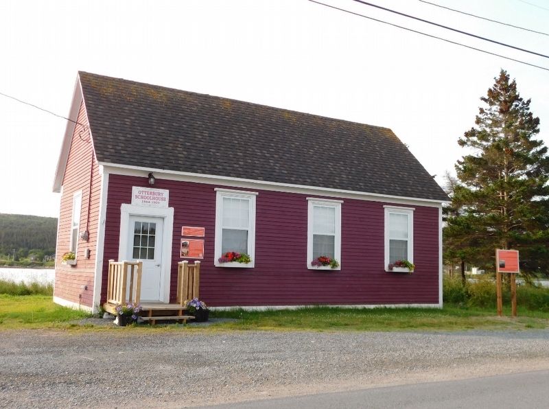
Otterbury Schoolhouse (Built circa 1884)
⎯⎯⎯
Preserving the Schoolhouse

Photographed by Jimmy Emerson, July 28, 2024
1. Otterbury Schoolhouse /Preserving the Schoolhouse Marker
Otterbury Schoolhouse was a traditional, one-room educational institution for Roman Catholic youth in the Riverhead and Ottertiury areas of Harbour Grace. A wood-burning stove provided heat for the students and teacher. Students were responsible for firewood and keeping the build clean. Originally located on Water Street West, volunteers moved the schoolhouse to its present location in 2010.
The Town of Harbour Grace gratefully acknowledges the dedication of Albert (Bud) Chafe, who was instrumental in moving Otterbury Schoolhouse, Municipal Heritage Site, to its present location. Facilitating this move saved the Schoolhouse from demolition and preserved an important heritage landmark in Harbour Grace.
Council also acknowledges the work of the Chafe and McCarthy families and others who supported and contributed to this restoration project.
Erected by Town of Harbour Grace.
Topics. This historical marker is listed in this topic list: Education. A significant historical year for this entry is 1884.
Location. 47° 40.376′ N, 53° 15.315′ W.
this page online

Regionally, this marker is in Atlantic Canada. Globally, it is in the North Atlantic Region, North America, the Western Hemisphere, the Western World, and the Anglosphere. Historically, it finds itself in what was once a British colony and also the Viceroyalty of New France.
Other nearby markers. At least 8 other markers are within 8 kilometers of this marker, measured as the crow flies: Education & Confederation (a few steps from this marker); Amelia Earhart (about 120 meters away, measured in a direct line); Rothesay House, Munn/Godden Residence (approx. 3.9 kilometers away); Transatlantic Flights / Vols Transatlantiques (approx. 4.1 kilometers away); Laurence Coughlan (approx. 4.1 kilometers away); Harbour Grace Court House / Palais de Justice D'Harbour Grace
Photographed by Jimmy Emerson, July 28, 2024
2. Otterbury Schoolhouse & Marker
Credits. This page was last revised on June 8, 2026. It was originally submitted on June 6, 2026, by Jimmy Emerson of Dalton, Georgia. This page has been viewed 19 times since then. Last updated on June 8, 2026, by Jimmy Emerson of Dalton, Georgia. Photos: 1, 2. submitted on June 6, 2026, by Jimmy Emerson of Dalton, Georgia. • Devry Becker Jones was the editor who published this page.
