Downtown Yonge in Toronto, Ontario — Central Canada (North America)
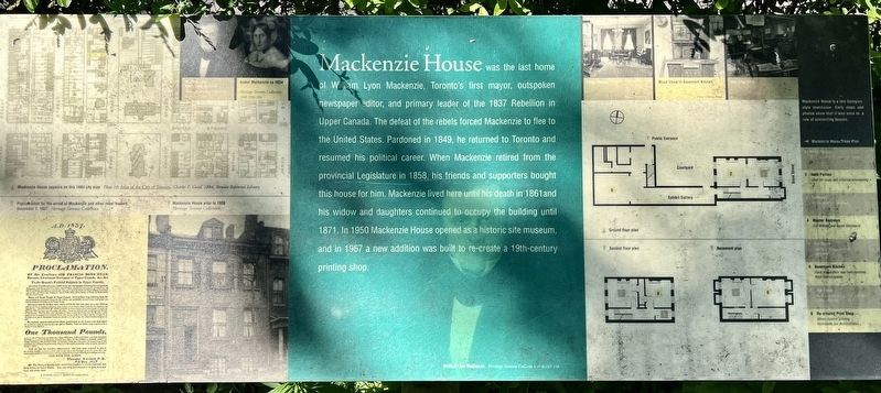
Mackenzie House
Photographed by Tim Boyd, June 1, 2026
1. Mackenzie House Marker
Topics. This historical marker is listed in this topic list: Government & Politics. A significant historical year for this entry is 1858.
Location. 43° 39.348′ N, 79° 22.709′ W. Marker is in Toronto, Ontario. It is in Downtown Yonge. It is on Bond Street 0.1 kilometers south of Dundas Street West, on the right when traveling south. Touch for map. Marker is at or near this postal address: 82 Bond Street, Toronto ON M5B M5B, Canada. Touch for directions.

Regionally,
this page online
Other nearby markers. At least 8 other markers are within walking distance of this marker: William Lyon Mackenzie (a few steps from this marker); St. Michael’s Cathedral (about 120 meters away, measured in a direct line); St. Michael’s Cathedral Rectory (about 120 meters away); Massey Hall (about 180 meters away); Sir Ernest MacMillan (about 180 meters away); Robert Simpson Co. Warehouse (about 210 meters away); International Union of Operating Engineers Local 793 (about 210 meters away); Simpsons Mail-Order Warehouse Dalhousie Street Extension (about 240 meters away). Touch for a list and map of all markers in Toronto.

Photographed by Tim Boyd, June 1, 2026
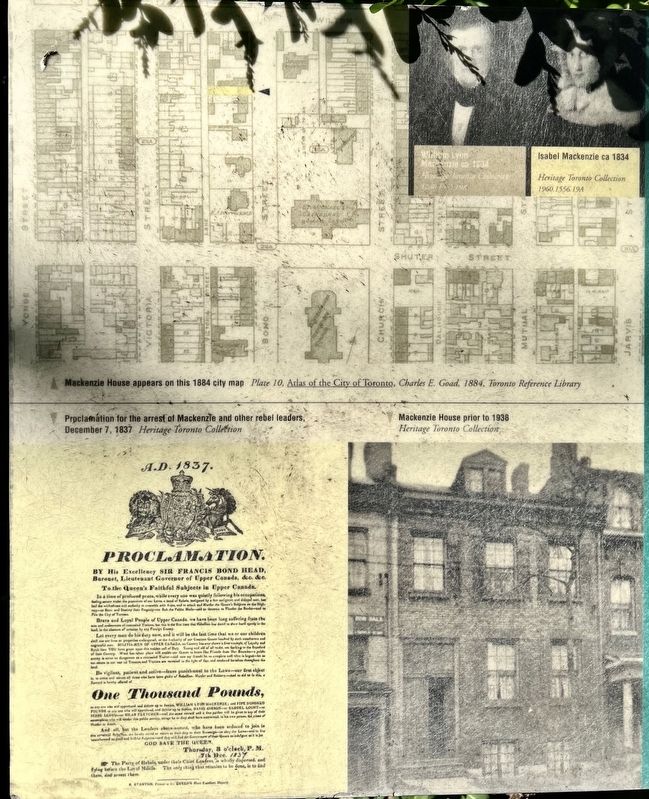
2. Mackenzie House Marker
The left of the two markers
Photographed by Tim Boyd, June 1, 2026
3. Mackenzie House marker illustrations and captions detail (left)
Photographed by Tim Boyd, June 1, 2026
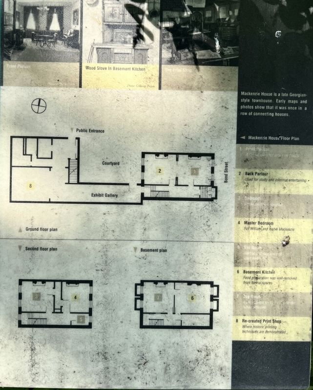
4. Mackenzie House marker illustrations and captions detail (right)
Photographed by Tim Boyd, June 1, 2026
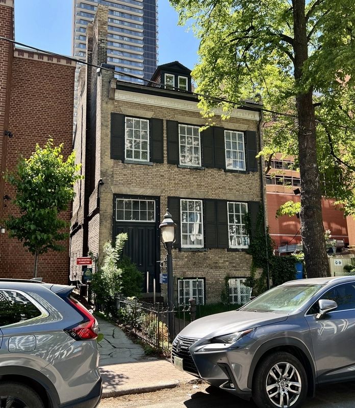
5. Mackenzie House in 2026
Credits. This page was last revised on June 16, 2026. It was originally submitted on June 10, 2026, by Tim Boyd of Hamilton, Ontario. This page has been viewed 15 times since then. Photos: 1, 2, 3, 4, 5. submitted on June 10, 2026, by Tim Boyd of Hamilton, Ontario. • Andrew Ruppenstein was the editor who published this page.
