Blarney in Cork in County Cork, Munster, Ireland — Irish South-West ((Éire) North Atlantic Ocean)
Blarney Village
Photographed by Ian Lefkowitz, May 15, 2026
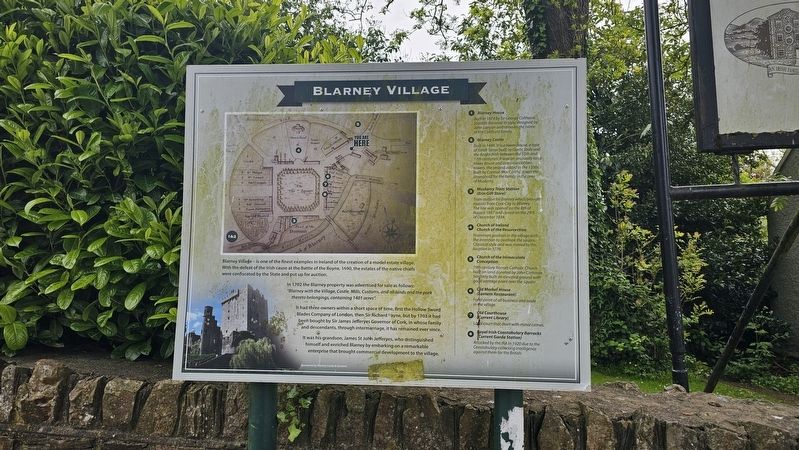
1. Blarney Village Marker
Blarney Village — is one of the finest examples in Ireland of the creation of a model estate village. With the defeat of the Irish cause at the Battle of the Boyne, 1690, the estates of the native chiefs were confiscated by the State and put up for auction.
In 1702 the Blarney property was advertised for sale as follows: “Blarney with the Village, Castle, Mills, Customs, and all lands and the park thereto belongings, containing 1401 acres.”
It had three owners within a short space of time, first the Hollow Sword Blades Company of London, then Sir Richard Payne, but by 1703 it had been bought by Sir James Jefferyes Governor of Cork, in whose family and descendants through intermarriage it has remained ever since.
It was his grandson, James St John Jefferyes, who distinguished himself and enriched Blarney by embarking on a remarkable enterprise that brought commercial development to the village.
1. Blarney House
Built in 1874 by Sir George Colthurst. Scottish Baronial in style, designed by John Lanyon and remains the home of the Colthurst family.
2. Blarney Castle
Built 1446. It is a tower house, a type of fortification built by
this page online
3. Muskerry Tram Station
(Erin Gift Store)
Train station for Blarney which brought tourists from Cork City to Blarney. The line was opened on the 8th of August 1887 and closed on the 29th of December 1934.
4. Church of Ireland
Church of the Resurrection
Prominent position in the village with the intention to overlook the Square. Classical style and was moved to this location in 1776.
5. Church of the Immaculate Conception
19th century Roman Catholic Church built on land donated by John Corkeran. Similarly built on elevated ground with good vantage point over the square.
6. Old Market House
(Lantern Restaurant)
Focal point of all business and trade in the village.
7. Old Courthouse
(Current Library)
Local court that dealt with minor crimes.
8. Royal Irish Constabulary Barracks
(Current Garda Station)
Attacked by the IRA in 1920 due to the Constabulary collecting intelligence against them for the British.
Sponsored by Blarney Castle & Gardens
Topics.
Photographed by Ian Lefkowitz, May 15, 2026
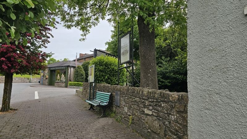
2. Blarney Village Marker
The marker is located next to the entrance to Blarney Woollen Mills. An identical marker is located near the village square.
Location. 51° 56′ N, 8° 34.012′ W. Marker is in Cork, Munster, in County Cork. It is in Blarney. It is on The Square west of Blarney Woollen Mills, on the left when traveling west. Touch for map. Marker is at or near this postal address: 10 The Square, Cork, Munster, Ireland. Touch for directions.

Regionally, it is on the Atlantic Ocean, in the North Atlantic Region, on the Atlantic Arc, in Europe, on the Island of Ireland, on the Celtic Fringe, in the European Union, in Atlantic Europe, on one of the British Isles, in the Western World, and in the Anglosphere.
Other nearby markers. At least 8 other markers are within walking distance of this marker: Plasterwork (within shouting distance of this marker); Family Room (within shouting distance of this marker); a different marker also named Blarney Village (about 120 meters away, measured in a direct line); Blarney World War I Memorial (about 120 meters away); The Square & Village Green (about 120 meters away); The Square (about 150 meters away); a different marker also named The Square & Village Green (about 150 meters away); The Muskerry Tram Turntable (about 180 meters away). Touch for a list and map of all markers in Cork.
Credits. This page was last revised on June 11, 2026. It was originally submitted on June 10, 2026, by Ian Lefkowitz of New York, New York. This page has been viewed 10 times since then. Photos: 1, 2. submitted on June 10, 2026, by Ian Lefkowitz of New York, New York. • Andrew Ruppenstein was the editor who published this page.
