THE HISTORICAL
MARKER DATABASE
“Bite-Size Bits of Local, National, and Global History”
Hickory in Burke County, North Carolina — The American South (South Atlantic)
 

Hickory Regional Airport
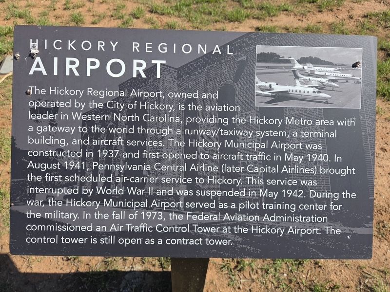
 
 
Hickory Regional Airport Marker image. Click for full size.
Photographed by Mark Parker, June 4, 2026
1. Hickory Regional Airport Marker
Inscription. The Hickory Regional Airport, owned and operated by the City of Hickory, is the aviation leader in Western North Carolina, providing the Hickory Metro area with a gateway to the world through a runway/taxiway system, a terminal building, and aircraft services. The Hickory Municipal Airport was constructed in 1937 and first opened to aircraft traffic in May 1940. In August 1941, Pennsylvania Central Airline (later Capital Airlines) brought the first scheduled air-carrier service to Hickory. This service was interrupted by World War II and was suspended in May 1942. During the war, the Hickory Municipal Airport served as a pilot training center for the military. In the fall of 1973, the Federal Aviation Administration commissioned an Air Traffic Control Tower at the Hickory Airport. The control tower is still open as a contract tower.
 
Topics. This historical marker is listed in these topic lists: Air & SpaceWar, World II. A significant historical year for this entry is 1937.
 
Location. 35° 44.595′ N, 81° 23.213′ W. Marker is in Hickory, North Carolina, in Burke County. It is at the intersection of 9th Avenue Drive Northwest
Paid Advertisement
Click or scan to see
this page online
and John Terrell Place, on the left when traveling west on 9th Avenue Drive Northwest. The marker is located at the entrance to the Hickory Regional Airport parking lot, at the Aviation Walk trailhead. Touch for map. Marker is at or near this postal address: 3101 9th Ave Dr NW, Hickory NC 28601, United States of America. Touch for directions.

Regionally, this marker is in North Carolina’s Mountains. It is also in the American South, specifically in the Upper South, in Appalachia, and specifically in Southern Appalachia. Globally, it is in North America, the Western Hemisphere, the Western World, and the Anglosphere. Historically, it finds itself in what was once the territory of the Mississippian Culture, one of the original Thirteen Colonies, one of the Confederate States of America, and the Antebellum South.

Other nearby markers. At least 8 other markers are within walking distance of this marker: Grumman OV-1D Mohawk (approx. 0.2 miles away); P-3 Orion (approx. 0.2 miles away); Sikorsky SH-3H Sea King (approx. 0.2 miles away); Grumman F-14D "Tomcat" (approx. 0.2 miles away); Republic F-105 "Thunderchief" (approx.
Hickory Regional Airport Marker. Air traffic control tower in the background image. Click for full size.
Photographed by Mark Parker, June 4, 2026
2. Hickory Regional Airport Marker. Air traffic control tower in the background
0.2 miles away); Ling-Temco-Vought A-7 "Corsair" II (approx. 0.2 miles away); Grumann F-9 "Cougar" (approx. 0.2 miles away); Curtiss XF15C-1 "Stingeree" (approx. 0.2 miles away). Touch for a list and map of all markers in Hickory.
 
Hickory Regional Airport Marker at the Aviation Walk trailhead image. Click for full size.
Photographed by Mark Parker, June 4, 2026
3. Hickory Regional Airport Marker at the Aviation Walk trailhead
 
 
Credits. This page was last revised on June 12, 2026. It was originally submitted on June 11, 2026, by Mark Parker of Hickory, North Carolina. This page has been viewed 10 times since then. Photos:   1, 2, 3. submitted on June 11, 2026, by Mark Parker of Hickory, North Carolina. • Bernard Fisher was the editor who published this page.

m=302423

CeraNet Cloud Computing sponsors the Historical Marker Database.
This website earns income from purchases you make after using our links to Amazon.com. We appreciate your support.
Paid Advertisement
Sep. 19, 2026
