Oakville in Halton Region, Ontario — Central Canada (North America)
St. Andrew’s Parish
Photographed by Tim Boyd, June 10, 2026
1. St. Andrew’s Parish Marker
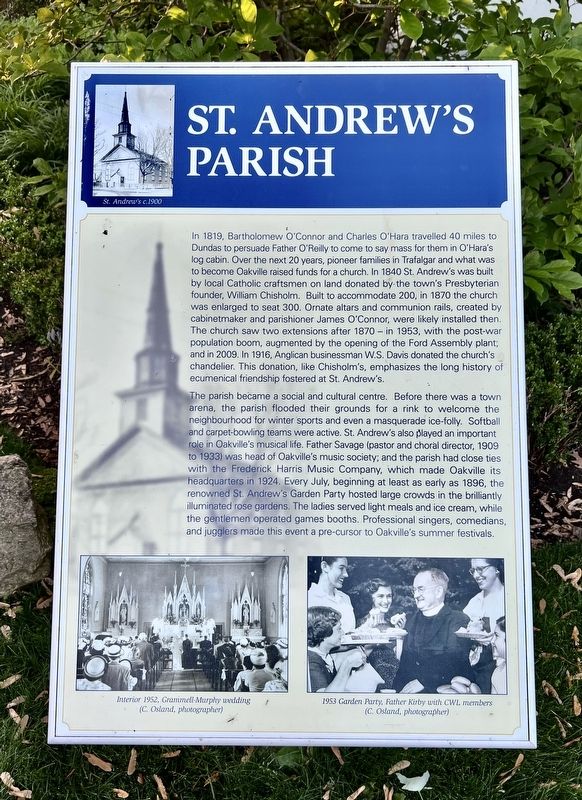
In 1819, Bartholomew O'Connor and Charles O'Hara travelled 40 miles to Dundas to persuade Father O'Reilly to come to say mass for them in O'Hara's log cabin. Over the next 20 years, pioneer families in Trafalgar and what was to become Oakville raised funds for a church. In 1840 St. Andrews was built by local Catholic craftsmen on land donated by the town's Presbyterian founder, William Chisholm. Built to accommodate 200, in 1870 the church was enlarged to seat 300. Ornate altars and communion rails, created by cabinetmaker and parishioner James O'Connor, were likely installed then. The church saw two extensions after 1870 - in 1953, with the post-war population boom, augmented by the opening of the Ford Assembly plant, and in 2009. In 1916, Anglican businessman W.S. Davis donated the church's chandelier. This donation, like Chisholm's, emphasizes the long history of ecumenical friendship fostered at St. Andrew's.
The parish became a social and cultural centre. Before there was a town arena, the parish flooded their grounds for a rink to welcome the neighbourhood for winter sports and even a masquerade ice-folly. Softball
this page online
Topics. This historical marker is listed in these topic lists: Arts, Letters, Music • Religion & Religious Structures. A significant historical year for this entry is 1819.
Location. 43° 26.812′ N, 79° 39.792′ W. Marker is in Oakville, Ontario, in Halton Region. It is at the intersection of King Street and Reynolds Street, on the right when traveling west on King Street. Touch for map. Marker is at or near this postal address: 41 Reynolds St, Oakville ON L6J 3J9, Canada.
Photographed by Tim Boyd, June 10, 2026
2. St. Andrew’s Parish Marker

Regionally, this marker is in Greater Toronto, specifically on the Golden Horseshoe, in the Hamilton-Halton-Brant Area, and specifically in the Toronto Metropolitan Area. It is also in Central Canada. Globally, it is in North America, on the Great Lakes, in the Western Hemisphere, in the Western World, and in the Anglosphere. Historically, it finds itself in what was once a British colony, the Viceroyalty of New France, the Haudenosaunee (Iroquois) Confederacy, and Rupert’s Land.
Other nearby markers. At least 8 other markers are within walking distance of this marker: St. Mary’s School (within shouting distance of this marker); Business on the “Main Street” (approx. 0.4 kilometers away); Lakeshore Road Taverns (approx. 0.4 kilometers away); Then and Now (approx. 0.4 kilometers away); Leading Citizens (approx. 0.4 kilometers away); St. Jude’s Anglican (approx. half a kilometer away); Lakeside Park Bandstand (approx. half a kilometer away); Heritage Homes of Trafalgar Road and George's Square (approx. 0.6 kilometers away). Touch for a list and map of all markers in Oakville.

Photographed by Tim Boyd, August 10, 2026
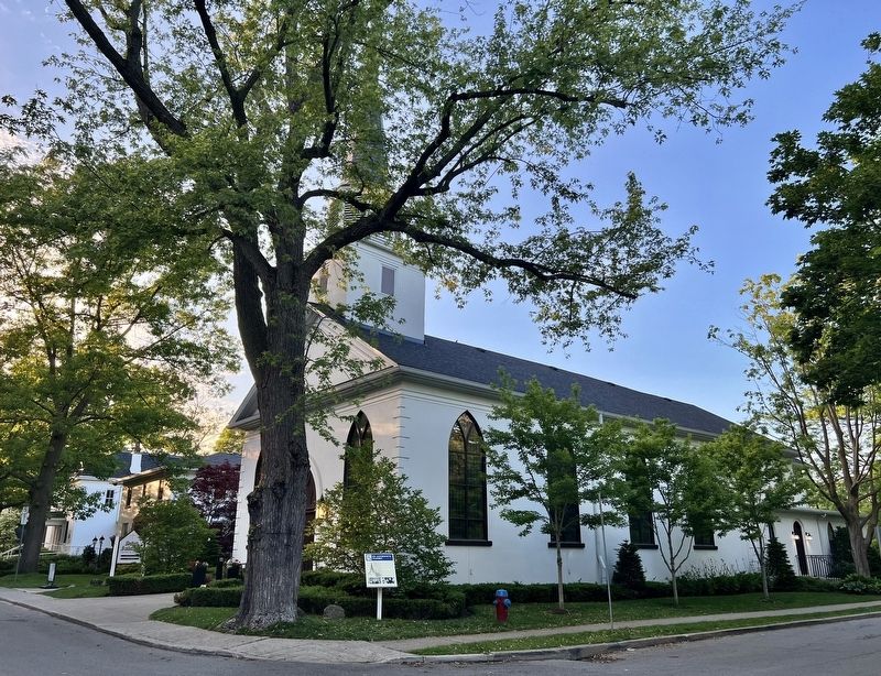
3. St. Andrew’s Church in 2026
Credits. This page was last revised on June 12, 2026. It was originally submitted on June 12, 2026, by Tim Boyd of Hamilton, Ontario. This page has been viewed 10 times since then. Photos: 1, 2, 3. submitted on June 12, 2026, by Tim Boyd of Hamilton, Ontario. • Andrew Ruppenstein was the editor who published this page.
