Ringmeen in Cobh in County Cork, Munster, Ireland — Irish South-West ((Éire) North Atlantic Ocean)
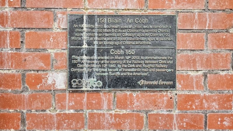
150 Bliain - An Cóbh
⎯⎯⎯
Cobh 150
Photographed by Ian Lefkowitz, May 15, 2026
1. 150 Bliain - An Cóbh / Cobh 150 Marker

150 Bliain - An Cóbh
An 10ú Márta 2012 a cuireadh suas an phlaic seo le comóradh a dhéanamh ar 150 bliain ó d’oscail Cuideachta Iarnróid Chorcaí agus Eochaille an t-Iarnród idir Corcaigh agus An Cóbh an 10ú Márta 1862 ar mhaithe leis an bpost trasatlantach agus le paisinéirí idir an Eoraip agus Críocha Mheiriceá.
Cobh 150
This plaque was erected on March 10th 2012, to commemorate the 150th Anniversary of the opening of the Railway between Cork and Cobh on March 10th 1862, by the Cork and Youghal Railway Company, for “the great benefit of transatlantic mail and passengers between Europe and the Americas”.
Erected 2012 by Iarnród Éireann.
Topics. This historical marker is listed in this topic list: Railroads & Streetcars. A significant historical date for this entry is March 10, 2012.
Location. 51° 50.929′ N, 8° 18.035′ W. Marker is in Cobh, Munster, in County Cork. It is in Ringmeen. It can be reached from the intersection of Lower Road and Westbourne Place, on the left when traveling west. The marker is located on the platform of the Cobh train station. Touch for map. Marker is at or near this postal
this page online

Regionally, it is on the Atlantic Ocean, in the North Atlantic Region, on the Atlantic Arc, in Europe, on the Island of Ireland, on the Celtic Fringe, in the European Union, in Atlantic Europe, on one of the British Isles, in the Western World, and in the Anglosphere.
Other nearby markers. At least 8 other markers are within walking distance of this marker: An Cóbh / Cobh (here, next to this marker); The History of the Cobh – Cork Railway Line (here, next to this marker); The Cobh Line / Cobh – Cork Railway – A Vital Transport Lifeline (a few steps from this marker); Rising of 1798 / Éirí Amach 1798 (about 120 meters away, measured in a direct line); The Deepwater Quay (about 120 meters away); Annie Moore / Áine Ní Mhórdha (about 120 meters away); Annie Moore Statue (about 120 meters away); Dealbh Annie Moore / Annie Moore Statue (about 120 meters away). Touch for a list and map of all markers in Cobh.
Also see . . . Cork and Youghal Railway (Wikipedia).
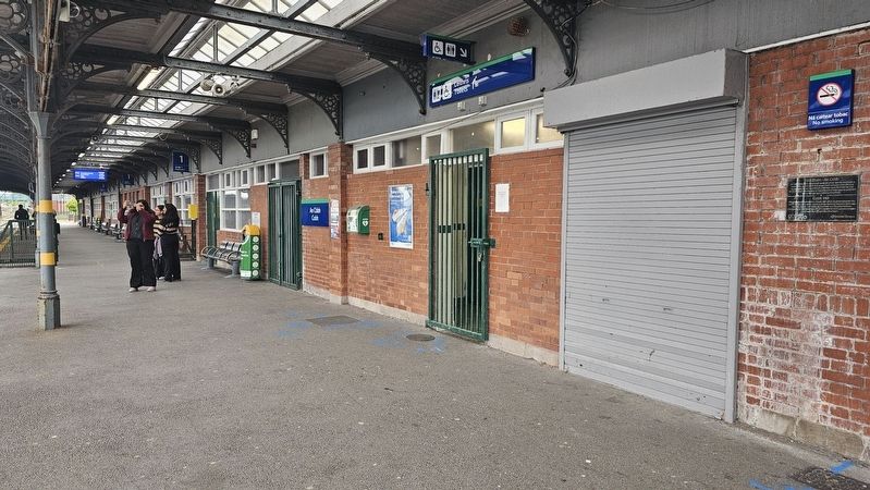
The Cork and Youghal Railway (C&YR) was a company that built and operated(Submitted on June 13, 2026, by Ian Lefkowitz of New York, New York.)a short 27 miles (43 km) railway built in the early 1860s in Ireland linking Cork with Youghal, a small resort with harbour at the mouth of the Munster Blackwater. There was an additional 6-mile (9.7 km) branch to Cobh (Queenstown), a deepwater port in Cork Harbour associated with transatlantic liners.Photographed by Ian Lefkowitz, May 15, 20262. 150 Bliain - An Cóbh / Cobh 150 MarkerThe marker is located on the platform at the end of the Cork-Cobh train line.
Credits. This page was last revised on June 13, 2026. It was originally submitted on June 13, 2026, by Ian Lefkowitz of New York, New York. This page has been viewed 9 times since then. Photos: 1, 2. submitted on June 13, 2026, by Ian Lefkowitz of New York, New York. • Andrew Ruppenstein was the editor who published this page.
