
Baltimore Hundred in Frankford in Sussex County, Delaware — The American Northeast (Mid-Atlantic)
Nugget Hollow & G.P. Mining Co.
est. 1824
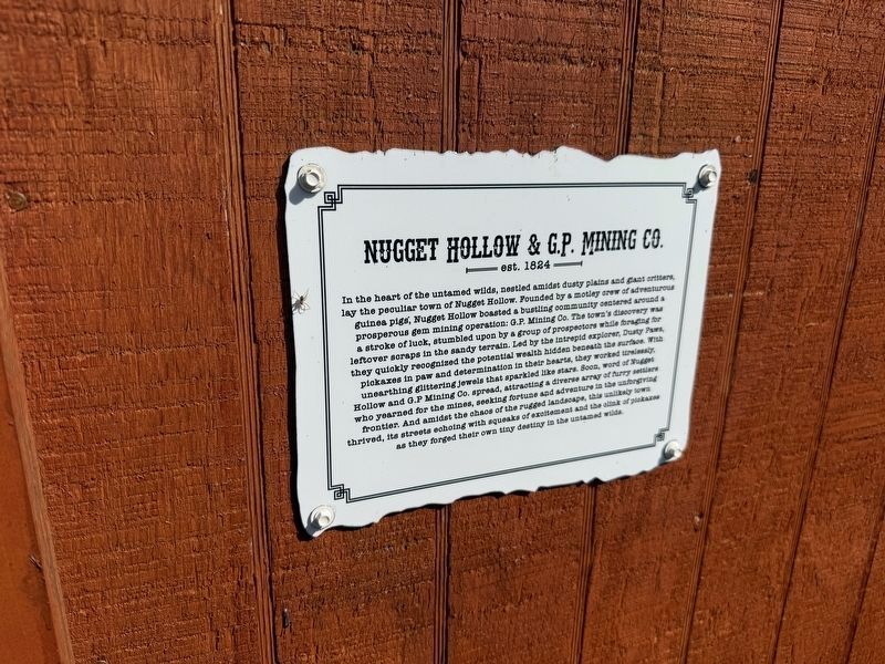
In the heart of the untamed wilds, nestled amidst dusty plains and giant critters, lay the peculiar town of Nugget Hollow. Founded by a motley crew of adventurous guinea pigs, Nugget Hollow boasted a bustling community centered around a prosperous gem minding operation: G.P. Mining Co. The town's discovery was a stroke of luck, stumbled upon by a group of prospectors while foraging for leftover scraps in the sandy terrain. Led by the intrepid explorers, Dusty Paws, they quickly recognized the potential wealth hidden beneath the surface. With pickaxes in paw and determination in their hearts, they worked tirelessly, unearthing glittering jewels that sparked like stars. Soon, word of Nugget Hollow and G.P Mining Co. spread, attracting a diverse array of furry settlers who yearned for the mines, seeking fortune and adventure in the unforgiving frontier. And amidst the chaos of the rugged landscape, this unlikely town thrived, its streets echoing with squeaks of excitement and the clink of pickaxes as they forged their own tiny destiny in the untamed wilds.
Erected by Coastal Wilds.
Topics. This historical marker
this page online
Location. 38° 31.125′ N, 75° 8.112′ W. Marker is in Frankford, Delaware, in Sussex County. It is in Baltimore Hundred. It is on Peppers Corner Road east of Beaver Dam Road, on the left when traveling east. Touch for map. Marker is at or near this postal address: 34215 Peppers Corner Rd, Frankford DE 19945, United States of America. Touch for directions.

Regionally, this marker is on Delaware’s Beaches. It is also in the American Mid-Atlantic, on the Delmarva Peninsula, and on the Eastern Seaboard. Globally, it is in the North Atlantic Region, North America, the Western Hemisphere, the Western World, and the Anglosphere. Historically, it finds itself in what was once New Netherland, one of the original Thirteen Colonies, and the Antebellum South.
Other nearby markers. At least 8 other markers are within 3 miles of this marker, measured as the crow flies: U.S. Army Radar Site 11 (approx. 1½ miles away); Our Community's Role in World War II (approx. 1½ miles
Additional commentary.
1. About the marker
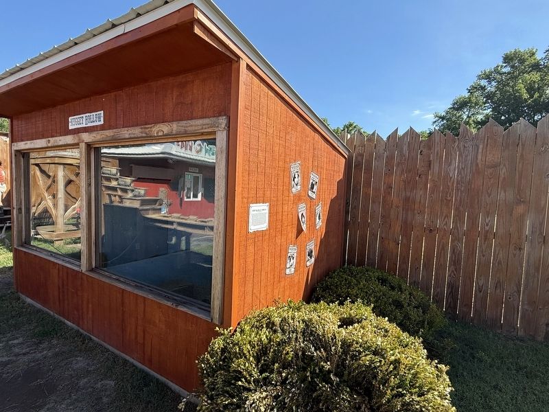
While the history on the marker is plainly fictional, the plaque is included in the database. Note that the narrative is analogous to some aspects of Euro-American expansion in the western United States.
— Submitted June 13, 2026, by Devry Becker Jones of Washington, District of Columbia.
Credits. This page was last revised on June 25, 2026. It was originally submitted on June 13, 2026, by Devry Becker Jones of Washington, District of Columbia. This page has been viewed 9 times since then. Photos: 1, 2. submitted on June 13, 2026, by Devry Becker Jones of Washington, District of Columbia.
