Falls River Square in Cuyahoga Falls in Summit County, Ohio — The American Midwest (Great Lakes)
Welcome To Cuyahoga Falls
The City on the River
| — | History Walking Tour | — |
Photographed by Craig Doda, December 7, 2025
1. Welcome To Cuyahoga Falls Marker
Falls River Square City Hall
The River And Industry
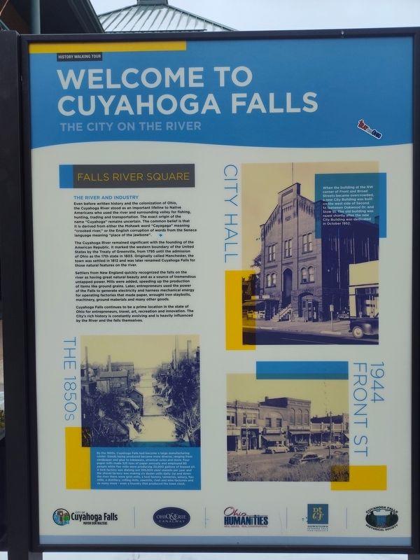
Even before written history and the colonization of Ohio, the Cuyahoga River stood as an important lifeline to Native Americans who used the river and surrounding valley for fishing, hunting, trading and transportation. The exact origin of the name "Cuyahoga" remains uncertain. The common belief is that it is derived from either the Mohawk word "Cayagaga" meaning "crooked river," or the English corruption of words from the Seneca language meaning "place of the jawbone".
The Cuyahoga River remained significant with the founding of the American Republic. It marked the western boundary of the United States by the Treaty of Greenville, from 1795 until the admission of Ohio as the 17th state in 1803. Originally called Manchester, the town was settled in 1812 and was later renamed Cuyahoga Falls for those natural features on the river.
Settlers from New England quickly recognized the falls on the river as having great natural beauty and as a source of tremendous untapped power. Mills were added, speeding up the production of items like ground grains. Later, entrepreneurs
this page online
Cuyahoga Falls continues to be a prime location in the state of Ohio for entrepreneurs, travel, art, recreation and innovation. The City's rich history is constantly evolving and is heavily influenced by the River and the falls themselves.
The 1850S
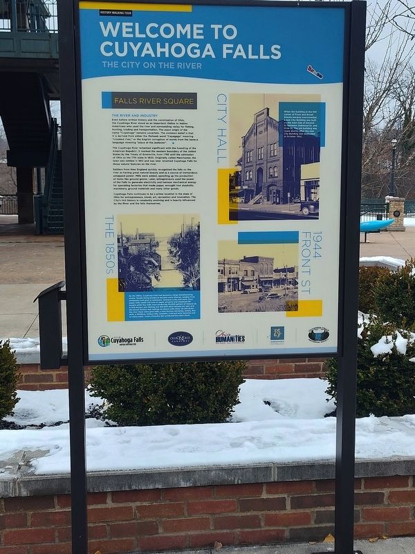
By the 1850s, Cuyahoga Falls had become a large manufacturing center. Goods being produced became more diverse, ranging from sandpaper and glue to tableware, streetcar axles and more. Four paper mills made 525 tons of paper annually and employed 60 people while flax mills were producing 30,000 gallons of linseed oil. A fork factory was dishing out 100,000 steel utensils per year and the shovel factory was making six dozen units daily. Up and down the river there were grist mills, a tool factory, tanneries, ashery, flax mills, a distillery, rolling mills, sawmills, rivet and wire factories and so many more-even a foundry that produced the town clock.
City Hall
When the building at the NW corner
Photographed by Craig Doda, December 7, 2025
2. Welcome To Cuyahoga Falls Marker
Erected by City of Cuyahoga; Ohio & Erie Canalway; Ohio Humanities; Downtown Cuyahoga Falls Partnership; Cuyahoga Falls Historical Society.
Topics. This historical marker is listed in these topic lists: Industry & Commerce • Settlements & Settlers. A significant historical month for this entry is October 1952.
Location. 41° 8.094′ N, 81° 28.976′ W. Marker is in Cuyahoga Falls, Ohio, in Summit County. It is in Falls River Square. It is at the intersection of Front Street and Broad Boulevard, on the right when traveling north on Front Street. Touch for map. Marker is at or near this postal address: 2091 Front St, Cuyahoga Falls OH 44221, United States of America. Touch for directions.

Regionally, this marker is in Greater Cleveland and in the Western Reserve. It is also in the American Midwest. Globally, it is in North America, the Western Hemisphere, the Western World, and the Anglosphere. Historically, it finds itself in what was once the Haudenosaunee (Iroquois) Confederacy, the territory of the Mississippian Culture, and the Northwest Territory.
Other nearby markers. At least 8 other markers are within walking distance of this marker: A Brief History of The Clock (about 300 feet away, measured in a direct line); Pilgrim Church (about 300 feet away); Crossroads (about 300 feet away); Veterans Memorial (about 400 feet away); Cuyahoga Falls Veterans Memorial (about 400 feet away); World War Veterans of Cuyahoga Falls (about 500 feet away); Front Street (about 500 feet away); Freedom Is Not Free (about 700 feet away). Touch for a list and map of all markers in Cuyahoga Falls.
Credits. This page was last revised on June 18, 2026. It was originally submitted on June 14, 2026, by Craig Doda of Napoleon, Ohio. This page has been viewed 17 times since then. Photos: 1, 2. submitted on June 14, 2026, by Craig Doda of Napoleon, Ohio. • Devry Becker Jones was the editor who published this page.
