THE HISTORICAL
MARKER DATABASE
“Bite-Size Bits of Local, National, and Global History”
Wainfleet in Niagara Region, Ontario — Central Canada (North America)
 

Wainfleet Township Hall, Circa 1880
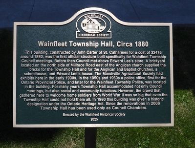
 
 
Wainfleet Township Hall, Circa 1880 - Marker image. Click for full size.
Photographed by Kevin Westell, June 13, 2026
1. Wainfleet Township Hall, Circa 1880 - Marker
Inscription. This building, constructed by John Carter of St. Catharines for a cost of $2475 around 1880, was the first official structure built specifically for Wainfleet Township Council meetings. Before then Council met above Edward Lee's store. A brickyard located on the north side of Millrace Road east of the Anglican church supplied the bricks for the Township Hall and for the Anglican and Baptist churches, a schoolhouse, and Edward Lee's house. The Marshville Agricultural Society had exhibits here in the early 1900s. In the 1950s and 1960s a police office, first for the Ontario Provincial Police, and later for the Wainfleet Township Police, was located in the building. For many years Township Hall accommodated not only Council meetings, but also social and community functions. However, the crowd that gathered here to welcome home soldiers from World War II was so big that even the Township Hall could not hold them all. In 1980 this building was given a historic designation under the Ontario Heritage Act. Since the renovations in 2006 Township Hall has been used only as Council Chambers.
 
Erected 2025 by Wainfleet
Paid Advertisement
Click or scan to see
this page online
Historical Society.
 
Topics. This historical marker is listed in this topic list: Notable Buildings. A significant historical year for this entry is 1880.
 
Location. 42° 55.354′ N, 79° 22.493′ W. Marker is in Wainfleet, Ontario, in Niagara Region. It is at the intersection of Hwy 3 and Park St, on the right when traveling east on Hwy 3. Touch for map. Marker is at or near this postal address: 31940 Hwy 3, Wainfleet ON L0S 1V0, Canada. Touch for directions.

Regionally, this marker is on the Golden Horseshoe and in Niagara Canada. It is also in Central Canada. Globally, it is in North America, on the Great Lakes, in the Western Hemisphere, in the Western World, and in the Anglosphere. Historically, it finds itself in what was once a British colony, the Viceroyalty of New France, the Haudenosaunee (Iroquois) Confederacy, and Rupert’s Land.

Other nearby markers. At least 8 other markers are within walking distance of this marker: Wainfleet Cenotaph (within shouting distance of this marker); The Feeder Canal (within shouting distance of this marker); Neff Morgan Cabin circa 1841 (about 240 meters away, measured in a direct
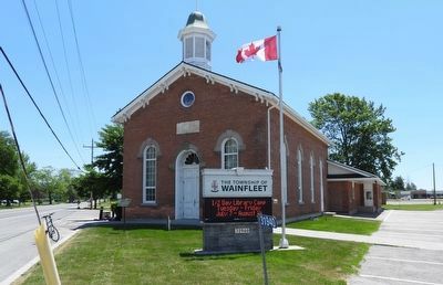
Wainfleet Township Hall image. Click for full size.
Photographed by Kevin Westell, June 13, 2026
2. Wainfleet Township Hall
Photo faces south-east and south. Highway 3 runs away on the left; Sugarloaf St is on the right. The marker (left) is on a post, on the lawn in front of the Township Hall.
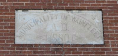
line); Neff-Morgan Cabin (about 240 meters away); Dean Sawmill circa 1883 (approx. 0.3 kilometers away); Jones & Palcso Wagonmaker Blacksmith Shop circa 1865 (approx. 0.3 kilometers away); Vivian Flour Mill circa 1841 (approx. 0.3 kilometers away); S.S. No. 11 circa 1866 (approx. 0.3 kilometers away). Touch for a list and map of all markers in Wainfleet.
 
Wainfleet Township Hall image. Click for full size.
Photographed by Kevin Westell, June 13, 2026
3. Wainfleet Township Hall
This block is built into the north wall, over the entrance.
 
 
Credits. This page was last revised on June 14, 2026. It was originally submitted on June 14, 2026, by Kevin Westell of St. Catharines, Ontario. This page has been viewed 16 times since then. Photos:   1, 2, 3. submitted on June 14, 2026, by Kevin Westell of St. Catharines, Ontario.

m=302882

CeraNet Cloud Computing sponsors the Historical Marker Database.
This website earns income from purchases you make after using our links to Amazon.com. We appreciate your support.
Paid Advertisement
Nov. 11, 2026