Waikoloa in Hawaii County, Hawaii — Hawaiian Island Archipelago (Pacific Ocean)
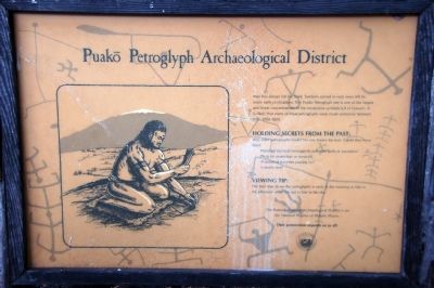
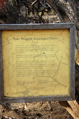
Puakō Petroglyph Archaeological District
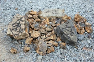
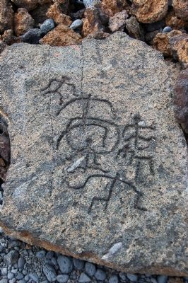
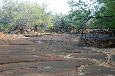
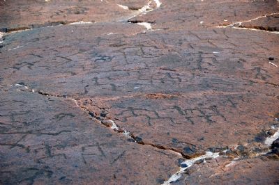
Man has always left his mark. Symbols in rock were left by many early civilizations. Te Puako Petroglyph site is one of the largest and finest concentrations of the mysterious symbols left in Hawai‘i. It is likely that many of these petroglyphs were made sometime between A.D. 1000-1800.
Holding Secrets from the Past:
Why were petroglyphs made? No one knows for sure. Could they have been:
Powerful mystical messages to primitive gods or ancestors?
Pleas for protection or survival?
A record of travelers passing by?
A family tree?
Viewing Tip:
The best time to see the petroglyphs is early in the morning or late in the afternoon when the sun is low in the sky.
The Puako Petroglyph Archaeological District is on the National Register of Historic Places.
Their preservation depends on us all!
Topics. This historical marker is listed in these topic lists: Anthropology & Archaeology • Asian Americans.
Location. 19° 57.308′ N, 155° 51.553′ W. Marker is in Waikoloa, Hawaii, in Hawaii County. Marker is on Holoholokai Beach Park Road, on the right when traveling west. Touch for map. Marker is in this post office area: Waikoloa HI 96738, United States of America. Touch for directions.
Other nearby markers. At least 8 other markers are within 3 miles of this marker , measured as the crow flies. Ancient Foot Trail (approx. 2˝ miles away); The Waikoloa Petroglyph Field (approx. 2.9 miles away); Kamehameha III (approx. 3.1 miles away); Kamehameha II (approx. 3.1 miles away); Kamehameha I (approx. 3.1 miles away); Kamehameha IV (approx. 3.1 miles away); Kamehameha V (approx. 3.1 miles away); William Charles Lunalilo (approx. 3.1 miles away). Touch for a list and map of all markers in Waikoloa.
Also see . . . American Rock Art Research Association. (Submitted on October 18, 2007, by Karen Key of Sacramento, California.)
Additional keywords. Native Hawaiians, Pacific Islanders
Photographed By Karen Key, September 5, 2007
2. Puako Petroglyph Archaeological District
Mauna Lani Resort's prime management objective for the archaeological district is long-term preservation of the petroglyphs and the information they contain. Both natural and human agents can adversely affect archaeological resources. At the petroglyph fields, the damage caused by human indifference is of much greater significance.
Calling attention to the petroglyphs increase the risk of destroying them. But we believe this risk is justified by the benefit derived from making the site accessible to you.
Barbed wire and chain link fences were excellent preservation devices, but they detract from the visitor's experience. Through education, and by encouraging enlightened malama (stewardship) and pride in the treasures the archaeological district contains. Mauna Lani Resort hopes to enhance and protect the original Hawaiian petroglyph experience for everyone to enjoy.
Since little is known about petroglyphs, their care and handling have come under considerable, often contentious discussions. If you would like to get involved in the stewardship of the petroglyphs, listed below are resources to help you develop an informed opinion:
Historic Site Section
Department of Land and Natural Resources
P.O. Box 621, Honolulu, HI 96809
(808) 548-6408
Mauna Lani Resort, Inc.
P.O. Box 4959, Konala Coast, HI 96743
(808) 885-6677
Rock Art Association of Hawai'i (RAAH)
P.O. Box 17902, Honolulu, HI 96837
Credits. This page was last revised on August 23, 2020. It was originally submitted on October 18, 2007, by Karen Key of Sacramento, California. This page has been viewed 3,062 times since then and 19 times this year. Photos: 1, 2, 3, 4, 5, 6, 7, 8. submitted on October 18, 2007, by Karen Key of Sacramento, California. • J. J. Prats was the editor who published this page.
