Kilgarvan in Cobh in County Cork, Munster, Ireland — Irish South-West ((Éire) North Atlantic Ocean)
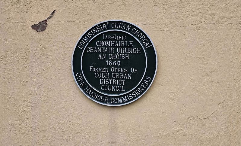
Chomhairle Ceantair Uirbigh an Chóibh
⎯⎯⎯
Cobh Urban District Council
Photographed by Ian Lefkowitz, May 15, 2026
1. Chomhairle Ceantair Uirbigh an Chóibh / Cobh Urban District Council Marker

Coimisinéirí Chuan Chorcaí
Iar-Oifig
Chomhairle
Ceantair Uirbigh
an Chóibh
1860
Cork Harbour Commissioners
Former Office of
Cobh Urban
District Council
1860
Topics. This historical marker is listed in this topic list: Government & Politics. A significant historical year for this entry is 1860.
Location. 51° 51.015′ N, 8° 17.455′ W. Marker is in Cobh, Munster, in County Cork. It is in Kilgarvan. It is at the intersection of East Beach and Lynch's Quay, on the left when traveling west on East Beach. Touch for map. Marker is at or near this postal address: 6 East Beach, Cobh, Munster, Ireland. Touch for directions.

Regionally, it is on the Atlantic Ocean, in the North Atlantic Region, on the Atlantic Arc, in Europe, on the Island of Ireland, on the Celtic Fringe, in the European Union, in Atlantic Europe, on one of the British Isles, in the Western World, and in the Anglosphere.
Other nearby markers. At least 8 other markers are within walking distance of this marker: Cork Harbour Tragedy (a few steps from this marker); a different marker also named Cork Harbour Tragedy (a few steps from this marker);
this page online
Also see . . . Old Town Hall, Cobh (Wikipedia).
The Old Town Hall is a 19th-century building in Cobh, Ireland. Situated slightly east of the town center, in what is referred to as Lynch's Quay or East Beach, it faces Cork Harbour. It is included in the Record of Protected Structures maintained by Cork County Council...Constructed c. 1870, the building originally served as the Cork Harbour Commissioners' Office, and later used as the Urban District Council Office. It has also been referred to as the Old Cobh Town Hall and Clock Tower Gallery.(Submitted on June 14, 2026, by Ian Lefkowitz of New York, New York.)
Additional keywords. green plaque
Photographed by Ian Lefkowitz, May 15, 2026
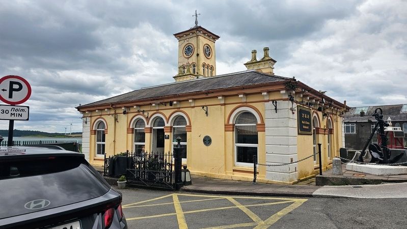
2. Chomhairle Ceantair Uirbigh an Chóibh / Cobh Urban District Council Marker
The marker is visible on Cobh's Old Town Hall.
Credits. This page was last revised on June 14, 2026. It was originally submitted on June 14, 2026, by Ian Lefkowitz of New York, New York. This page has been viewed 9 times since then. Photos: 1, 2. submitted on June 14, 2026, by Ian Lefkowitz of New York, New York. • Andrew Ruppenstein was the editor who published this page.
