Tooele in Tooele County, Utah — The American Mountains (Southwest)
The Military in Tooele
Photographed by Jeremy Snow, June 12, 2026
1. The Military in Tooele Marker
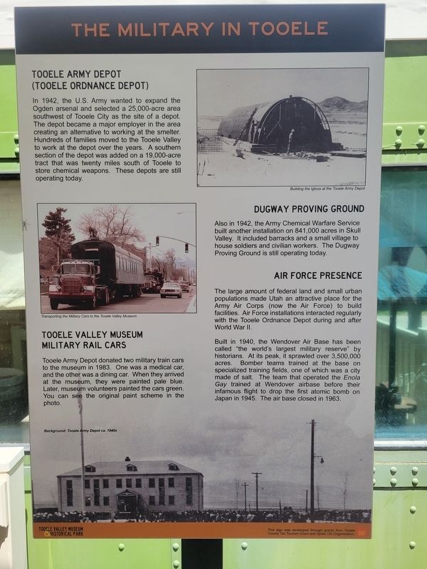
In 1942, the U.S. Army wanted to expand the Ogden arsenal and selected a 25,000-acre area southwest of Tooele City as the site of a depot. The depot became a major employer in the area creating an alternative to working at the smelter. Hundreds of families moved to the Tooele Valley to work at the depot over the years. A southern section of the depot was added on a 19,000-acre tract that was twenty miles south of Tooele to store chemical weapons. These depots are still operating today.
Dugway Proving Ground
Also in 1942, the Army Chemical Warfare Service built another installation on 841,000 acres in Skull Valley. It included barracks and a small village to house soldiers and civilian workers. The Dugway Proving Ground is still operating today.
Air Force Presence
The large amount of federal land and small urban populations made Utah an attractive place for the Army Air Corps (now the Air Force) to build facilities. Air Force installations interacted regularly with the Tooele Ordnance Depot during and after World War II.
Built in 1940, the Wendover Air Base
this page online
Tooele Valley Museum Military Rail Cars
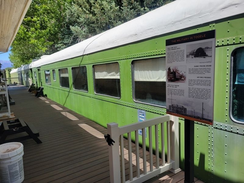
Tooele Army Depot donated two military train cars to the museum in 1983. One was a medical car, and the other was a dining car. When they arrived at the museum, they were painted pale blue. Later, museum volunteers painted the cars green. You can see the original paint scheme in the photo.
Topics. This historical marker is listed in these topic lists: Military • Railroads & Streetcars • War, World II. A significant historical year for this entry is 1942.
Location. 40° 31.867′ N, 112° 17.318′ W. Marker is in Tooele, Utah, in Tooele County. It can be reached from the intersection of North Broadway Street and E. Vine Street, on the left when traveling north. Marker located inside the Tooele
Photographed by Jeremy Snow, June 12, 2026
2. The Military in Tooele Marker

Regionally, this marker is in the Wasatch Front, in the West Desert, and in Greater Salt Lake. It is also in the American Mountain West and on the Colorado Plateau. Globally, it is in North America, the Rocky Mountains, the Western Hemisphere, the Western World, and the Anglosphere. Historically, it finds itself in what was once New Spain and also Mexico’s Alta California.
Other nearby markers. At least 8 other markers are within walking distance of this marker: Tooele Valley Railroad Complex (here, next to this marker); The Caboose (a few steps from this marker); The Powerhouse (within shouting distance of this marker); Working on the Railway (within shouting distance of this marker); Tooele Valley Railway Depot (within shouting distance of this marker); Railroads in Tooele County (within shouting distance of this marker); Mining in Tooele (within shouting distance of this marker); Tooele Carnegie Free Public Library (approx. half a mile away). Touch for a list and map of all markers in Tooele.
Credits. This page was last revised on June 16, 2026. It was originally submitted on June 15, 2026, by Jeremy Snow of Cedar City, Utah. This page has been viewed 18 times since then. Photos: 1, 2. submitted on June 15, 2026, by Jeremy Snow of Cedar City, Utah. • Andrew Ruppenstein was the editor who published this page.
