Kettle River in Carlton County, Minnesota — The American Midwest (Upper Plains)
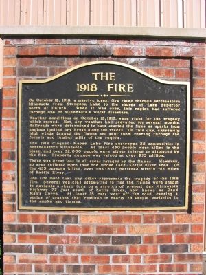
The 1918 Fire
Weather conditions on October l2, 1918, were right for the tragedy which ensued. Hot, dry weather had prevailed for several months. Railroads were determined to have started the fires as sparks from the engines ignited dry brush along the tracks. On this day, extremely high winds fanned the flames and sent them roaring through the forests and lumber mills of the region.
The 1918 Cloquet - Moose Lake Fire destroyed 38 communities in northeastern Minnesota. At feast 450 people were killed in the blaze, and over 52,000 people were either injured or displaced by the fire. Property damage was valued at over $73 million.
There was great loss in all areas ravaged by the flames. However, no area suffered more than the Moose Lake - Kettle River area. Of the 453 persons killed, over one-half perished within ten miles of Kettle River.
One site more than any other represents the tragedy of the 1918 fire. Several vehicles attempting to flee the flames were unable to navigate a sharp turn on a stretch of present day Minnesota Highway 73 just south of Kettle River, now known as Dead Man’s Curve. At first 15 cars went off the road, causing a series of crashes that resulted in nearly 25 people perishing in the smoke and flames.
Topics. This historical marker is listed in this topic list: Notable Events. A significant historical month for this entry is October 1862.
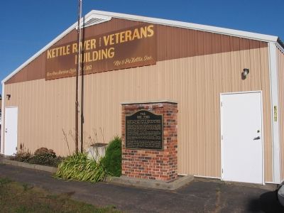
Location. 46° 29.241′ N, 92° 52.638′ W. Marker is in Kettle River, Minnesota, in Carlton County. Marker is on Main Street (State Highway 73) north of 1st Avenue South, on the right when traveling north. Marker is between Soo Line Road and 1st Avenue South, in front of the Kettle River Area Veterans Building. Touch for map. Marker is at or near this postal address: 3960 Main Street, Kettle River MN 55757, United States of America. Touch for directions.
Other nearby markers. At least 4 other markers are within 10 miles of this marker, measured as the crow flies. 1872 (approx. 3.6 miles away); Geology of Minnesota (approx. 5.9 miles away); Site of Mass Grave (approx. 6.2 miles away); Christopher C. Andrews, Conservation Pioneer (approx. 9.6 miles away).
Additional keywords. The Great 1918 Fire
Credits. This page was last revised on August 29, 2022. It was originally submitted on October 18, 2007, by Keith L of Wisconsin Rapids, Wisconsin. This page has been viewed 3,844 times since then and 97 times this year. Photos: 1, 2. submitted on October 18, 2007, by Keith L of Wisconsin Rapids, Wisconsin. • J. J. Prats was the editor who published this page.

