Mitte in Leipzig, Saxony, Germany — Central Europe
Matthäikirche
⎯⎯⎯
St. Matthew's Church
Photographed by James Hulse, March 11, 2026
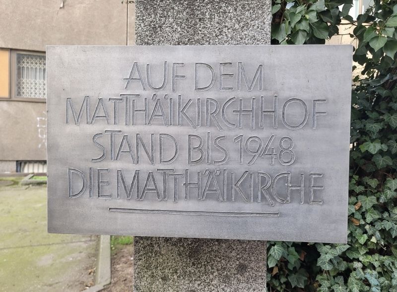
1. Matthäikirche / St. Matthew's Church Marker

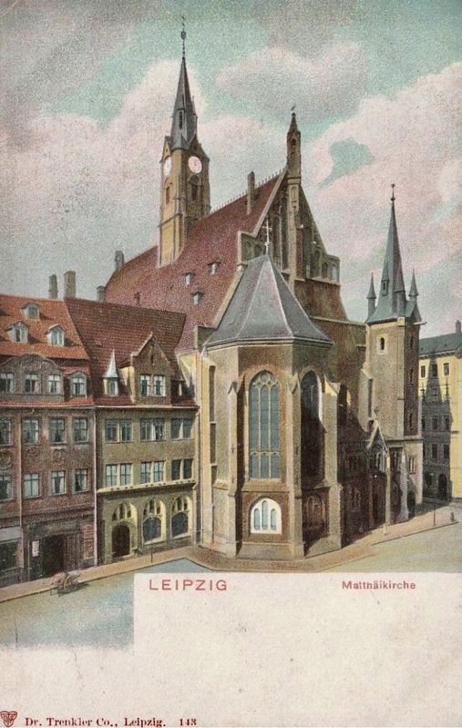
Auf dem Matthäikirchhof stand bis 1948 die Matthäikirche.
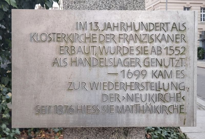
Im 13. Jahrhundert als Klosterkirche der Franziskaner erbaut, wurde sie ab 1552 als Handelslager genutzt. 1699 kam es zur Wiedererrichtung der „Neukirche“. Seit 1876 hieß sie Matthäikirche.
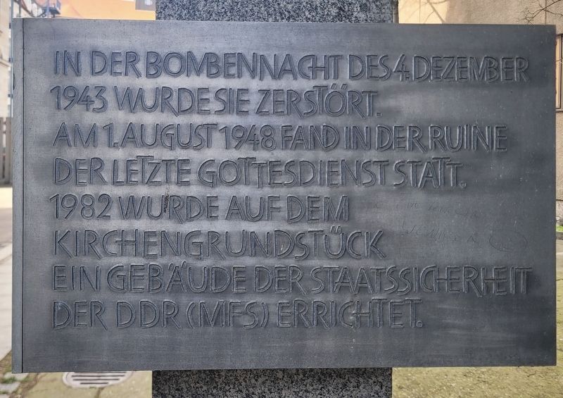
In der Bombennacht des 4. Dezember 1943 wurde sie zerstört. Am 1. August 1948 fand in der Ruine der letzte Gottesdienst statt. 1982 wurde auf dem Kirchengrundstück ein Gebäude der Staatssicherheit der DDR (MfS) errichtet.
St. Matthew's Church stood on Matthäikirchhof until 1948.
Built in the 13th century as the church of the Franciscan monastery, it was used as a commercial warehouse from 1552 onward. In 1699, it was rebuilt as the “New Church” (Neukirche). From 1876 onward, it was known as St. Matthew's Church (Matthäikirche).
It was destroyed during the bombing raid of December 4, 1943. The last church service was held in the ruins on August 1, 1948. In 1982, a building of the East German Ministry for State Security (Stasi, MfS) was erected on the church property.
Topics. This historical marker is listed in these topic
this page online
Location. 51° 20.498′ N, 12° 22.29′ E. Marker is in Leipzig, Sachsen (Saxony). It is in Mitte. It is at the intersection of Kleine Fleischergasse and Matthäikirchhof, on the right when traveling west on Kleine Fleischergasse. Touch for map. Marker is in this post office area: Leipzig SN 04109, Germany. Touch for directions.

Regionally, this marker is in Central Germany. Globally, it is in Europe, the European Union, Atlantic Europe, Central Europe, the Schengen Area, Western Europe, and the Western World. Historically, it finds itself in what was once the Holy Roman Empire and also the former East Germany.
Other nearby markers. At least 8 other markers are within walking distance of this marker: Befreiung Leipzigs 1945 / Liberation of Leipzig, 1945 (about 90 meters away, measured in a direct line); Die Klingertreppe / The Klinger Staircase (about 120 meters away); Bezirksverwaltung für Staatssicherheit Leipzig / Leipzig District Administration for State Security (about 120 meters away); Planung und Bau / Planning and Construction
Photographed by James Hulse, March 11, 2026
2. Matthäikirche / St. Matthew's Church Marker - Left Side
Photographed by James Hulse, March 11, 2026
3. Matthäikirche / St. Matthew's Church Marker - Right Side
Photographed by James Hulse, March 11, 2026
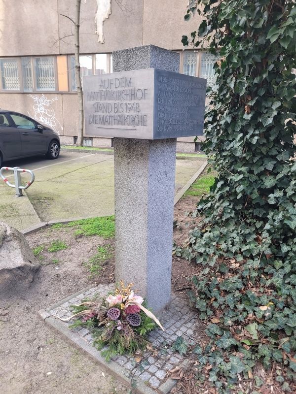
4. Matthäikirche / St. Matthew's Church Marker
Photographed by James Hulse, March 11, 2026
5. Matthäikirche / St. Matthew's Church Marker
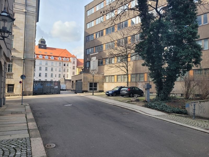
The view of the marker along the street.
Photographed by Dr. Trenkler Co., Leipzig, 1905
6. Matthäikirche
Credits. This page was last revised on June 22, 2026. It was originally submitted on June 17, 2026, by James Hulse of Medina, Texas. This page has been viewed 9 times since then. Photos: 1, 2, 3, 4, 5. submitted on June 18, 2026, by James Hulse of Medina, Texas. 6. submitted on June 22, 2026.
