Downtown Riverside in Riverside County, California — The American West (Pacific Coastal)
Hammer-Wallihan House
1926
| — | Cultural Heritage Board Landmark | — |

Photographed by Volt Craft, June 16, 2026
1. Hammer-Wallihan House Marker
Erected by City of Riverside. (Marker Number 77.)
Topics and series. This historical marker is listed in this topic list: Architecture. In addition, it is included in the Riverside Cultural Heritage Board Landmarks series list. A significant historical year for this entry is 1943.
Location. 33° 58.387′ N, 117° 22.69′ W. Marker is in Riverside, California, in Riverside County. It is in Downtown Riverside. It is at the intersection of Prospect Avenue and Orange Grove Avenue on Prospect Avenue. Touch for map. Marker is at or near this postal address: 3563 Prospect Avenue, Riverside CA 92501, United States of America.
this page online

Regionally, this marker is in Greater Los Angeles, in the Inland Empire, and in the Peninsular Ranges. It is also in the American Southwest. Globally, it is in North America, on the Ring of Fire, on the Pacific Rim, in the Western Hemisphere, in the Western World, and in the Anglosphere. Historically, it finds itself in what was once New Spain and also Mexico’s Alta California.
Other nearby markers. At least 8 other markers are within walking distance of this marker: Shiels House (about 400 feet away, measured in a direct line); The De Anza Statue and Newman Park (approx. ¼ mile away); The Tetley Buildings (approx. 0.3 miles away); J.R. Willis Building (1927) (approx. 0.3 miles away); Riverside City College Quadrangle (approx. 0.3 miles away); M. H. Simons Undertaking Chapel (approx. 0.4 miles away); Grant Elementary School (approx. 0.4 miles away); John G. Gabbert (approx. 0.4 miles away). Touch for a list and map of all markers in Riverside.
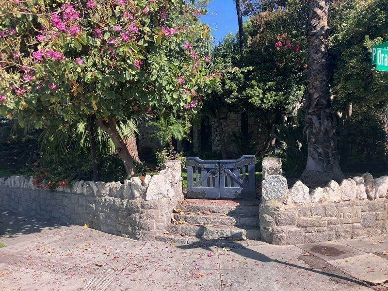
More about this marker. Marker is on the brick wall to the left of the steps at the street corner.
Regarding Hammer-Wallihan House. Designed by
Photographed by Volt Craft, June 16, 2026
2. Hammer-Wallihan House Marker
The marker is to the left of the steps.
Also see . . . Landmarks of the City of Riverside (#77). (Submitted on June 17, 2026, by Volt Craft of Riverside, California.)

Photographed by Volt Craft, June 16, 2026
3. Hammer-Wallihan House

Photographed by Volt Craft, June 16, 2026
4. Hammer-Wallihan House location
Credits. This page was last revised on June 24, 2026. It was originally submitted on June 17, 2026, by Volt Craft of Riverside, California. This page has been viewed 13 times since then. Photos: 1, 2, 3, 4. submitted on June 17, 2026, by Volt Craft of Riverside, California. • Andrew Ruppenstein was the editor who published this page.
