Mile Square in Indianapolis in Marion County, Indiana — The American Midwest (Great Lakes)
Indiana State Library

Photographed by Tom Bosse, June 14, 2026
1. Indiana State Library Marker (Side 1)
The Indiana General Assembly established the Indiana State Library (ISL) in 1825 to provide reference services for state government. ISL was located in the Indiana Statehouse alongside other agencies. In 1903, legislation passed broadening ISL's lending to all Hoosiers, thus supplementing local library collections and serving residents where no library yet existed.
ISL's physical collection and services grew quickly in the 20th century, necessitating the State Library and Historical Building., dedicated here in 1934. ISL gained renown for its reference, state, and federal document collections, literary services for the blind and physically handicapped, and genealogy materials, which have helped preserve Hoosier history and culture.
Erected 2025 by Indiana Historical Bureau, Indiana State Library, and the Indiana State Library Foundation.
Topics. This historical marker is listed in these topic lists: Arts, Letters, Music • Education. A significant historical year for this entry is 1825.
Location. 39° 46.199′ N, 86° 9.869′ W. Marker is in Indianapolis, Indiana, in Marion County. It is in Mile Square. It is on
this page online

Regionally, this marker is in Central Indiana. It is also in the American Midwest and in the Corn Belt. Globally, it is in North America, the Western Hemisphere, the Western World, and the Anglosphere. Historically, it finds itself in what was once the territory of the Mississippian Culture and also the Northwest Territory.
Other nearby markers. At least 8 other markers are within walking distance of this marker: 1907 Indiana Eugenics Law (about 300 feet away, measured in a direct line); The Indiana 9/11 Memorial (about 400 feet away); Timothy J. Maude (about 400 feet away); September 11, 2001 (about 400 feet away); The Survivor Tree (about 400 feet away); Site of the Central Canal (about 500 feet away); Without Coal (about 500 feet away); Robert D. Orr, 1917-2004 (about 600 feet away). Touch for a list and map of all markers in Indianapolis.

Photographed by Tom Bosse, June 14, 2026
2. Indiana State Library Marker (Side 2)
Photographed by Tom Bosse, June 14, 2026
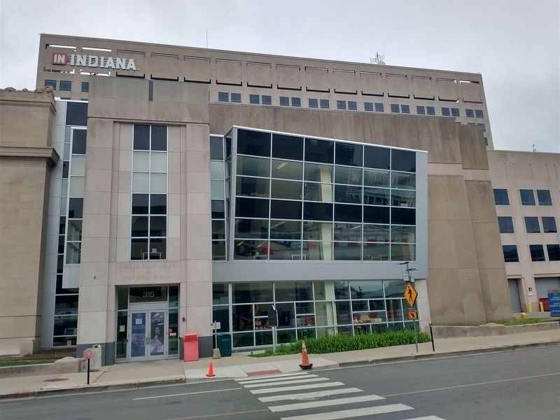
3. The Indiana State Library

Photographed by Tom Bosse, June 14, 2026
4. Indiana State Library Marker
Credits. This page was last revised on June 18, 2026. It was originally submitted on June 17, 2026, by Tom Bosse of Jefferson City, Tennessee. This page has been viewed 17 times since then. Photos: 1, 2, 3, 4. submitted on June 17, 2026, by Tom Bosse of Jefferson City, Tennessee. • Devry Becker Jones was the editor who published this page.
