
Lucketts in Loudoun County, Virginia — The American South (Mid-Atlantic)
Wayne's Crossing

Erected 2024 by Department of Historic Resources. (Marker Number F-5.)
Topics and series. This historical marker is listed in this topic list: War, US Revolutionary. In addition, it is included in the Virginia Department of Historic Resources (DHR) series list. A significant historical date for this entry is May 26, 1781.
Location. 39° 12.75′ N, 77° 32.119′ W. Marker is in Lucketts, Virginia, in Loudoun County. It is on James Monroe Highway (U.S. 15) 0.2 miles Spinks Ferry Road, on the right
this page online

Regionally, this marker is in the Washington Metropolitan Area and in Northern Virginia. It is also in the American South, specifically in the Upper South, and in the Mid-Atlantic. Globally, it is in the North Atlantic Region, North America, the Western Hemisphere, the Western World, and the Anglosphere. Historically, it finds itself in what was once the territory of the Mississippian Culture, one of the original Thirteen Colonies, one of the Confederate States of America, and the Antebellum South.
Other nearby markers. At least 8 other markers are within 3 miles of this marker, measured as the crow flies: Catoctin Rural Historic District (a few steps from this marker); Lucketts School (approx. 0.2 miles away); Potomac Crossings (approx. half a mile away); The Kincaid Farm Barns (approx. 2.3 miles away); Welcome to Temple Hall Farm Regional Park (approx. 2.3 miles away); Conditions of the Enslaved at Temple Hall Farm

Another marker is no longer nearby. Wayne's Crossing (has been replaced with this marker).
Related markers. Click here for a list of markers that are related to this marker. This list shows various locations of Wayne's March in that started in York, Pennsylvania into Virginia to meet up with General Lafayette in the actions leading to the British surrender at the Battle of Yorktown.
Photographed by Edward Spannaus, June 1, 2025
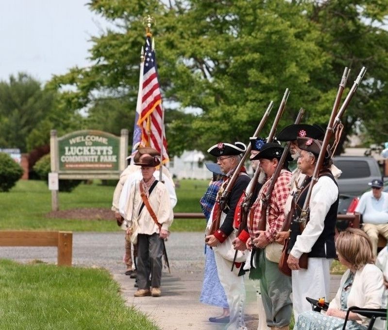
3. Wayne’s Crossing Marker Dedication
SAR Color Guard at dedication ceremony, June 1, 2025.
Credits. This page was last revised on June 21, 2026. It was originally submitted on January 11, 2026, by Devry Becker Jones of Washington, District of Columbia. This page has been viewed 72 times since then. Last updated on June 19, 2026, by John Laycock of Sykesville, Maryland. Photos: 1, 2. submitted on January 11, 2026, by Devry Becker Jones of Washington, District of Columbia. 3. submitted on July 26, 2025, by Edward Spannaus of Lovettsville, Virginia. • Bernard Fisher was the editor who published this page.
