
Medemblik, North Holland, Netherlands — Northwestern Europe
Stadhuis
⎯⎯⎯
Town Hall
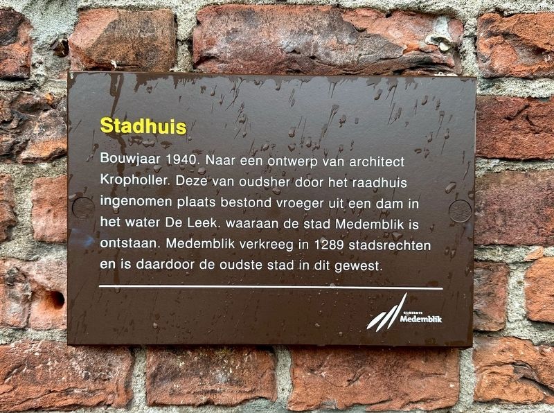
Photographed by Andrew Ruppenstein, June 2, 2026
1. Stadhuis / Town Hall Marker

Erected by Gemeente Medemblik.
Topics. This historical marker is listed in this topic list: Notable Buildings. A significant historical year for this entry is 1940.
Location. 52° 46.429′ N, 5° 6.371′ E. Marker is in Medemblik, Noord-Holland (North Holland). It is at the intersection of Dam and Nieuwstraat, on the right when traveling west on Dam. Touch for map. Marker is at or near this postal address: Dam 4, Medemblik, Noord-Holland 1671 AW, Netherlands. Touch for directions.

Regionally, it is in Europe, the European Union, Atlantic Europe,
this page online
Other nearby markers. At least 8 other markers are within 6 kilometers of this marker, measured as the crow flies: Medemblik: heden en verleden / Medemblik: Past and Present (a few steps from this marker); Station (within shouting distance of this marker); Oorlogsmonument Medemblik / Medemblik War Memorial (about 90 meters away, measured in a direct line); Het Koggehuis / The Koggehuis (about 120 meters away); Alle Euwen Bedrijvigheid / Centuries of Activity (about 150 meters away); Vrome Vrouwen… / Pious Women… / Fromme Frauen… (about 150 meters away); Sint Martinuskerk / St. Martin Church (approx. 0.3 kilometers away); Vliegtuigcrash Mosquito Mk. IV DZ386 Herdenking / Mosquito Mk. IV DZ386 Crash Memorial (approx. 5.5 kilometers away). Touch for a list and map of all markers in Medemblik.
Also see . . . Stadhuis van Medemblik (Wikipedia, in Dutch). Excerpt (in translation):
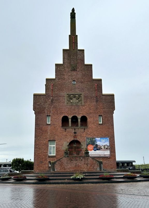
The Medemblik town hall is a former municipal building in the town of Medemblik, North Holland.(Submitted on June 21, 2026.)It was built in 1939 based on a design by the traditionalist architect A.J. Kropholler. Kropholler positioned the building on an elevated site aligned with the axis of Nieuwstraat, intended to lend the structure a greater sense of authority.Photographed by Andrew Ruppenstein, June 2, 20262. Stadhuis / Town Hall and markerThe marker is visible here on the left corner of the building.
Credits. This page was last revised on June 21, 2026. It was originally submitted on June 21, 2026, by Andrew Ruppenstein of Lamorinda, California. This page has been viewed 6 times since then. Photos: 1, 2. submitted on June 21, 2026, by Andrew Ruppenstein of Lamorinda, California.
