
Marker Logo
THE HISTORICAL
MARKER DATABASE
“Bite-Size Bits of Local, National, and Global History”
Medemblik, North Holland, Netherlands — Northwestern Europe
 

Station
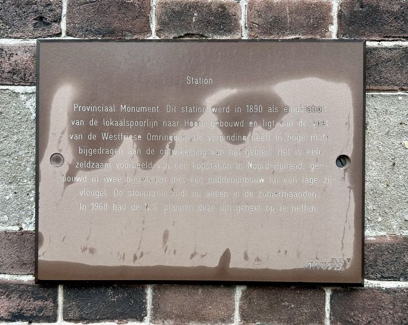
 
 
Station Marker image. Click for full size.
Photographed by Andrew Ruppenstein, June 2, 2026
1. Station Marker
Inscription.  
Provinciaal Monument. Dit station werd in 1890 als eindstation van de lokaalspoorlijn naar Hoorn gebouwd en ligt aan de voet van de Westfriese Omringdijk. De verbinding heeft in hoge mate bijgedragen aan de ontwikkeling van het gebied. Het is een zeldzaam voorbeeld van een kopstation in Noord-Holland. gebouwd in twee bouwlagen met een middenuitbouw en een lage zij vleugel. De stoomtrein rijdt nu alleen in de zomermaanden. In 1968 had de NS plannen deze lijn geheel op te heffen.

(Provincial Monument. Built in 1890 as the terminus of the local railway line to Hoorn, this station is situated at the foot of the West Frisian Ring Dike. The railway connection contributed significantly to the development of the area. It is a rare example of a terminus station in North Holland, featuring a two-story structure with a central projection and a low side wing. Steam trains now operate only during the summer months. In 1968, the Dutch Railways (NS) planned to close the line entirely.)
 
Erected by the ANWB, VVV.
 
Topics. This historical marker is listed in this topic list: Railroads & Streetcars. A significant historical year for this entry is 1890.
 
Location. 52° 46.43′ N,
Paid Advertisement
Click or scan to see
this page online
5° 6.343′ E. Marker is in Medemblik, Noord-Holland (North Holland). It is on Dam, on the left when traveling east. Touch for map. Marker is at or near this postal address: Dam 2, Medemblik, Noord-Holland 1671 AS, Netherlands. Touch for directions.

Regionally, it is in Europe, the European Union, Atlantic Europe, the Benelux Low Countries, the Schengen Area, Western Europe, and the Western World. Historically, it finds itself in what was once the Holy Roman Empire.

Other nearby markers. At least 8 other markers are within 6 kilometers of this marker, measured as the crow flies: Medemblik: heden en verleden / Medemblik: Past and Present (a few steps from this marker); Stadhuis / Town Hall (within shouting distance of this marker); Oorlogsmonument Medemblik / Medemblik War Memorial (about 90 meters away, measured in a direct line); Het Koggehuis / The Koggehuis (about 120 meters away); Alle Euwen Bedrijvigheid / Centuries of Activity (about 150 meters away); Vrome Vrouwen… / Pious Women… / Fromme Frauen… (about 150 meters away); Sint Martinuskerk / St. Martin Church (approx. 0.3 kilometers away); Vliegtuigcrash Mosquito Mk. IV DZ386 Herdenking / Mosquito Mk. IV DZ386 Crash Memorial
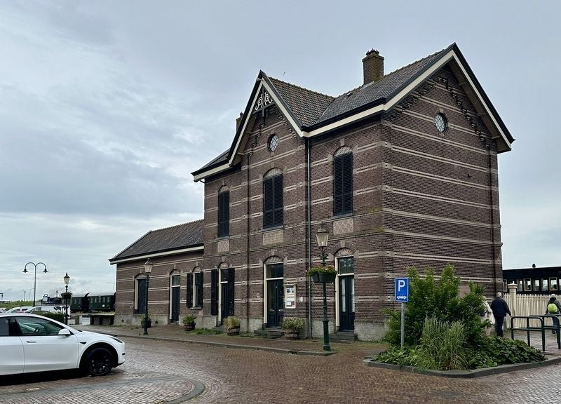
Station and marker image. Click for full size.
Photographed by Andrew Ruppenstein, June 2, 2026
2. Station and marker
The can be seen here just to the left of the entrance.
(approx. 5.5 kilometers away). Touch for a list and map of all markers in Medemblik.
 
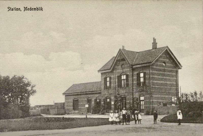
Station, Medemblik image. Click for full size.
courtesy Noord-Hollands Archief, circa 1910
3. Station, Medemblik
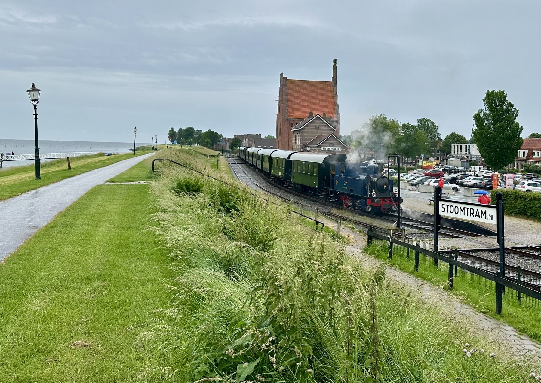
View of the <i>Stoomtram</i> with Medemblik Station image. Click for full size.
Photographed by Andrew Ruppenstein, June 2, 2026
4. View of the Stoomtram with Medemblik Station
 
 
Credits. This page was last revised on June 22, 2026. It was originally submitted on June 22, 2026, by Andrew Ruppenstein of Lamorinda, California. This page has been viewed 12 times since then. Photos:   1, 2, 3, 4. submitted on June 22, 2026, by Andrew Ruppenstein of Lamorinda, California.

m=303626

CeraNet Cloud Computing sponsors the Historical Marker Database.
This website earns income from purchases you make after using our links to Amazon.com. We appreciate your support.
Paid Advertisement
Aug. 15, 2026
