Lawrenceville in Lawrence Township in Mercer County, New Jersey — The American Northeast (Mid-Atlantic)
Johnson Trolley Line
| — | Lawrence-Hopewell Trail | — |
Photographed by Richard Peterson, June 14, 2026
1. Johnson Trolley Line Marker
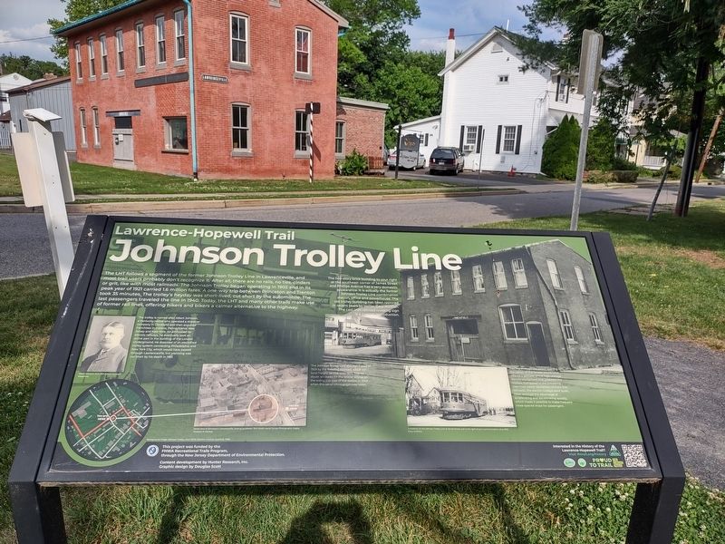
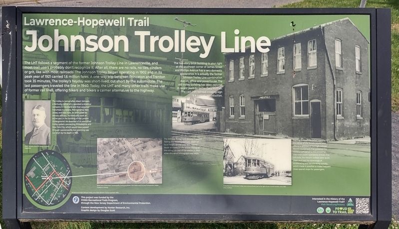
LHT follows a segment of the former Johnson Trolley Line in Lawrenceville, and most trail users probably don’t recognize it. After all, there are no rails, no ties, cinders or grit, like with most railroads. The Johnson Trolley began operating in 1902 and in its peak year of 1921 carried 1.6 million fares. A one-way trip between Princeton and Trenton took 35 minutes. The trolley’s heyday was short-lived, cut short by the automobile. The last passengers traveled the line in 1940. Today, the LHT and many other trails make use of former rail lines, offering hikers and bikers a calmer alternative to the highway.
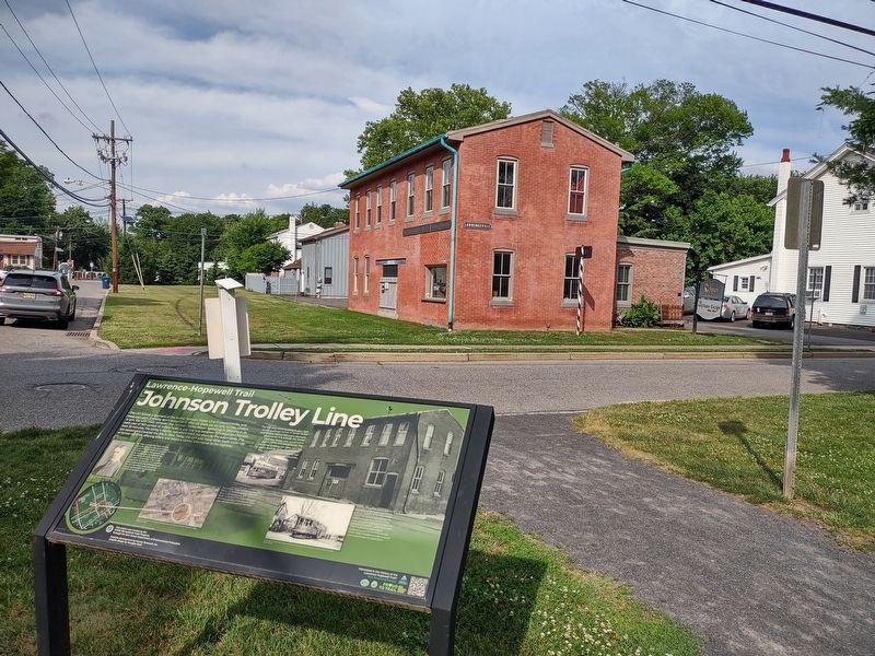
The two-story brick building to your right at the southeast corner of James Street and Phillips Avenue has a very domestic appearance. It is actually the former Johnson Trolley Line combination station, office and powerhouse. The old trolley building has been restored in recent years by owner Gary Hullfish. The cast-iron railroad crossing sign is a custom reproduction.
The trolley is named after Albert Johnson, a Kentucky native who operated a streetcar company in Cleveland and then acquired franchises in Indiana,
this page online
The Johnson Trolley Line was purchased in 1929 by the Reading Railroad which ran local freight service until 1973. This no doubt accounts for the boxcar sitting on the siding just east of the station in 1940 when this aerial photograph was taken.
Peering through the gated opening in the center of the facade would have offered a glimpse of the high-voltage electric equipment that powered the trolleys. Compared to the prevailing coal-fired steam operations of main line railroads, the electric trolleys were quiet, clean and had the advantage of accelerating and decelerating quickly, which made it possible to make frequent close-spaced stops for passengers.
( photo captions )
— Albert Johnson, June 1901 (Albert Munsey’s Magazine).
— Aerial view of downtown Lawrenceville, looking southeast, 1940
Photographed by Richard Peterson, June 14, 2026
2. Johnson Trolley Line Marker
The former Trenton-Princeton Traction Company building is beyond the marker.
— A streetcar on the Johnson Trolley Line at James Street, just to the right of your current location, circa 1930 (Gary Hullfish).
— Background image: Johnson Trolley, circa 1900s (Electric Traction Quarterly 1965).
This project was funded by the FHWA Recreational Trails Program, through the New Jersey Department of Environmental Protection.
Content development by Hunter Research, Inc. Graphic design by Douglas Scott
Interested in the History of the Lawrence-Hopewell Trail? Visit lhtrail.org/history
Topics. This historical marker is listed in this topic list: Railroads & Streetcars. A significant historical year for this entry is 1902.
Location. 40° 17.894′ N, 74° 43.873′ W. Marker is in Lawrence Township, New Jersey, in Mercer County. It is in Lawrenceville. It is at the intersection of Phillips Avenue and James Street, on the left when traveling north on Phillips Avenue. Touch for map. Marker is in this post office area: Lawrence Township NJ 08648, United States of America. Touch for directions.

Regionally, this marker is in Central Jersey and in Greater Princeton.
Photographed by Richard Peterson, June 14, 2026
3. Johnson Trolley Line Marker
Other nearby markers. At least 8 other markers are within walking distance of this marker: A different marker also named Johnson Trolley Line (about 500 feet away, measured in a direct line); Maidenhead Church (about 600 feet away); John Moore’s Tavern (about 800 feet away); Lawrence House, 1840 (approx. 0.2 miles away); First Town Hall (approx. 0.2 miles away); Arctic Parkway (approx. 0.4 miles away); Lewisville Road (approx. 0.8 miles away); a different marker also named Lewisville Road (approx. 0.9 miles away). Touch for a list and map of all markers in Lawrence Township.
Also see . . . History along the LHT. A list of markers currently installed along the Lawrence Hopewell Trail. (Submitted on June 22, 2026, by Richard Peterson of East Windsor, New Jersey.)
Credits. This page was last revised on June 29, 2026. It was originally submitted on June 22, 2026, by Richard Peterson of East Windsor, New Jersey. This page has been viewed 16 times since then. Photos: 1, 2, 3. submitted on June 22, 2026, by Richard Peterson of East Windsor, New Jersey. • Michael Herrick was the editor who published this page.
