Buffalo in Harding County, South Dakota — The American Midwest (Upper Plains)
The Custer Black Hills Expedition of 1874
Photographed by Cosmos Mariner, August 24, 2023
1. The Custer Black Hills Expedition of 1874 Marker
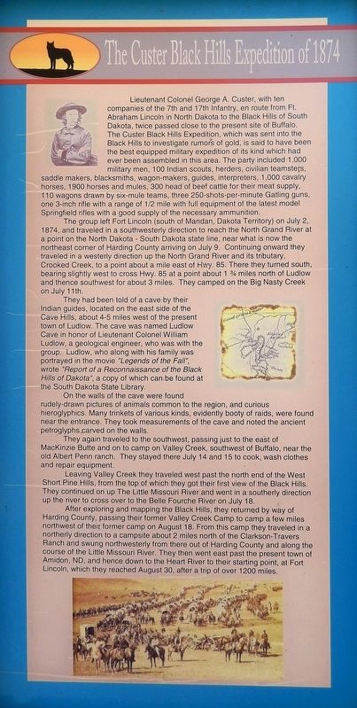
Lieutenant Colonel George A. Custer, with ten companies of the 7th and 17th Infantry, en route from Ft. Abraham Lincoln in North Dakota to the Black Hills of South Dakota, twice passed close to the present site of Buffalo. The Custer Black Hills Expedition, which was sent into the Black Hills to investigate rumors of gold, is said to have been the best equipped military expedition of its kind which had ever been assembled in this area. The party included 1,000 military men, 100 Indian scouts, herders, civilian teamsters, saddle makers, blacksmiths, wagon-makers, guides, interpreters, 1,000 cavalry horses, 1900 horses and mules, 300 head of beef cattle for their meat supply, 110 wagons drawn by six-mule teams, three 250-shots-per-minute Gatling guns, one 3-inch rifle with a range of ½ mile with full equipment of the latest model Springfield rifles with a good supply of the necessary ammunition.
The group left Fort Lincoln (south of Mandan, Dakota Territory) on July 2, 1874, and traveled in a southwesterly direction to reach the North Grand River at a point on the North Dakota - South Dakota state line, near what is now the northeast corner of Harding County arriving on July 9. Continuing onward they traveled in a westerly direction up the North Grand River and its tributary, Crooked Creek, to a point about a mile east of Hwy. 85. There they turned south, bearing slightly west to cross Hwy. 85 at a point about 1¾ miles north of Ludlow and thence southwest for about 3 miles. They camped on the Big Nasty Creek on July 11th.
They had been told of a cave by their Indian guides, located on the east side of the Cave Hills, about 4-5 miles west of the present town of Ludlow. The cave was named Ludlow Cave in honor of Lieutenant Colonel William Ludlow, a geological engineer, who was with the group. Ludlow, who along
this page online
On the walls of the cave were found rudely-drawn pictures of animals common to the region, and curious hieroglyphics. Many trinkets of various kinds, evidently booty of raids, were found near the entrance. They took measurements of the cave and noted the ancient petroglyphs carved on the walls.
They again traveled to the southwest, passing just to the east of MacKinzie Butte and on to camp on Valley Creek, southwest of Buffalo, near the old Albert Penn ranch. They stayed there July 14 and 15 to cook, wash clothes and repair equipment.
Leaving Valley Creek, they traveled west past the north end of the West Short Pine Hills, from the top of which they got their first view of the Black Hills. They continued on up The Little Missouri River and went in a southerly direction up the river to cross over to the Belle Fourche River on July 18.
After exploring and mapping the Black Hills, they returned by way of Harding County, passing their former Valley

Photographed by Cosmos Mariner, August 24, 2023
2. The Custer Black Hills Expedition of 1874 Marker
The marker is on the heritage walkway in Centennial Park.
Erected by Buffalo & Harding County, South Dakota.
Topics. This historical marker is listed in this topic list: Exploration. A significant historical date for this entry is July 2, 1874.
Location. 45° 34.855′ N, 103° 32.781′ W. Marker is in Buffalo, South Dakota, in Harding County. It can be reached from Theodore Roosevelt Expressway (CanAm Highway) (U.S. 85) just south of Connel Street (State Highway 20), on the left when traveling north. The marker is in Centennial Park. Touch for map. Marker is at or near this postal address: 91 US Highway 85, Buffalo SD 57720, United States of America. Touch for directions.

Regionally, this marker is in West River. It is also in the American Lewis & Clark Corridor, on the prairies, and on the Northern Plains. Globally, it is in North America, the Western Hemisphere, the Western World, and the Anglosphere. Historically, it finds itself in what was once Rupert’s Land and also the Louisiana Purchase.
Other nearby markers. At least 8 other markers are within walking distance of this marker: Ludlow Cave (here, next to this marker); Battle of the Slim Buttes (here, next to this marker); Battle of the Crow Buttes (here, next to this marker); Medora - Deadwood Stage Line (here, next to this marker); The Homesteaders (here, next to this marker); Sky Ranch for Boys (here, next to this marker); Tex Fletcher, the "Singing Cowboy" (here, next to this marker); Cattle Ranching in Harding County (here, next to this marker). Touch for a list and map of all markers in Buffalo.
Also see . . . Black Hills Expedition (Wikipedia).
Excerpt: Its mission was to look for suitable locations for a fort, find a route to the southwest, and to investigate the possibility of gold mining. Custer and his unit, the 7th Cavalry, arrived in the Black Hills on July 22, 1874, with orders to return by August 30. The expedition set up a camp at the site of the future town of Custer; while Custer and the military units searched for a suitable location for a fort, civilians searched for gold, and it is disputed whether or not any substantial amount was found. Nonetheless, this prompted a mass gold rush which in turn antagonized the Sioux Indians who had been promised protection of their sacred land through Treaties made by the US government, and who were later to kill Custer at the Battle of the Little Big Horn in the Great Sioux War of 1876–1877 between themselves and the United States.(Submitted on June 24, 2026, by Cosmos Mariner of Cape Canaveral, Florida.)Throughout the expedition, civilian experts who accompanied the expedition located traces of gold in the rivers. A significant discovery was made on August 1 when tests of the soil by the French Creek determined that a miner could earn as much as $150 per day mining in the Black Hills. Custer wrote in a letter of August 15, 1874 to the Assistant Adjutant General of the Department of Dakota that "there is no doubt as to the existence of various metals throughout the hills. ... [And] examinations at numerous points confirm and strengthen the fact of the existence of gold in the Black Hills." His messages were carried by scout Charley Reynolds to Fort Laramie, and from there it was telegraphed to the press eastwards.
Credits. This page was last revised on June 26, 2026. It was originally submitted on June 22, 2026, by Cosmos Mariner of Cape Canaveral, Florida. This page has been viewed 23 times since then. Photos: 1, 2. submitted on June 24, 2026, by Cosmos Mariner of Cape Canaveral, Florida.
