Grote Markt in Haarlem, North Holland, Netherlands — Northwestern Europe
Stadhuis
⎯⎯⎯
City Hall

Photographed by Andrew Ruppenstein, June 3, 2026
1. Stadhuis / City Hall Marker (minor panel)

(minor panel:)
In oorsprong jachthuis van de Graven van Holland, midden 13 de eeuw.
Na brand in 1551 herbouwd. Kort daarna het voorste deel als stadhuis in gebruik.
Tot 1581 in achterste deel Predikherenklooster gevestigd. (Kloostergangen) Tal van verbouwingen in de 17 de eeuw. Toren in 1914 herbouwd.
^——- meer informatie
(major panel:)
Het Stadhuis
De geschiedenis van het stadhuiscomplex begint in 1250.Graaf Willem II liet hier een jachtslot bouwen, dat in 1351 tijdens een stadsbrand grotendeels werd verwoest. Graaf Willem V schonk de restanten aan de stad. Na de herbouw van het gekanteelde rechthoekige, gebouw werd het als stadhuis in gebruik genomen. Dit oudste deel (A) bevat de GRAVENZAAL (1), nu ontvangstruimte en trouwzaal. Uit dezelfde periode zijn -in de kern- de KLEINE(2) en GROTE VIERSCHAAR(3), waar de rechtspraak plaatsvond. Hiervoor was het SCHAVOT (4), dat in 1855 is afgebroken.
Achter het jachtslot werd ca. 1250 een klooster (B) gesticht door de Predikheren of Dominikanen, dat na 1287 aanzienlijk werd uitgebreid. Tijdens de Hervorming werd het klooster complex door
this page online
De stadhuistoren uit 1465-1468 werd in 1772 wegens bouwvalligheid afgebroken. Op initiatief van de Vereniging Haerlem is de toren in 1913 volgens oude afbeeldingen herbouwd.
In de 17de eeuw onderging het complex een aantal belangrijke wijzigingen. Aan de Zijlstraat werd in 1622-1630 een nieuwe vleugel (14) aangebouwd naar ontwerp van Lieven de Key in de stijl van de Hollandse Renaissance. Daarin is de 'Vroedscapskamer nu vergaderzaal voor burgemeester en wethouders. Kort daarop werd de voorgevel van de Gravenzaal van een nieuwe indeling voorzien en is de Grote Vierschaar in klassicistische stijl verbouwd.
Eén der belangrijkste ingrepen in de 19de eeuw betrof het bouwen van museumzalen boven de kloostergangen o.a. voor schilderijen van Frans Hals (nu in het Frans Halsmuseum). De laatste uitbreiding was de vleugel aan de Koningstraat (15) uit 1937-1940 naar ontwerp
Photographed by Andrew Ruppenstein, June 3, 2026
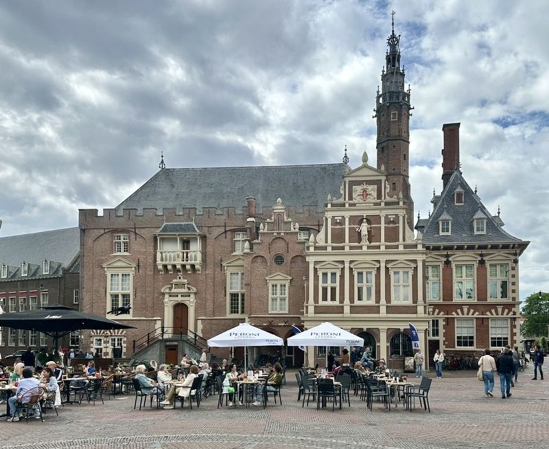
2. Haarlem Stadhuis / City Hall and marker
The marker is (with sufficient squinting) visible here on the left corner of the building.
(minor panel:)
City Hall
Originally a hunting lodge of the Counts of Holland, dating from the mid-13th century.
Rebuilt after a fire in 1551. Shortly thereafter, the front section came into use as the town hall.
The rear section housed a Dominican friary until 1581. (Cloisters) Numerous alterations were made in the 17th century. The tower was rebuilt in 1914.
^——- more information
(major panel:)
The City Hall
The history of the city hall complex dates back to 1250. Count William II had a hunting lodge built here, which was largely destroyed by a city fire in 1351. Count William V donated the remains to the city. Following the reconstruction of the rectangular, crenellated building, it was put into use as the city hall. This oldest section (A) houses the Counts' Hall (1), now used as a reception area and wedding venue. Dating from the same period — in their core structure —are the Small (2) and Large (3) Vierschaar (courtrooms), where judicial proceedings took place. Located in front of this was the scaffold (4), which was demolished in 1855.
Around 1250,
Photographed by Andrew Ruppenstein, June 3, 2026
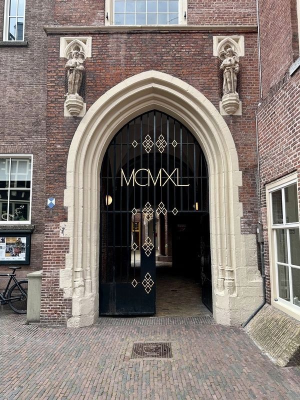
3. Entryway to major panel
As depicted on the minor panel (“more information”), one goes through this entryway (about 4 meters from the minor panel) and then another 8 or so meters to reach the second entryway in which the major panel is located (see next photo).
The town hall tower, originally built between 1465 and 1468, was demolished in 1772 due to its dilapidated state. In 1913, at the initiative of the Vereniging Haerlem (Haarlem Association), the tower was rebuilt based on historical images.
Photographed by Andrew Ruppenstein, June 3, 2026
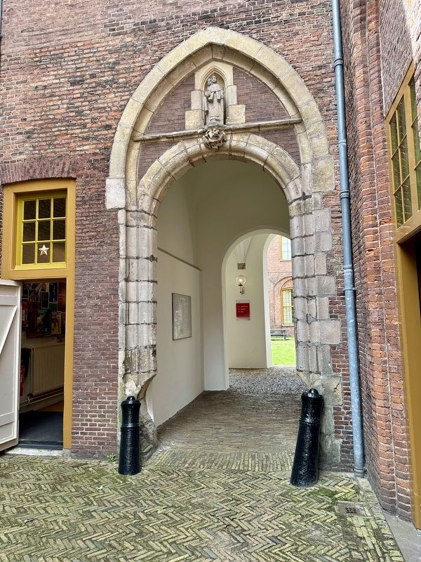
4. Second entryway with major panel
One of the most significant 19th-century interventions was the construction of museum galleries above the cloisters—intended, among other things, to house paintings by Frans Hals (now in the Frans Hals Museum). The final expansion was the wing along Koningstraat (15), built between 1937 and 1940 to a design by architect A.J. van der Steur.
Erected by the ANWB, VVV.
Topics. This historical marker is listed in this topic list: Government & Politics. A significant historical year for this entry is 1551.
Location. 52° 22.881′ N, 4° 38.105′ E. Marker is in Haarlem, Noord-Holland (North Holland). It is in Grote Markt. It is at the intersection of Grote Markt and Koningstraat on Grote Markt. Touch for map. Marker is at or near this postal address: Grote Markt 2a, Haarlem, Noord-Holland 2011 GM, Netherlands. Touch for directions.

Regionally, it is in Europe, the European Union, Atlantic Europe, the Benelux Low Countries, the Schengen Area, Western Europe, and the Western World. Historically, it finds itself in what was once the Holy Roman Empire.
Other nearby markers. At least 8
Photographed by Andrew Ruppenstein, June 3, 2026
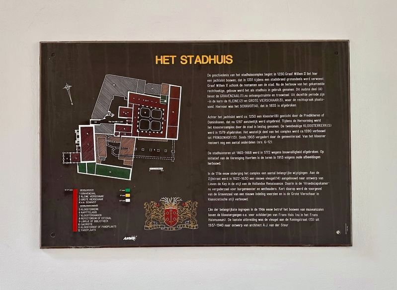
5. Stadhuis / City Hall Marker (major panel)
The numbers in the text refer to locations on the accompanying illustration.
Also see . . . Haarlem City Hall (Wikipedia). (Submitted on June 23, 2026.)
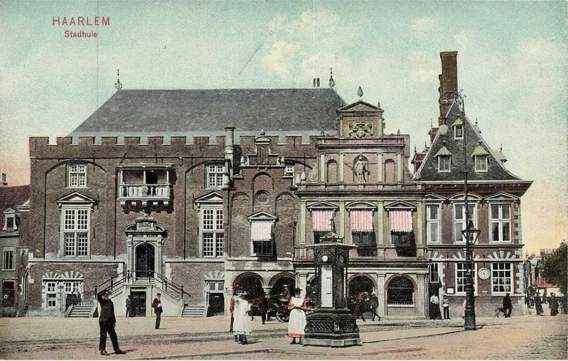
Photographed by Dr. Trenkler Co., Leipzig, circa 1910
6. Haarlem Stadhuis / City Hall
The missing tower means that this photo was taken prior to 1913.
Credits. This page was last revised on June 23, 2026. It was originally submitted on June 23, 2026, by Andrew Ruppenstein of Lamorinda, California. This page has been viewed 27 times since then. Photos: 1, 2, 3, 4, 5, 6. submitted on June 23, 2026, by Andrew Ruppenstein of Lamorinda, California.
