Town Point Park in Norfolk, Virginia — The American South (Mid-Atlantic)
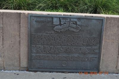
Norfolk 1682
Photographed by Sandra Hughes, August 11, 2010
1. Norfolk 1682 Marker
Town Point is where Norfolk began. In 1680 the General Assembly of his Majesty's Colony of Virginia enacted a law requiring each county to establish and develop a town site. In lower Norfolk County fifty acres of land at the entrance of the Eastern Branch of the Elizabeth River were purchased from Nicholas Wise, thus assuring the town of good water access to the surrounding areas. County surveyor John Ferebee laid out Front Street (now Main Street) on high ground and the town was divided into half-acre sites for dwelling housed and warehouses.
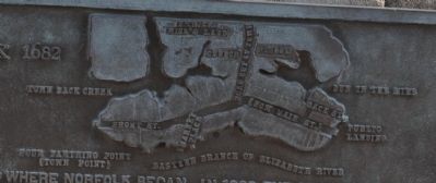
The original town was almost completely surrounded by water, access by land was limited to a single road which later became Church Street (now Lower St. Paul's Boulevard). The town covered what is now the southern portion of downtown Norfolk, bounded generally by the river on the south and west, City Hall Avenue on the north and interstate 264 on the east.
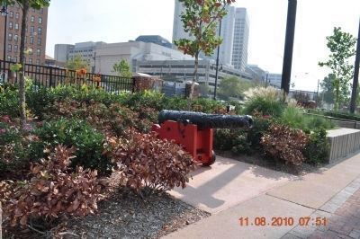
The cannon displayed here were unearthed in 1982 from Otter Berth and Town Point Park. They are of Revolutionary War vintage and are of unknown foreign origin. The carriages were constructed of white oak to 18th century
this page online
Erected 1986 by Norfolk Rotary Club.
Topics and series. This historical marker is listed in these topic lists: Settlements & Settlers • War, US Revolutionary. In addition, it is included in the Rotary International series list. A significant historical year for this entry is 1680.
Location. 36° 50.708′ N, 76° 17.578′ W. Marker is in Norfolk, Virginia. It is in Town Point Park. It can be reached from Waterside Drive west of Martins Lane, on the right when traveling east. Along the Elizabeth River Trail in Town Point Park. Touch for map. Marker is in this post office area: Norfolk VA 23510, United States of America. Touch for directions.

Regionally, this marker is in Hampton Roads, specifically in Coastal Virginia, and in the Hampton Roads Metropolitan Area. It is also in the American South, specifically in the Upper South, in the Tidewater, and on the Eastern Seaboard. Globally, it is in the North Atlantic Region, North America, the Western Hemisphere, the Western World, and the Anglosphere. Historically, it finds itself in what was once the territory of the
Photographed by Sandra Hughes, August 11, 2010
2. Revolutionary War vintage cannon displayed here unearthd in 1982
Other nearby markers. At least 8 other markers are within walking distance of this marker: Navy Escort Carriers Based in Norfolk (about 300 feet away, measured in a direct line); The Underground Railroad (about 300 feet away); The Customhouse, 1859 (about 400 feet away); Four Farthing or Town Point (about 500 feet away); Main Street (about 500 feet away); Granby Street (about 600 feet away); Flood Protection for Downtown Norfolk (about 700 feet away); Atlantic Intracoastal Waterway (about 700 feet away). Touch for a list and map of all markers in Norfolk.
Also see . . . The Savage Chronicles. The original feoffees hired one John Ferebee, surveyor, to plat out the fifty acres so that the town land could be sold in an orderly manner. Ferebee had arrived some years earlier from the little town of Chipping Camden, in the Cotswolds. By October, 1680, Ferebee’s plat was ready for recording. It showed a planned community with 51 lots, as well as the one or two existing structures, most notably
Photographed by Sandra Hughes, August 11, 2010
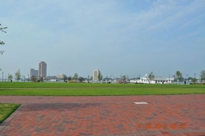
3. Norfolk Park
Photographed by Sandra Hughes, August 11, 2010
4. Norfolk 1682 Map
Photographed by Sandra Hughes, August 11, 2010
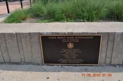
5. Town Point Park Renovation
City of Norfolk
Re-Dedicated Juoy 2009
City Council at Dedication
Paul D. Fraim Mayor
Anthony L. Burfoot Vice-Mayor
Daun S. Hester
Paul R. Riddick
Theresa W. Whibley M.D.
Donald L. Williams
Barclay W. Winn
W. Randy Wright
Regina V.K. Williams~City Manager
John M. Keifer~Director of Public Works
Architect~MMM Design Group
Contractor~Conrad Brothers, Inc.
Photographed by Sandra Hughes, August 11, 2010
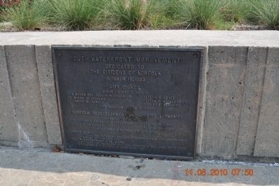
6. South Waterfront Improvements
Dedicatd to the citizens of Norfok October 18,1983
Photographed by Sandra Hughes, August 11, 2010
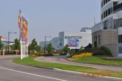
7. Town Point Park Renovation
Credits. This page was last revised on June 24, 2026. It was originally submitted on December 26, 2013, by Sandra Hughes Tidwell of Killen, Alabama, USA. This page has been viewed 1,140 times since then and 88 times this year. Last updated on June 23, 2026, by Evan Dwyer of Richmond, Virginia. Photos: 1, 2, 3, 4, 5, 6, 7. submitted on December 26, 2013, by Sandra Hughes Tidwell of Killen, Alabama, USA. • Devry Becker Jones was the editor who published this page.
